Sunday 26th July
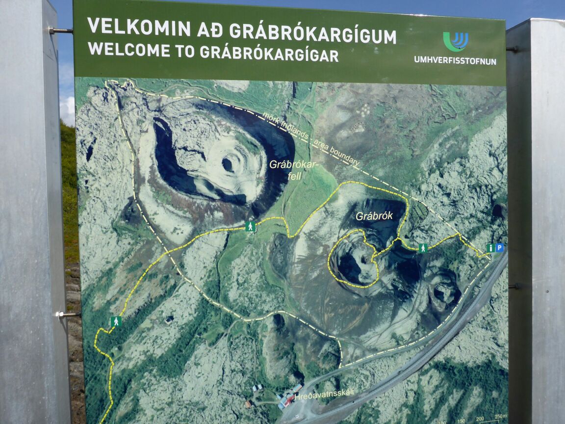
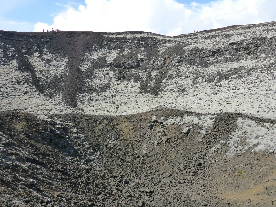
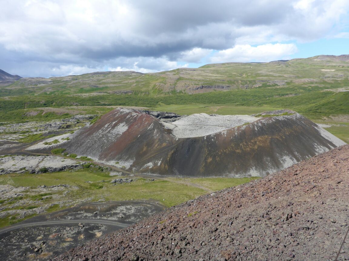
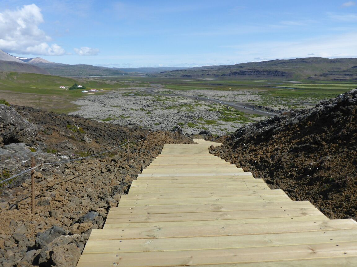
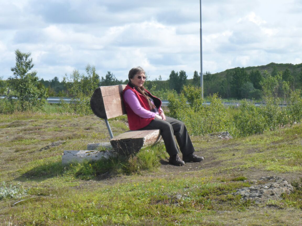
We’re up early to finish packing and to do breakfast duties at the B&B. We’re only there 20 minutes and Ása arrives. We bring her up to date on what’s been happening and then we pack her car – she’s lending us her skoda estate for the week. And she’s had it in the garage too, to fix the tyres and brakes. This is so generous of her. We’re on the road by 10am. It’s a nice day and we make it to Reykjavik by 3pm after a stop off for lunch and to see Grábrókargígar, the site of 2 small volcanic craters, we enjoy a nice walk in the sunshine up and around the nearest one.
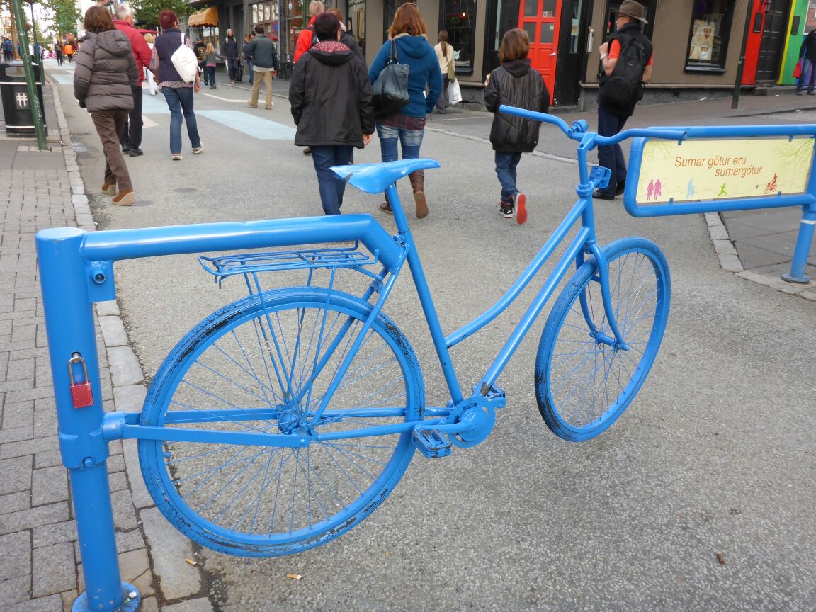
In Reykjavik we look for the first geocache laid in Iceland,
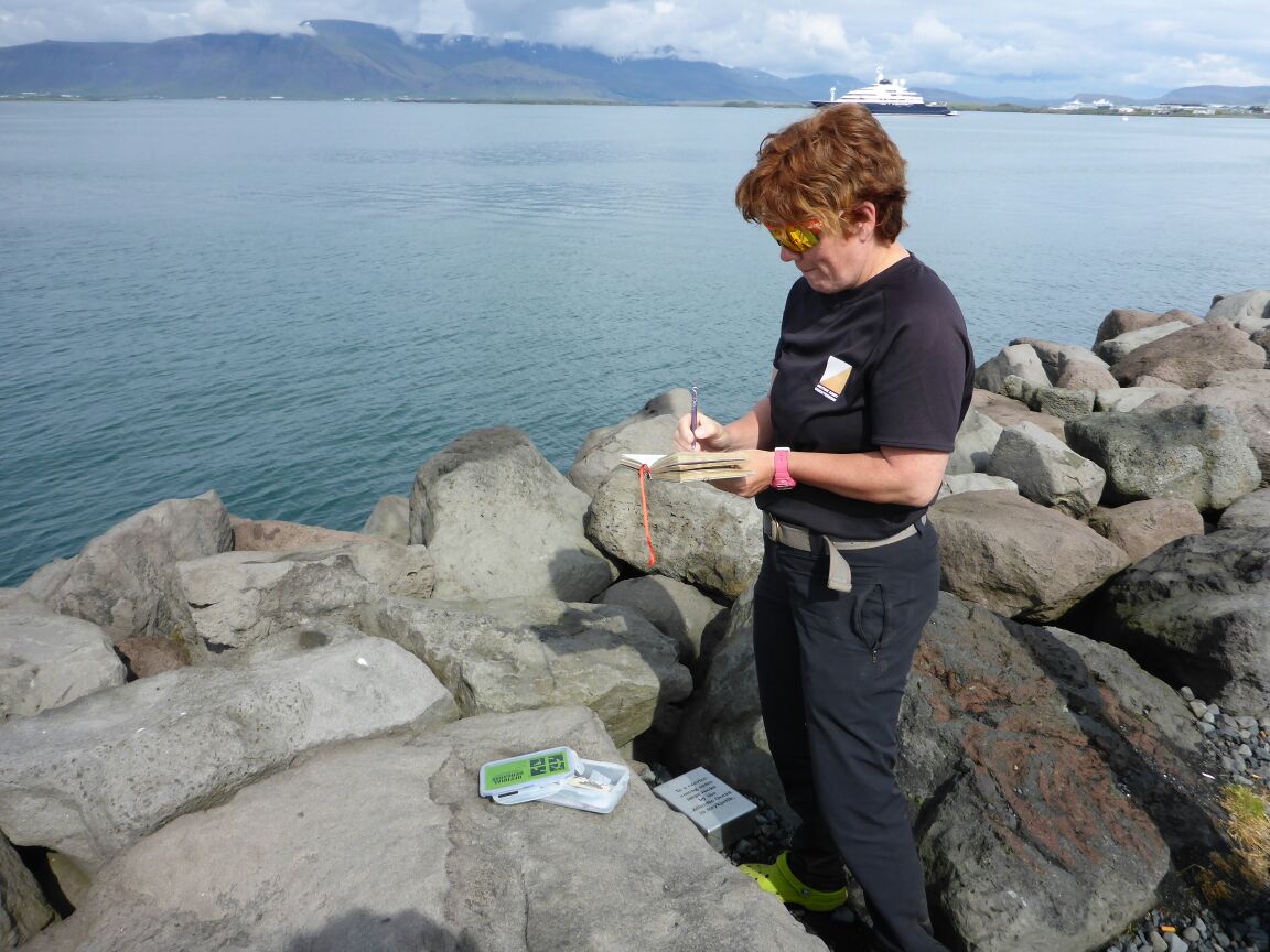
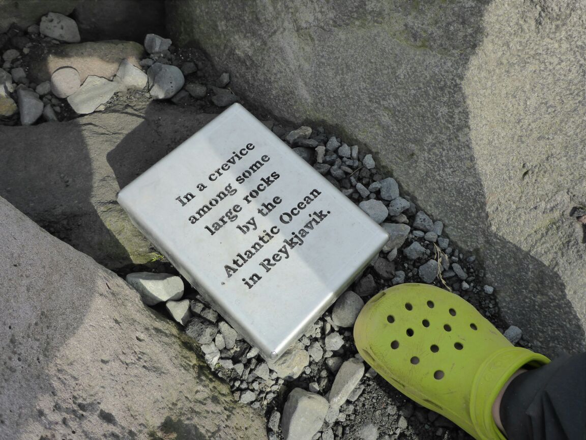
with 133 favourites; take a walk around the peninsula and then do a shop.
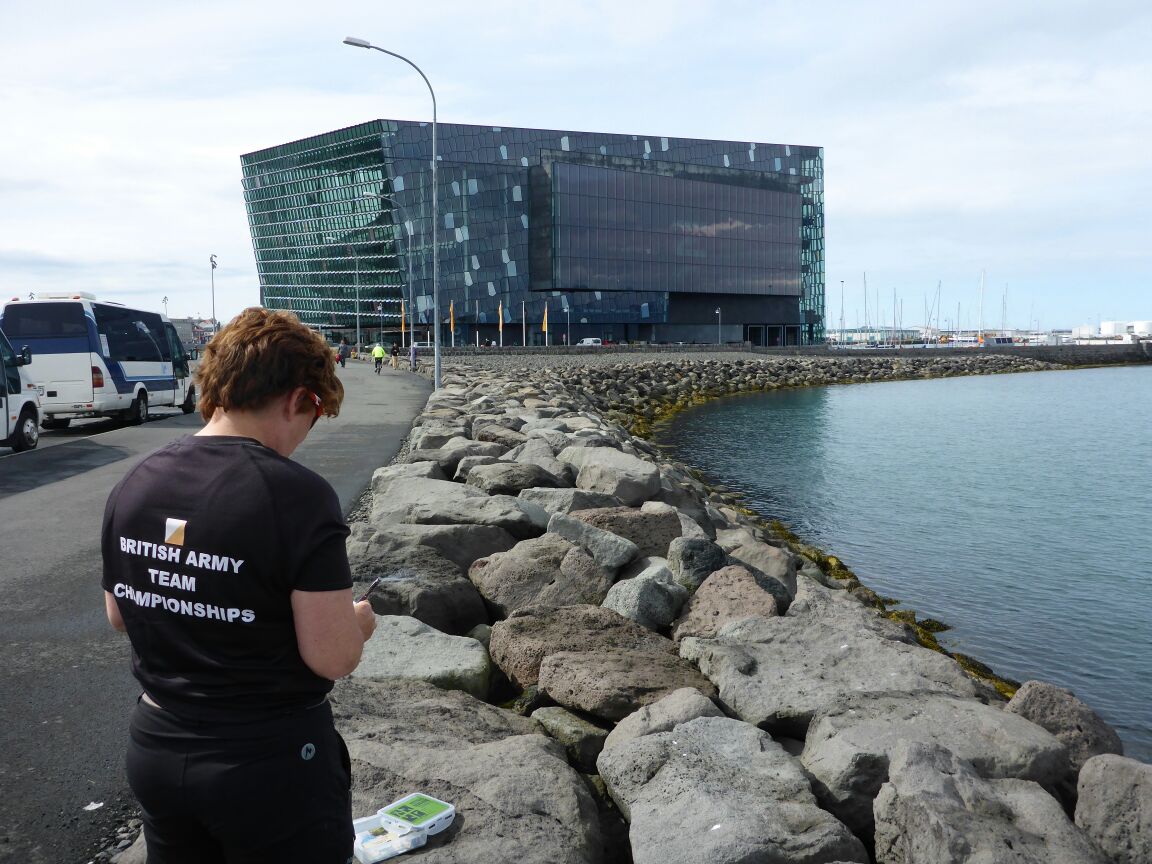
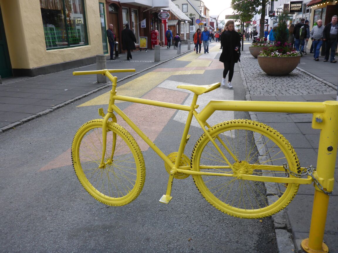
Then we find the city centre and have a look round. I wasn’t expecting much but actually it’s rather quaint, although not enough to keep you occupied for long.
 After a bite to eat, we head out to the airport via Hafnarfjörđur to pick up the cottage keys. Mum’s flight is due at 2250hrs but is a little delayed, not landing until 2305hrs. She’s fine, although a little weary, and we head out to the cottage. We think it’ll take about 2 hours but it’s a little quicker with hardly any traffic. It seems a little darker, nearer twilight than daylight now that we are in the south of Iceland, and as we drive along the quiet roads we spot our first geothermal plumes coming up in the cool night air. We are realy looking forward to seeing what the south of Iceland has to offer. When we arrive at the cottage we’re all so tired that we get the car unloaded, have a quick cuppa and we’re all off to bed at 2am!!
Monday 27th July
Everyone starts stirring at around 0830am. I’d have liked more sleep but it’s not to be. We have a relaxed breakfast and enjoy the views.
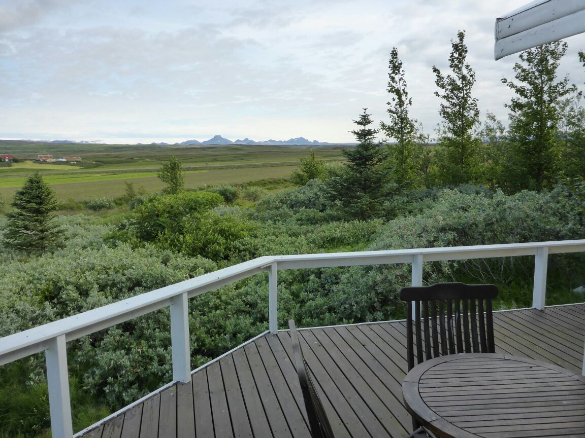
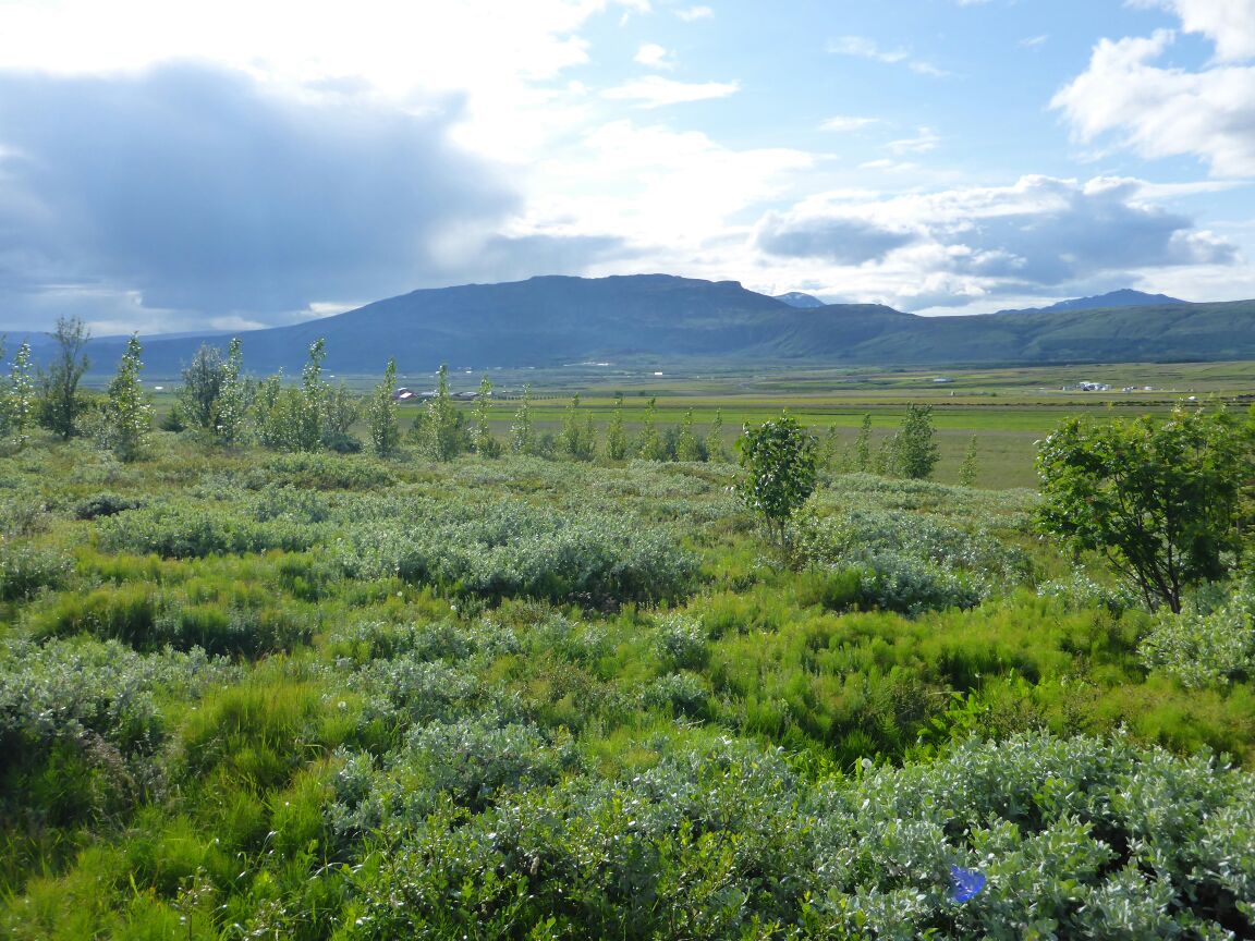
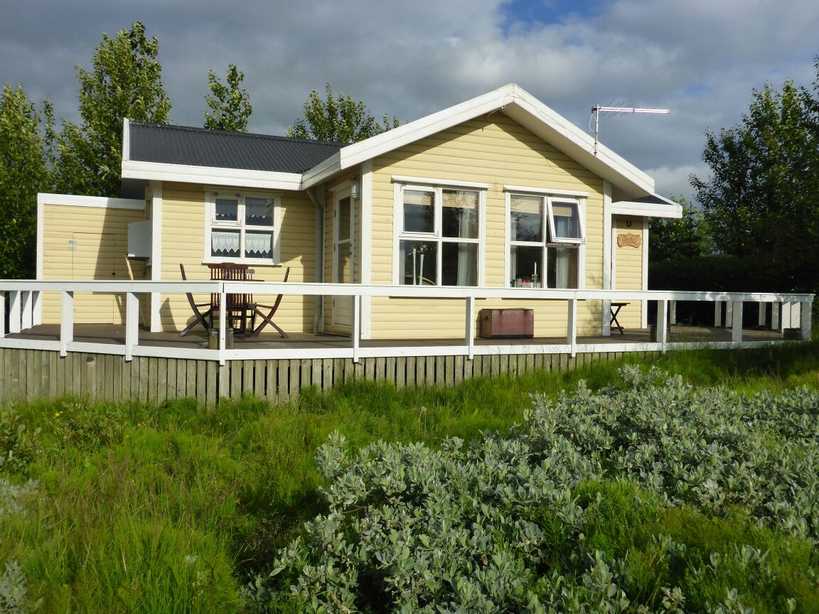
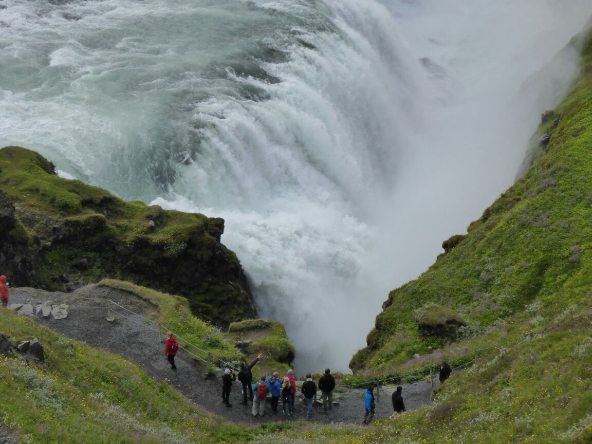
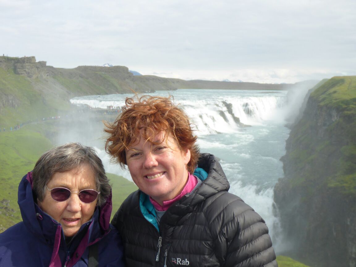
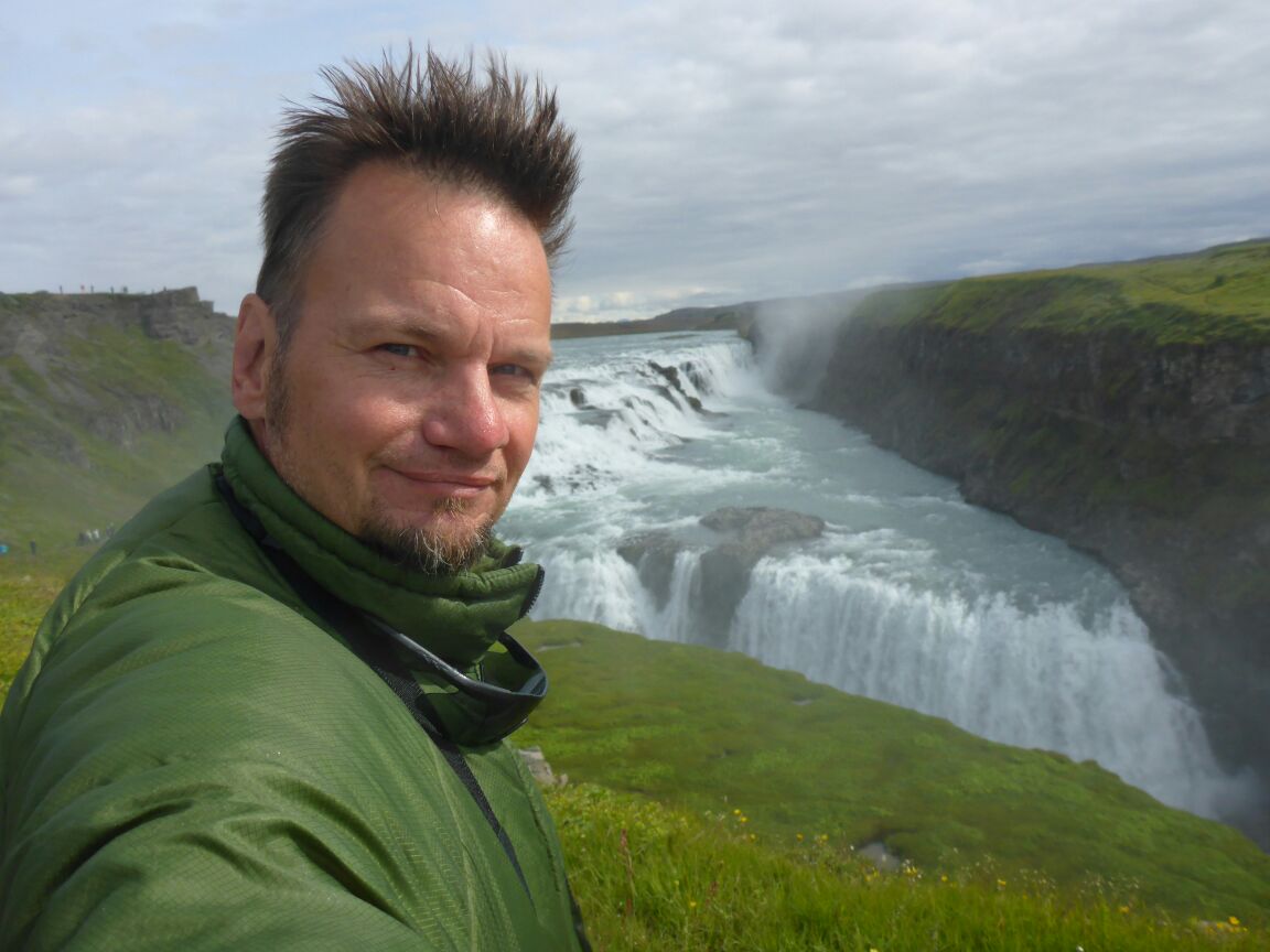
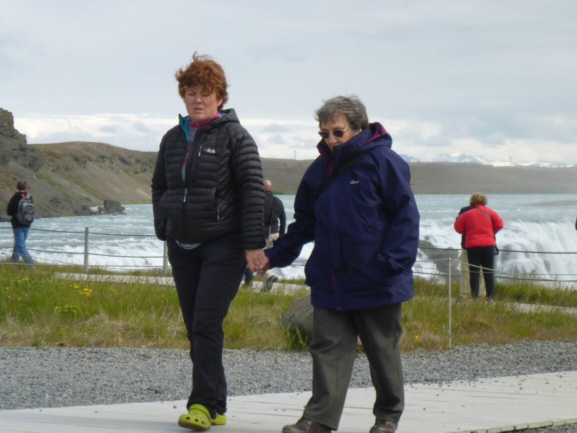
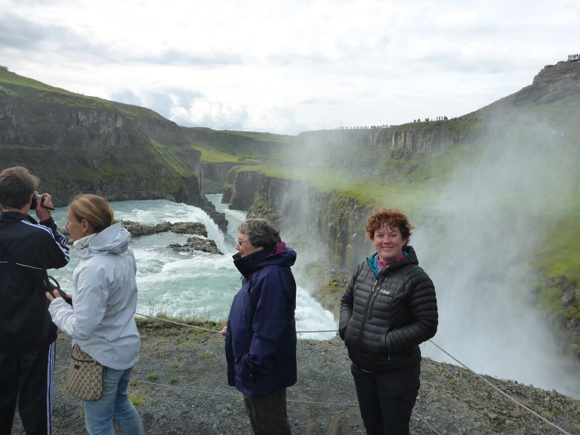
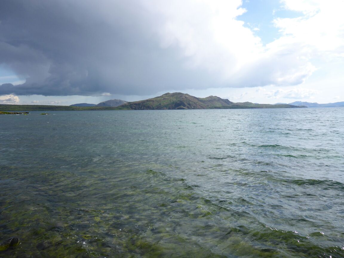
 The cottage is only 5km from Gullfoss and Geysir, which we can see in the valley laid out below us as we stand on the decking and we can also see Langjökull glacier to the north, an amazingly large amount of snow. After breakfast we drive to Gulfoss. Mum is just commenting that it can’t be anything special because there’s no high ground and then we turn the corner to see the land fall away in the river valley, and a fantastic waterfall. Awesome.
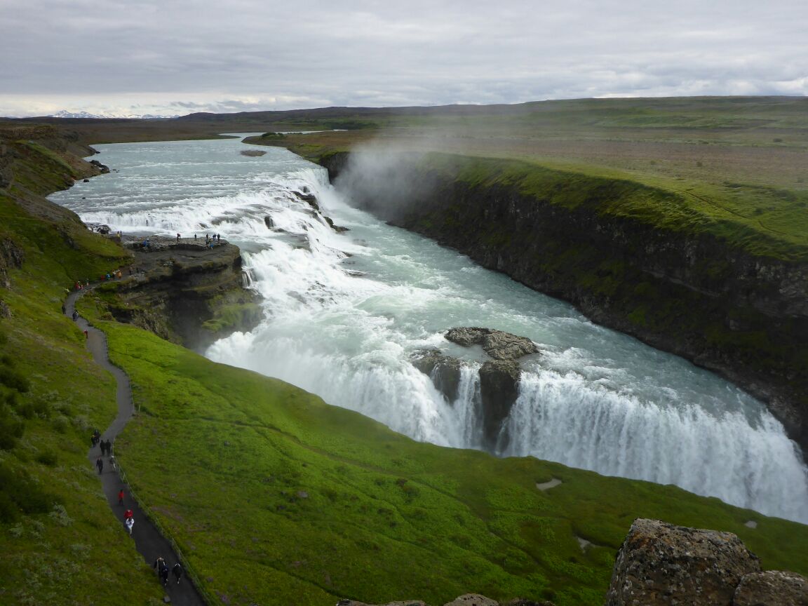
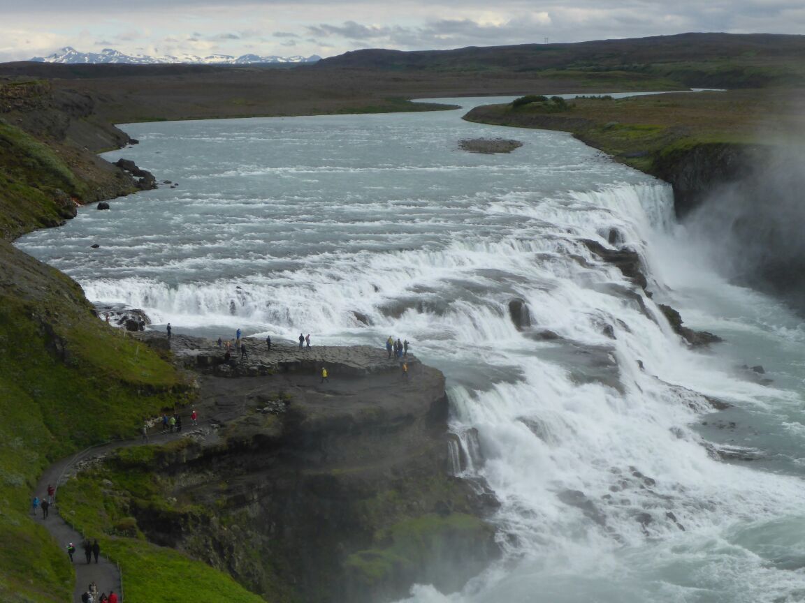
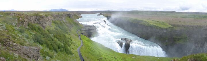
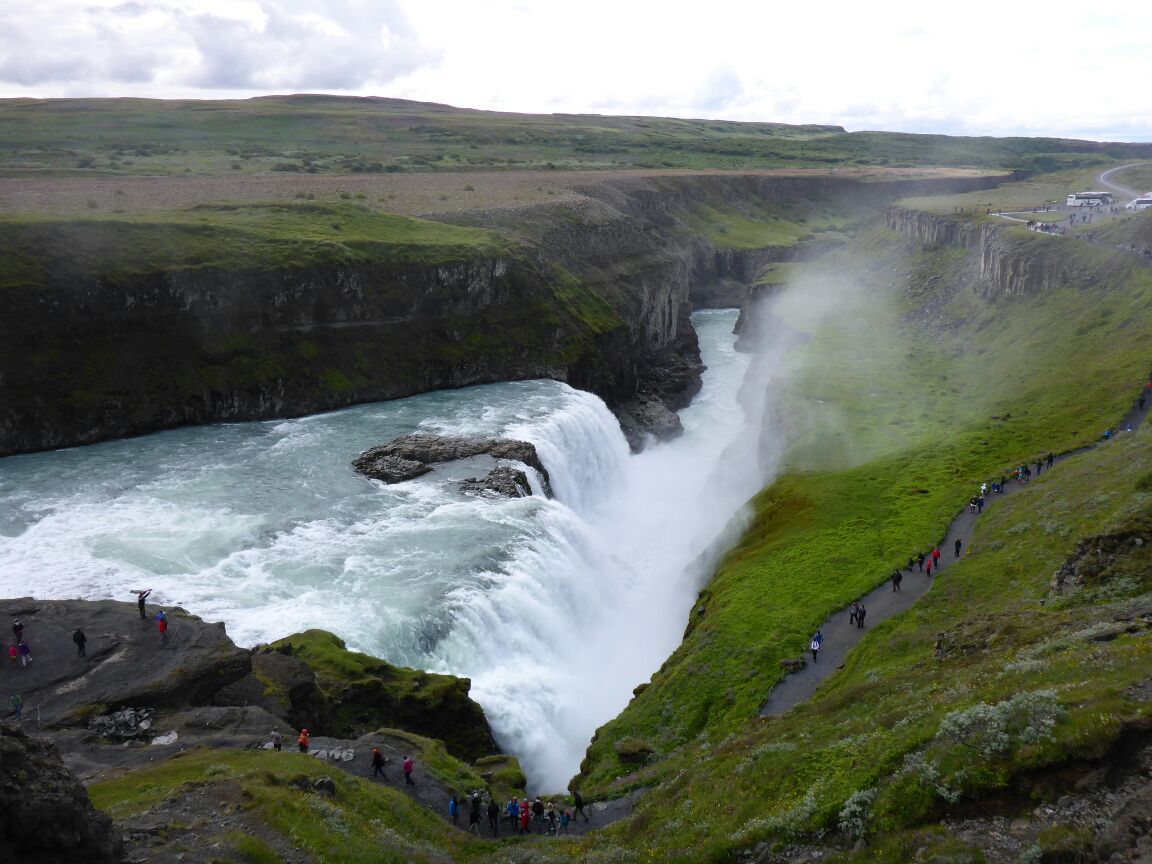
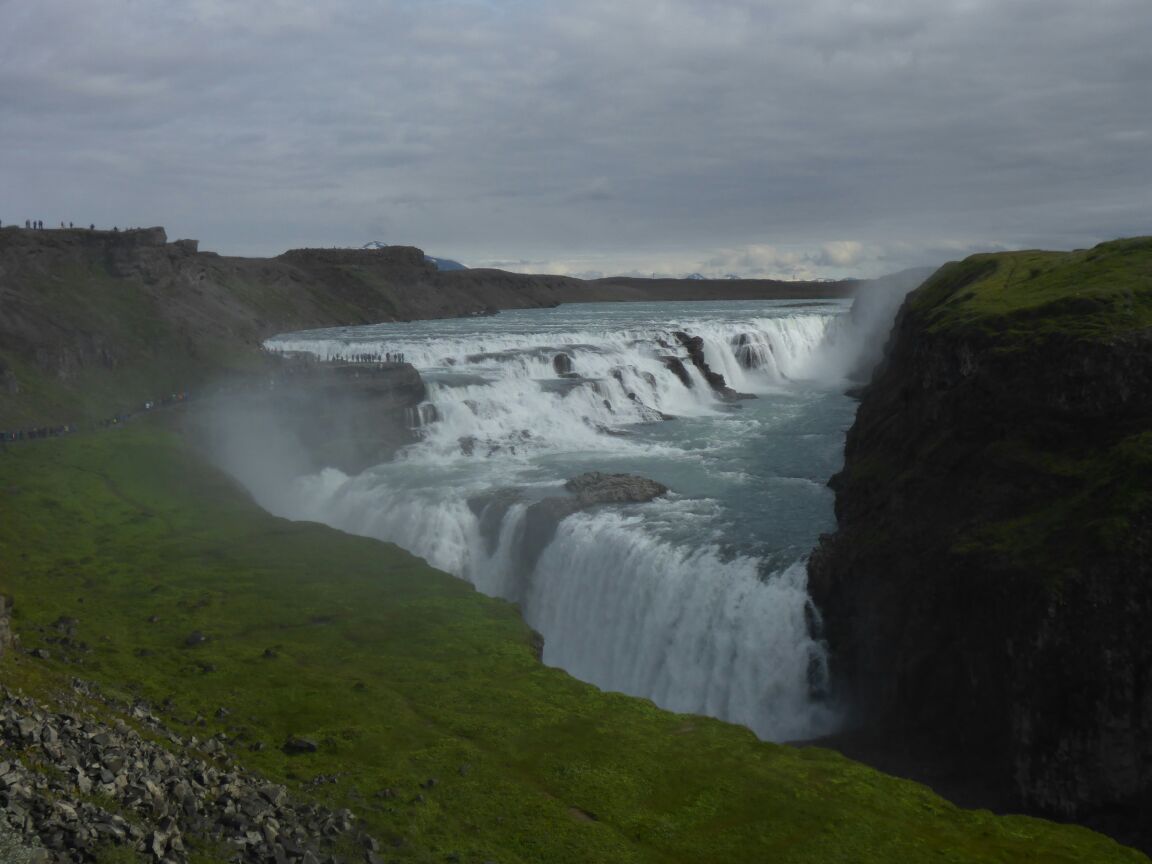
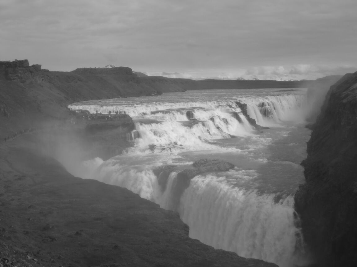
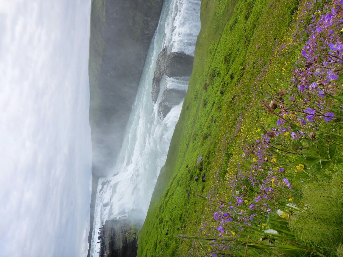
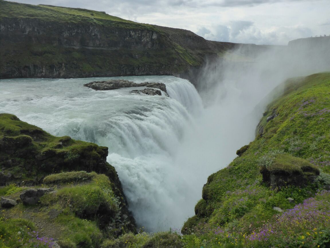
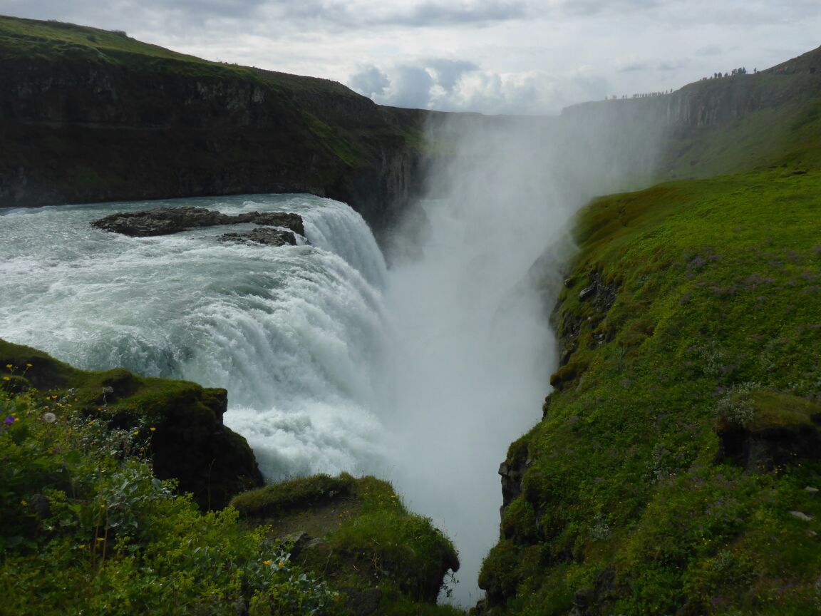
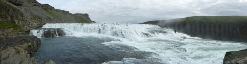
Gullfoss is Iceland’s most famous waterfall. Gullfoss means translated “Golden Falls” and is one of Iceland’s most beautiful and without a doubt Iceland’s most popular waterfall. Gullfoss is in the river Hvítá (engl. white river), which has its origin in the glacier lake Hvítávatn (engl. white river lake, simples huh??) at Lángjökull glacier about 40km north of Gullfoss.
Gullfoss consists of 2 waterfalls. The height of the upper waterfall is 11m and the lower one is 20m. The Gulfoss gorge was formed by flash flood waters that forced their way through cracks in the basalt lava layers. The average water flow is 109m3 per second, but sometimes reaches 2000m3sec (makes me want to go tinkle!!). The gorge is approximately 2.5km in length and up to 70metres in depth
Glacial water is brownish, since it carries lots of sediments that the glacial ice has carved off the earth. Gullfoss is called the “Golden Falls”, since on a sunny, day the water plunging down the three step staircase and then tumbling in two steps down into the 32 m deep crevice truly looks golden.
Sigríður Tómasdóttir, the daughter of Tómas Tómasson who owned the waterfall in the first half of the 20th century must have felt the same. She lived at a farm nearby and loved Gullfoss as no one else. At this period of time much speculation about using Gullfoss to harness electricity was going on. Foreign investors who rented Gullfoss indirectly from the owners wanted to build a hydroelectric powerplant, which would have changed and destroyed Gullfoss forever. As the story goes it’s thanks to Sigríður Tómasdóttir that we still can uplift ourself with the beauty of Gullfoss, because she was the one that protested so intensly against these plans by going as far to threat that she would throw herself into Gullfoss and therby kill herself. To make her threat believeable she went barefoot on a protest march from Gullfoss to Reykjavik. In those days the roads weren’t paved and when she arrived after 120 kilometers her feet were bleeding and she was in very bad shape.
The people believed her and listened and the powerplant at Gullfoss was never built.
Today you can see the memorial site of Sigríður that depicts her profile at the top of the falls.
We enjoy a walk to all the viewpoints and are stunned by the majesty of this natural phenomenon. After the visit we drive back to the cottage for some lunch and have a little rest.
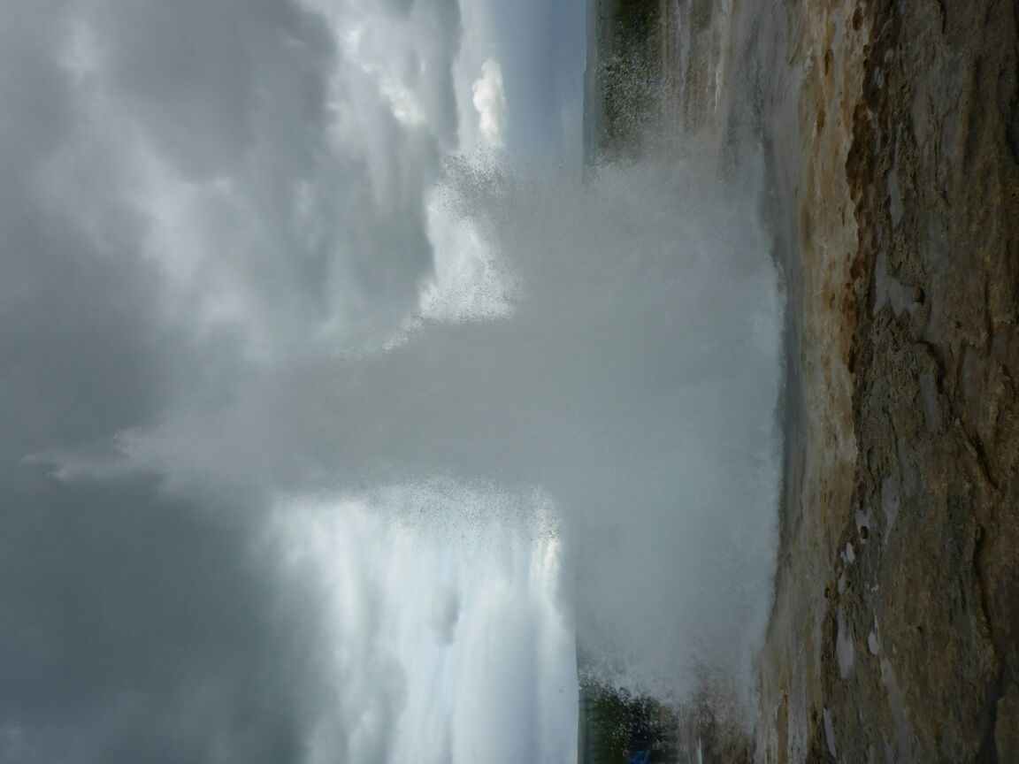
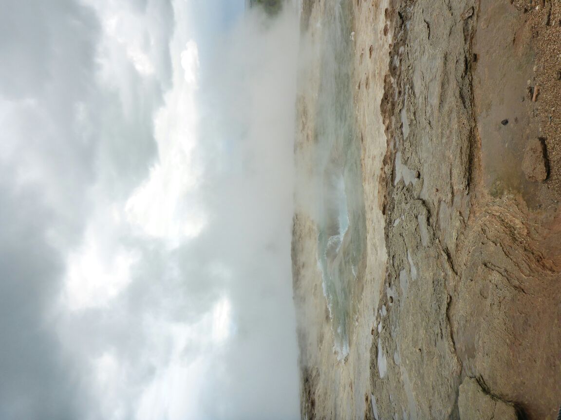
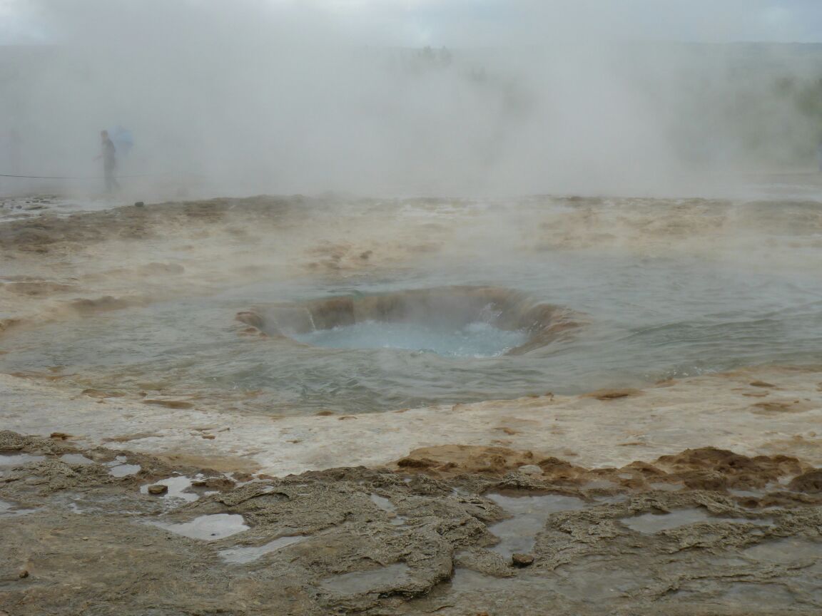
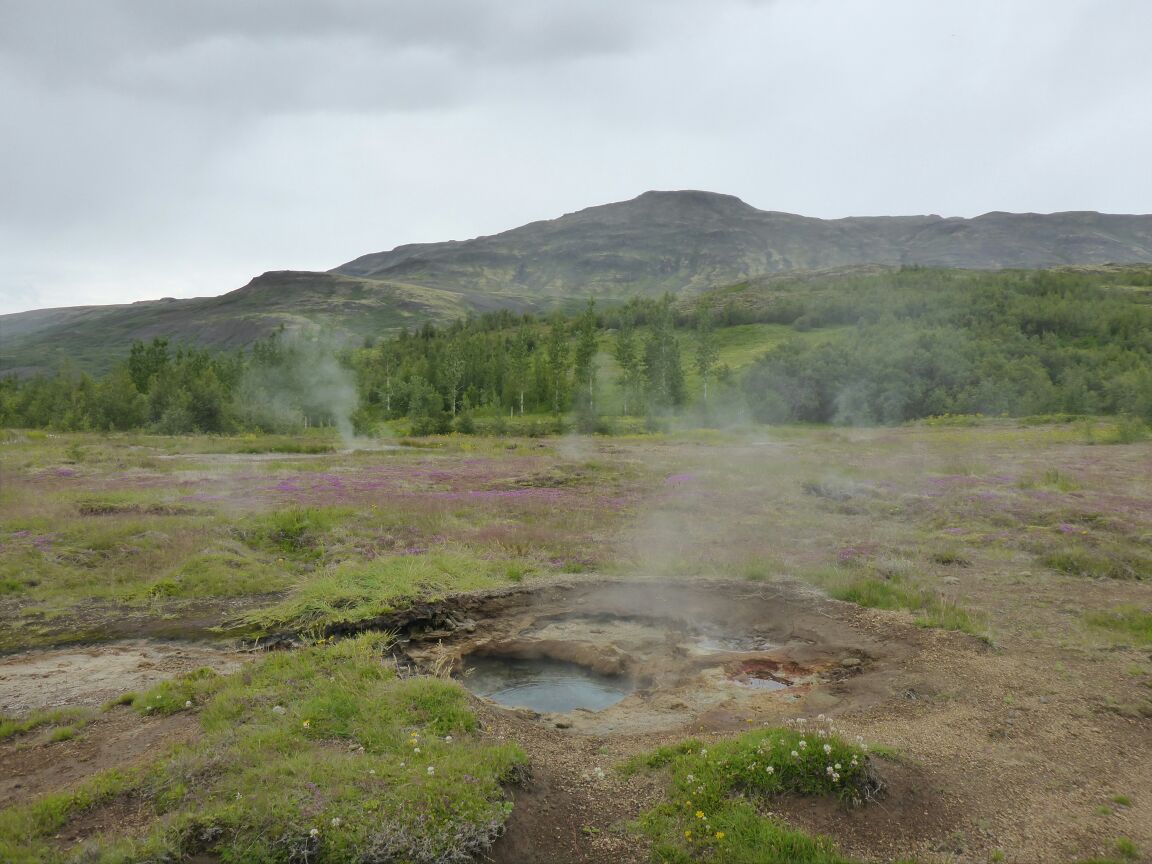
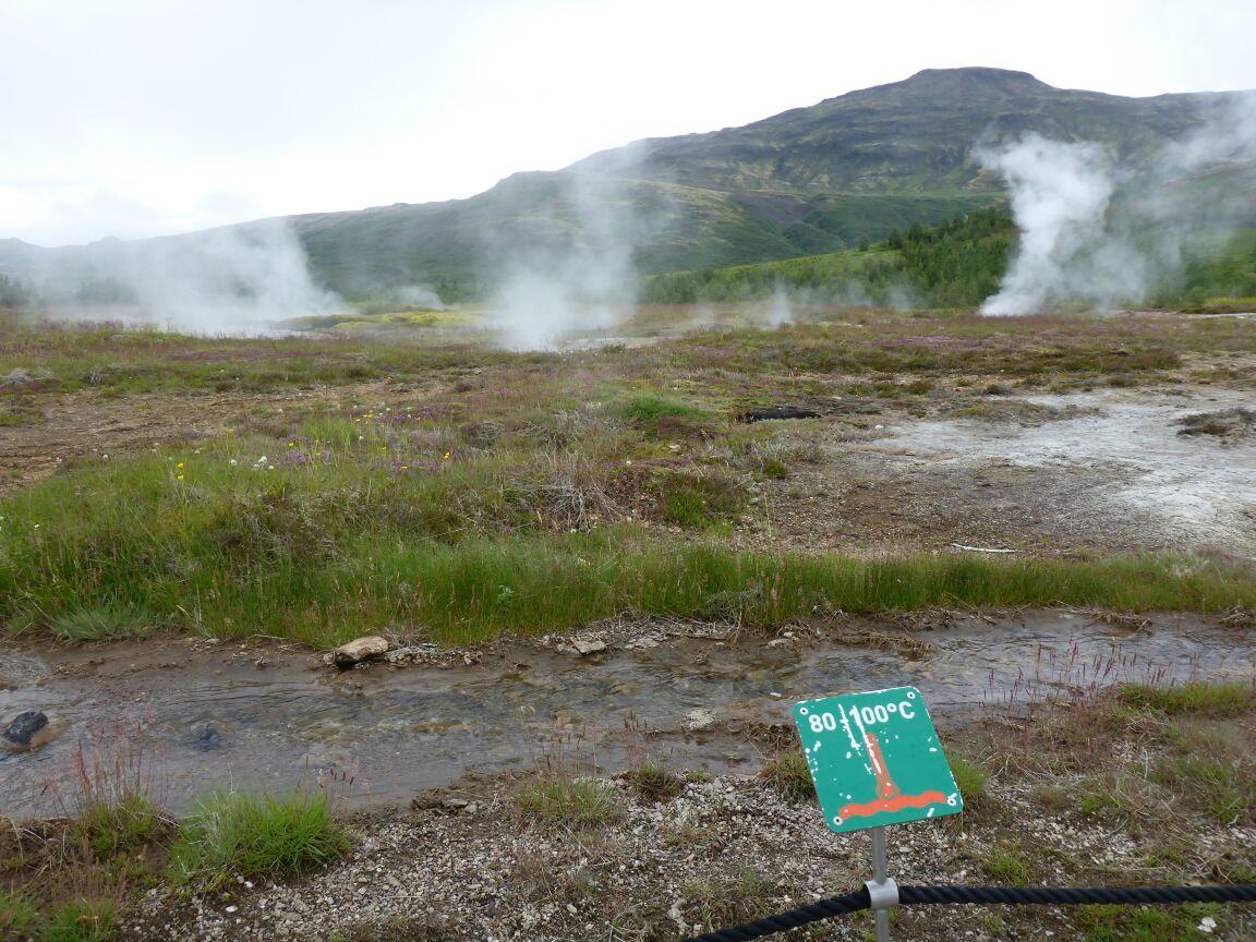
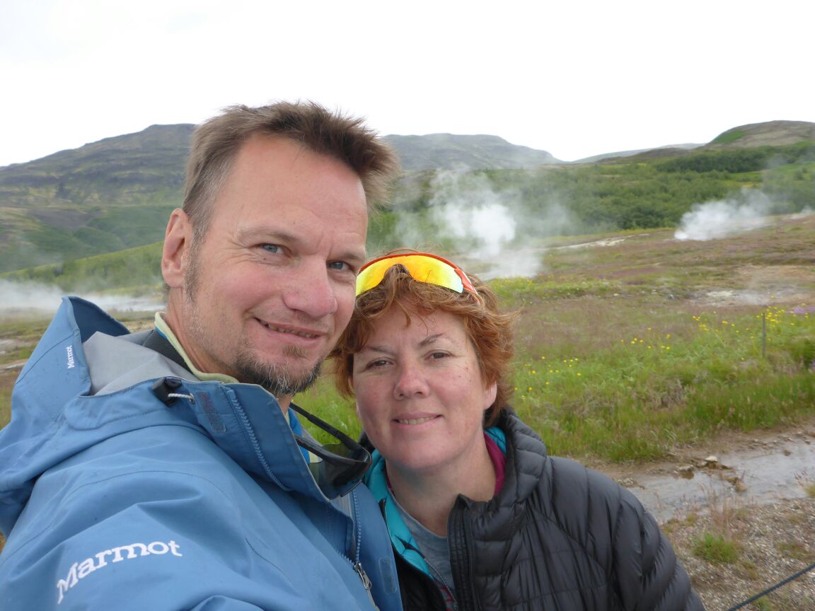
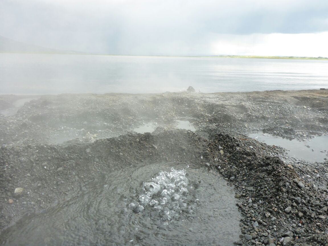
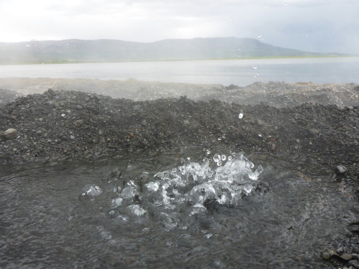
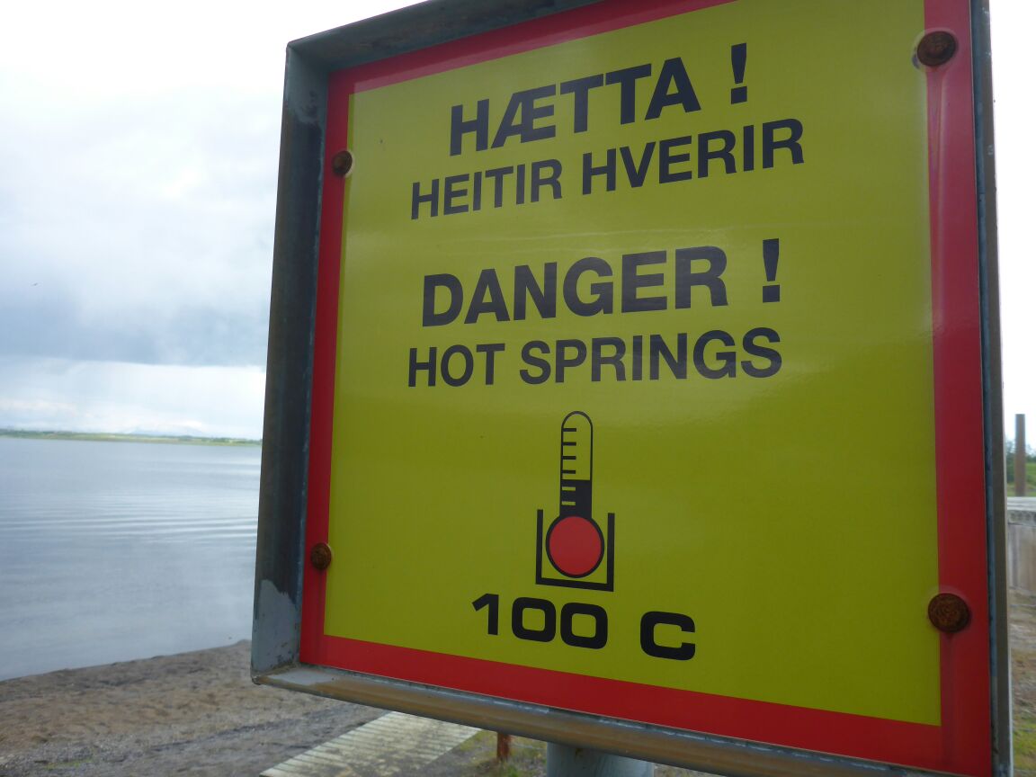
In the afternoon we drive to Geysir. The Icelandic geysers are in an active geothermal field. The Geysir field is situated at the northern edge of the southern lowlands, at an altitude of 105-120 m above sea level. Until recently, the area was called Hverasandar. The hot springs are located to the east of a little mountain called Laugafell.
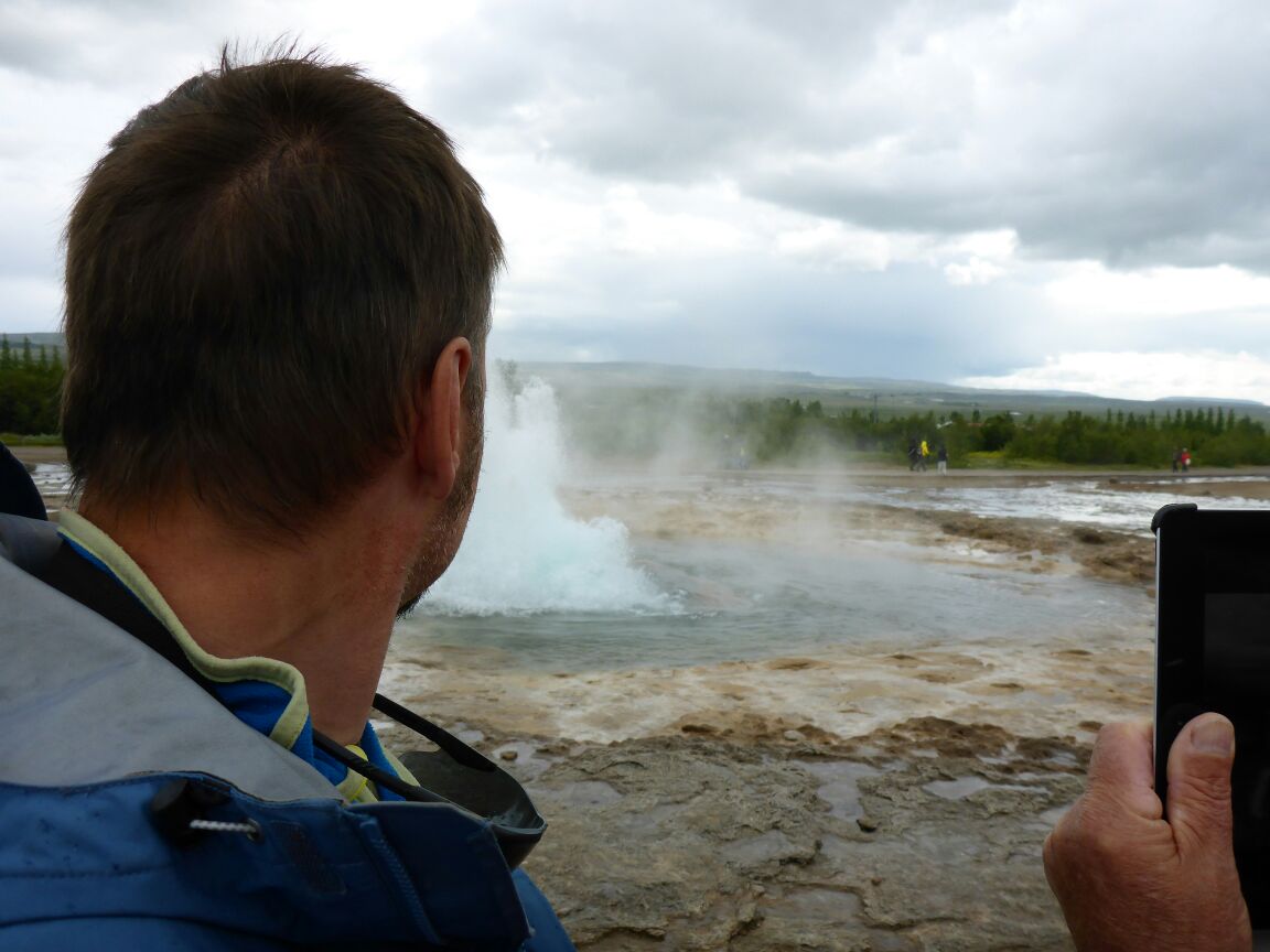
Strokkur (the churn) is currently the most energetic spouting spring in Iceland. It spouts every few minutes, sometimes to a height of 40 m, yet generally less than 10-20 m.
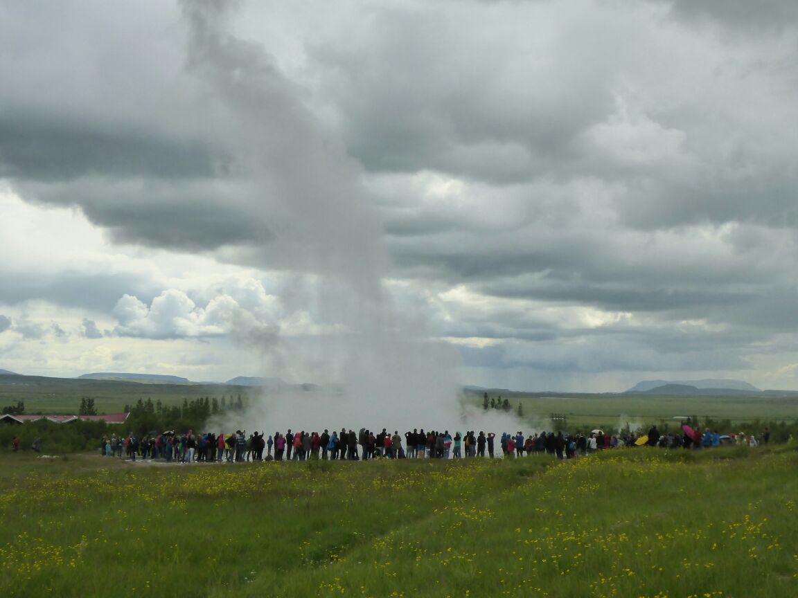
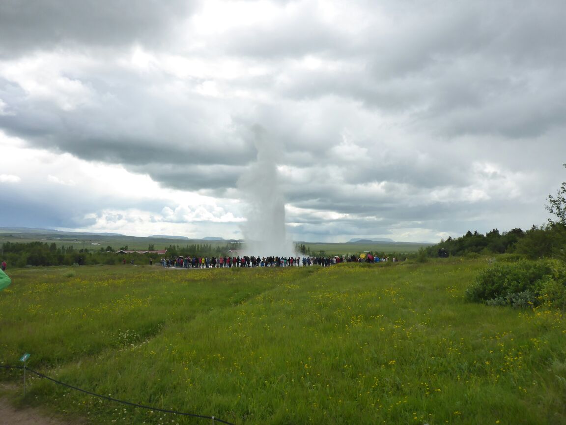
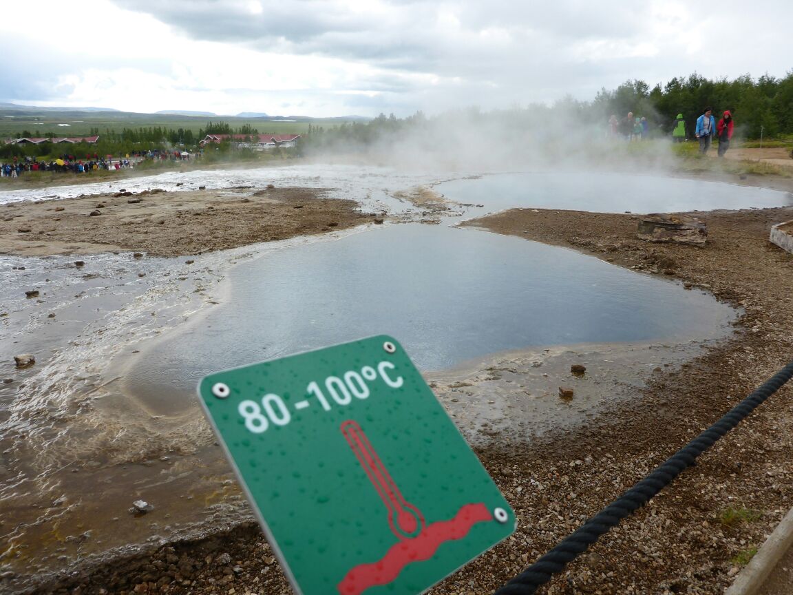
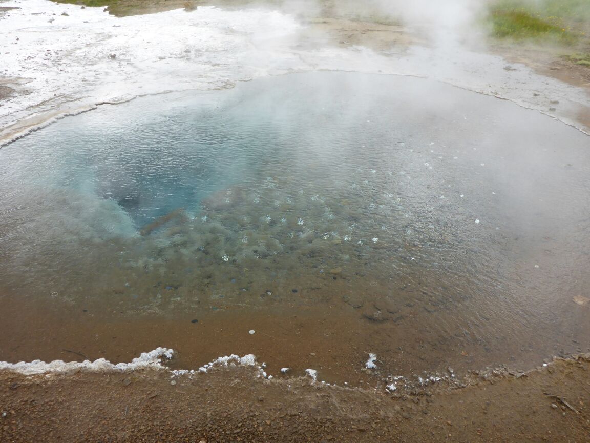
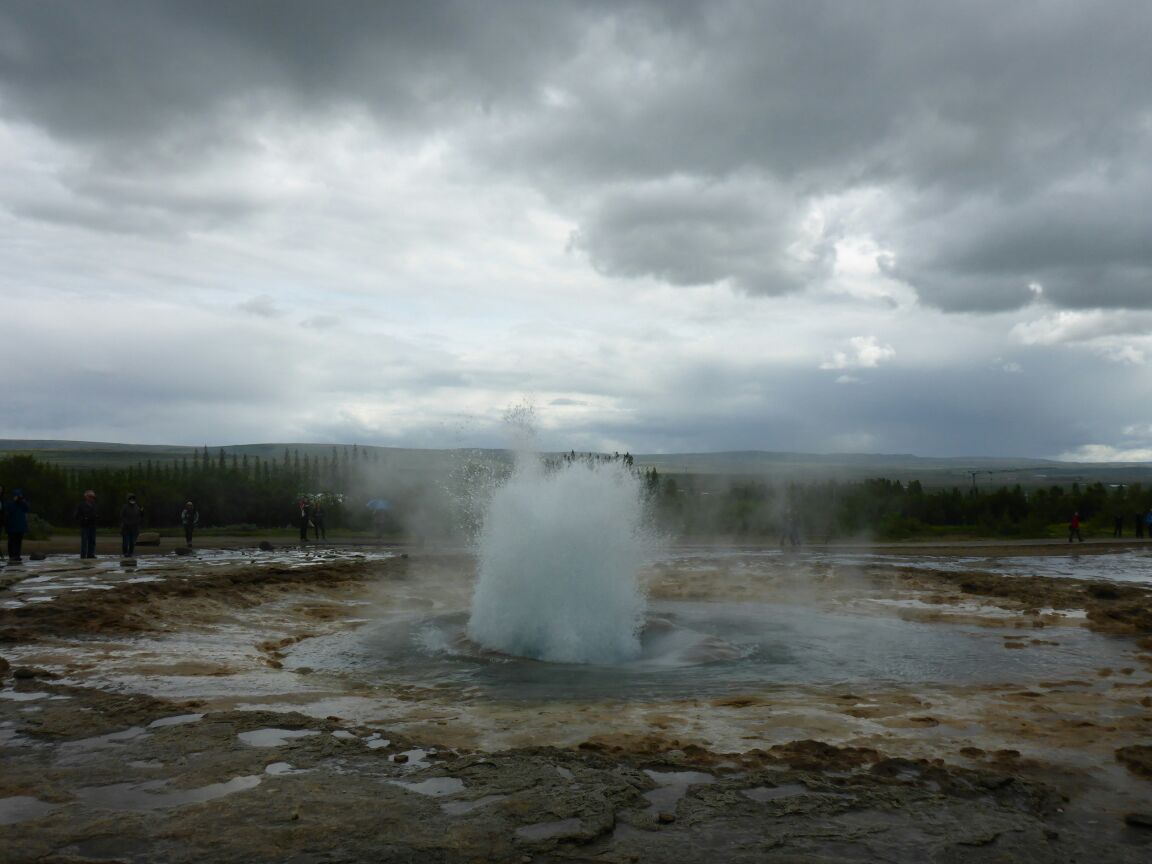
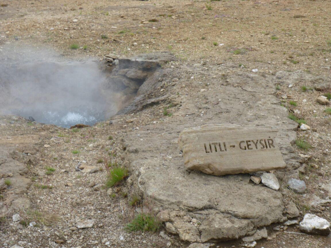
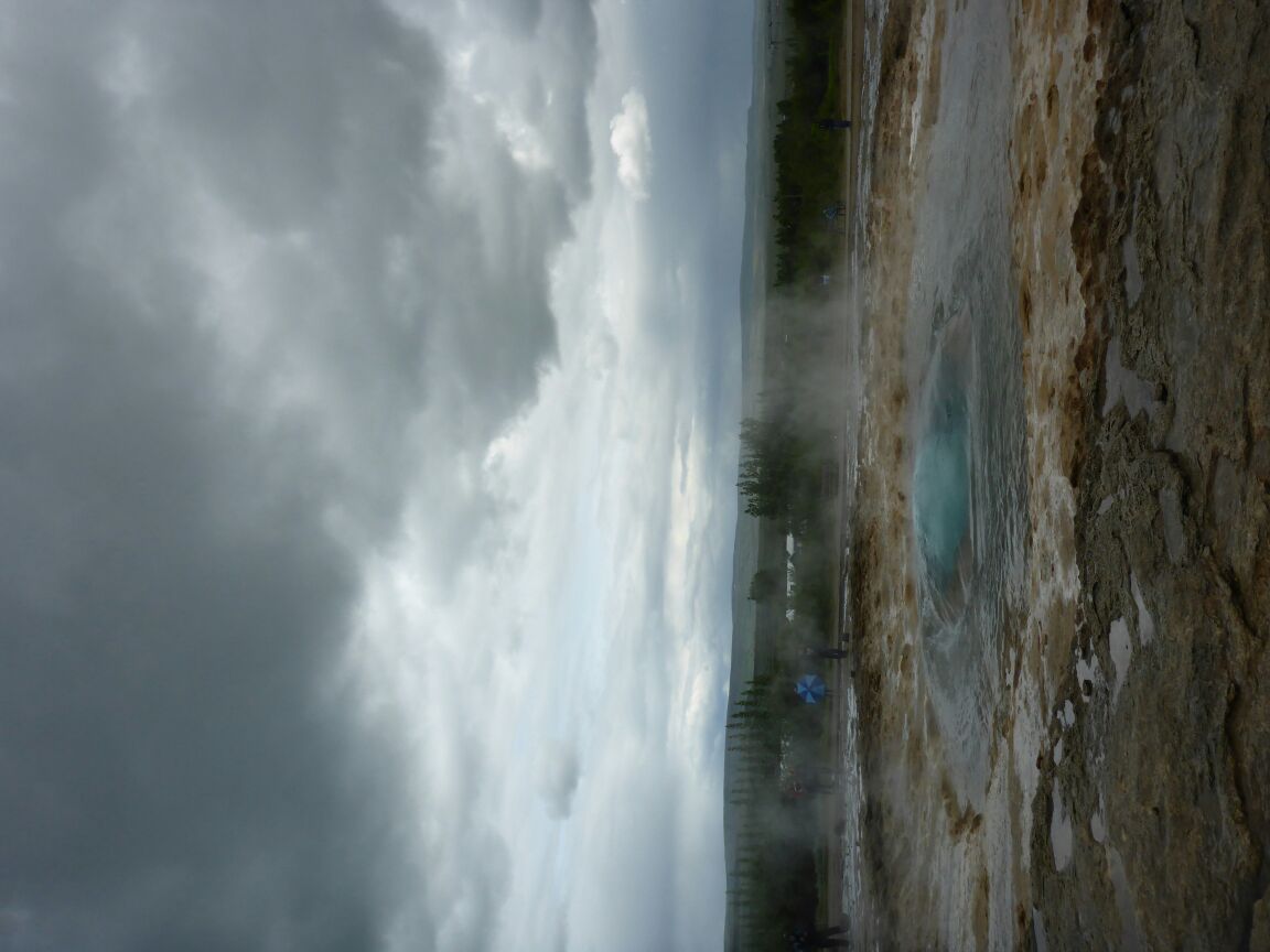 We know little of Strokkur’s age and past history. It was set off during an earthquake in 1789, having then been quiescent for some time. In all probability though, it had been active before. The Great Geysir (from which all others gained their name) has been adversely affected by earthquakes and now only erupts extremely infrequently. There are around thirty much smaller geysers and hot pools in the area, including one called Litli Geysir (‘Little Geysir’). The whole area is pretty amazing, but a strong smell of eggs makes me wonder if it’s Daz or the sulphur!!
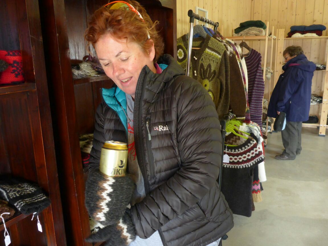
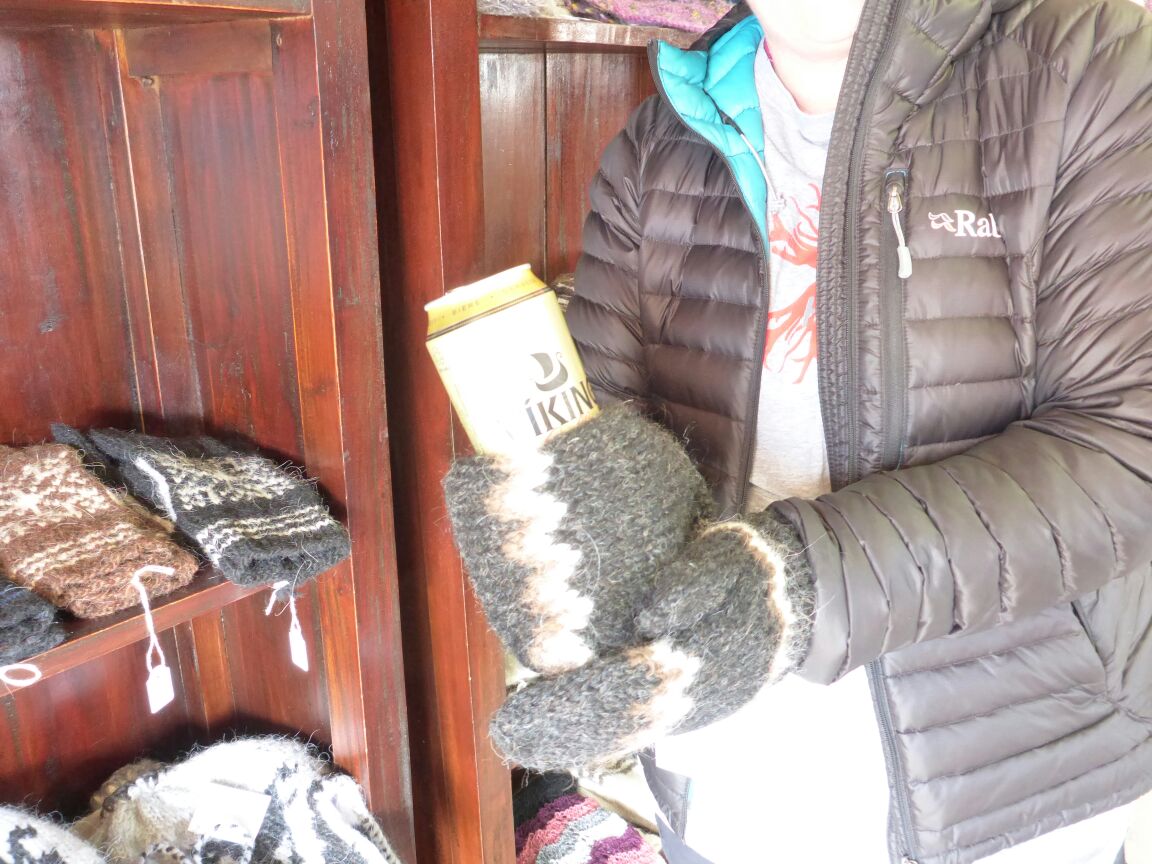
We head back to the cottage and have a short walk to a wool market
before retiring back to the cottage for some well earned dinner and sleep.
Tuesday 28th July.
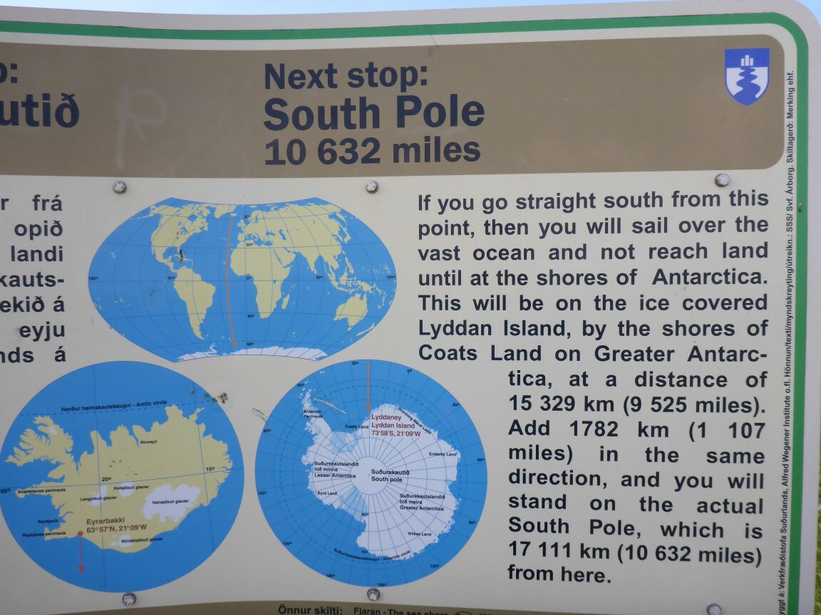
Today we are going to drive to the coast to Eyrabakki, the oldest but now defunct fishing village in Iceland, after we will go up to Thingvellir Nature Park and check out the Tectonic Plate area, where the American and Eurasian plates are splitting apart at an average rate of 2cm a year.
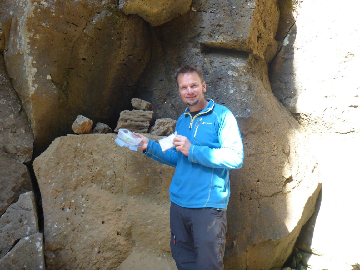
After a relaxed breakfast we head out into some glorious sunshine, on route to the coast. On the way we stop at the crater Kerið which was formed about 6,500 years ago and lies at the northern end of a row of craters known as Tjarnarhólar.
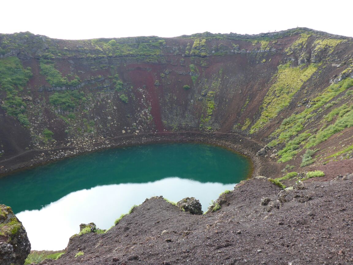
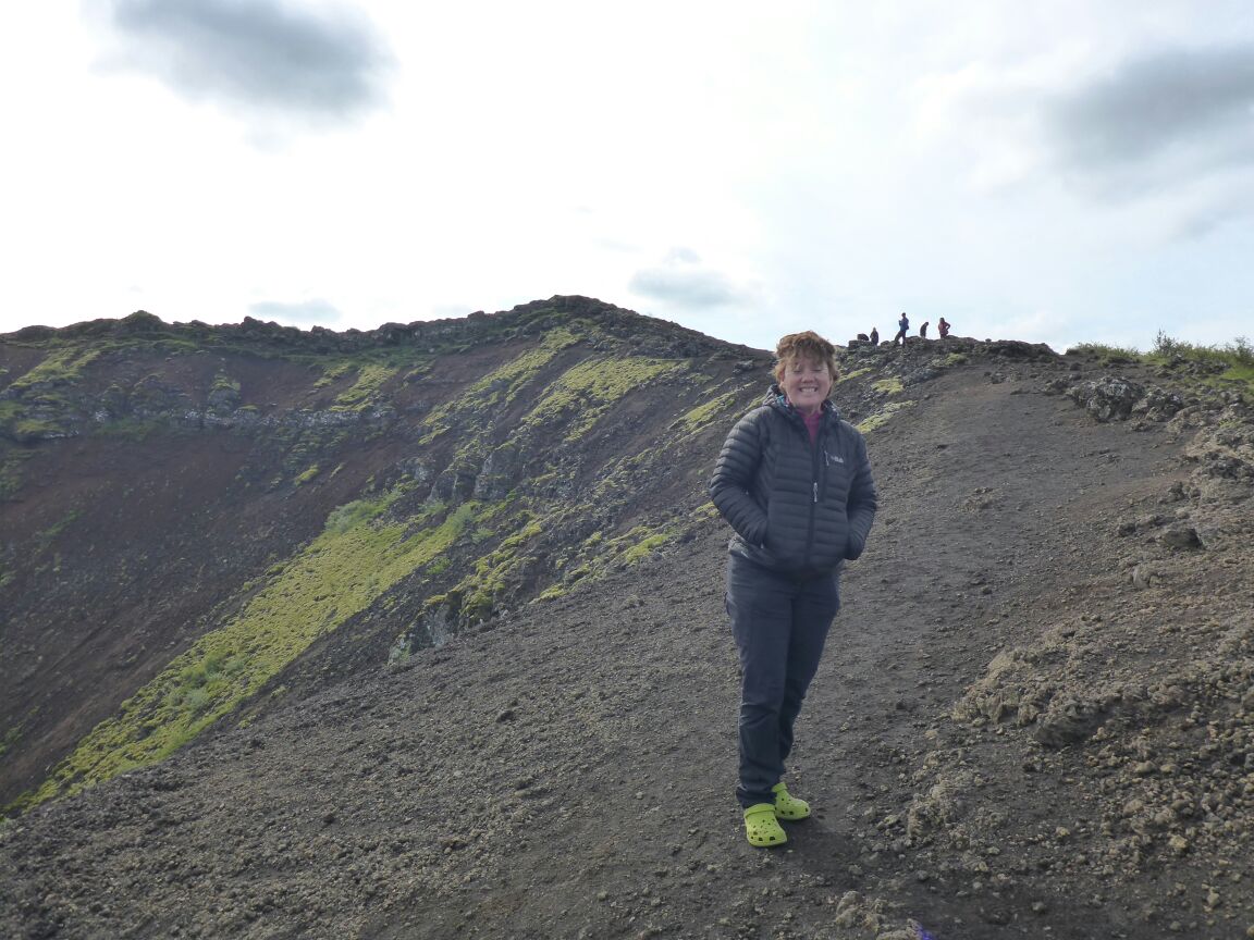
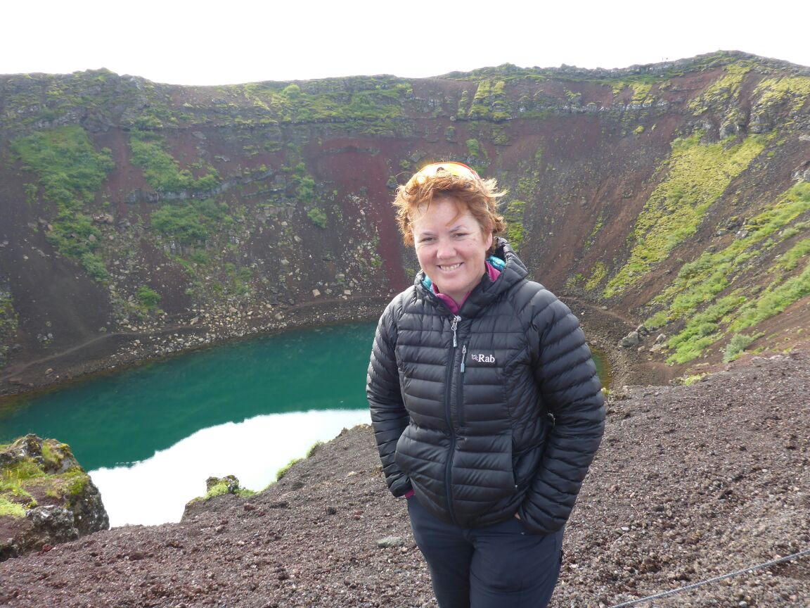
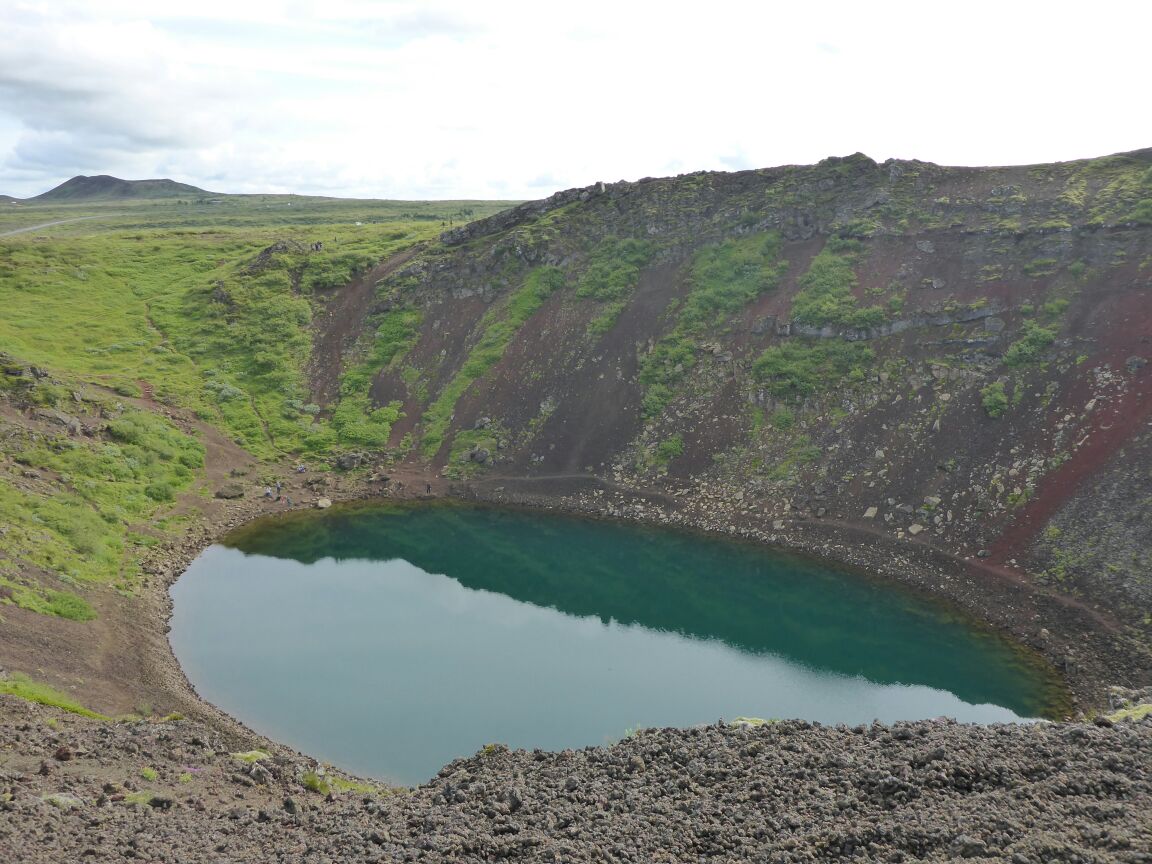
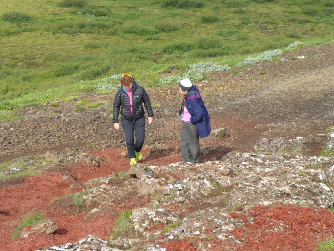
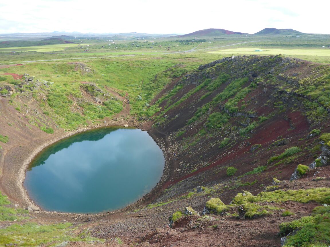
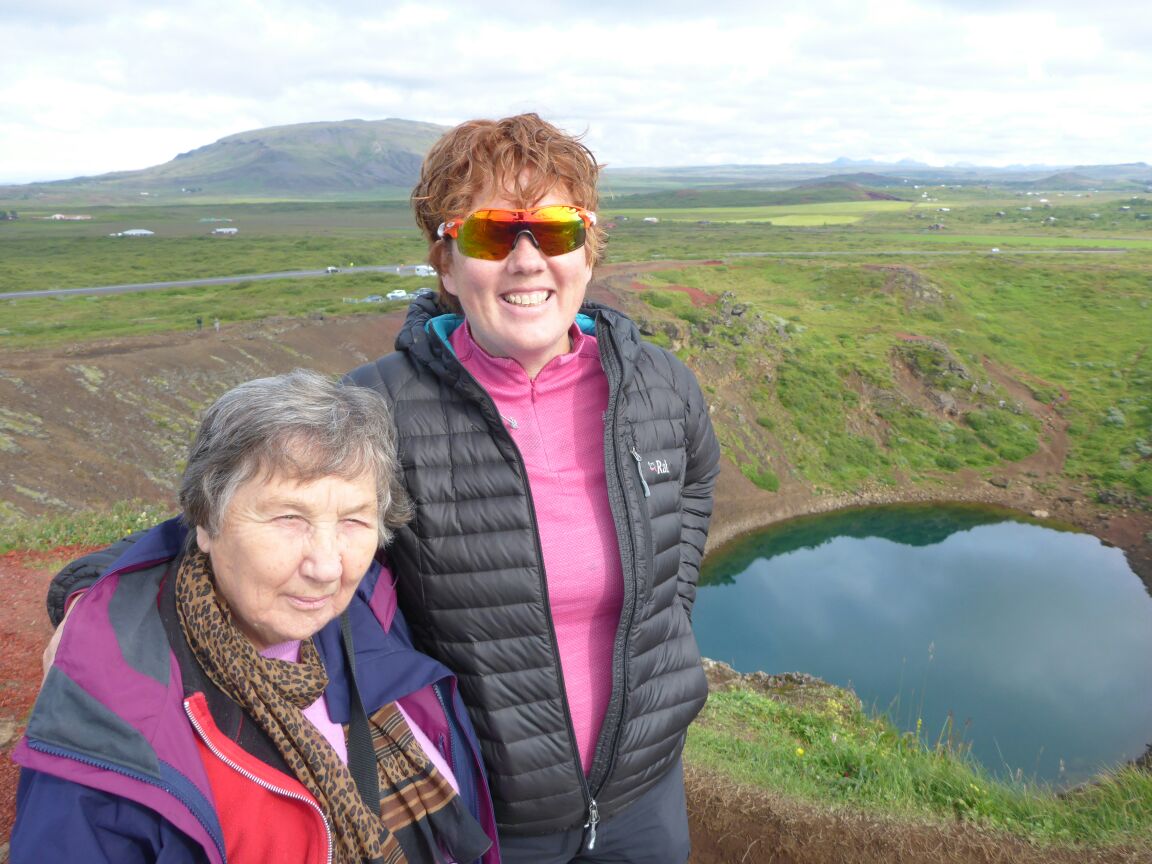
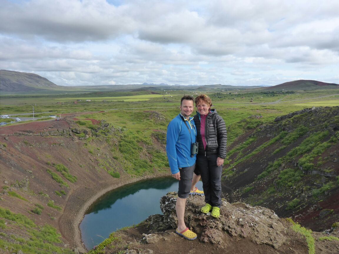
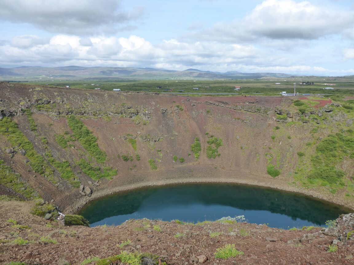
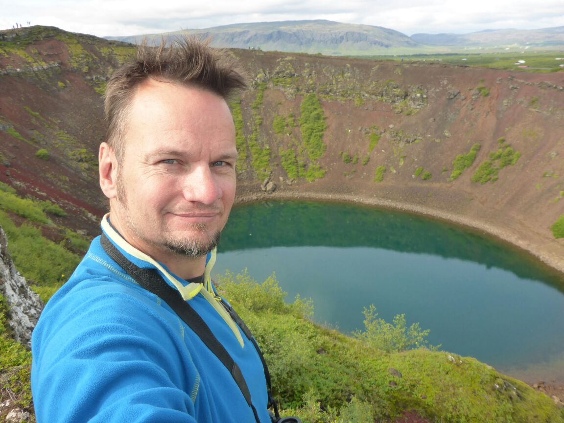
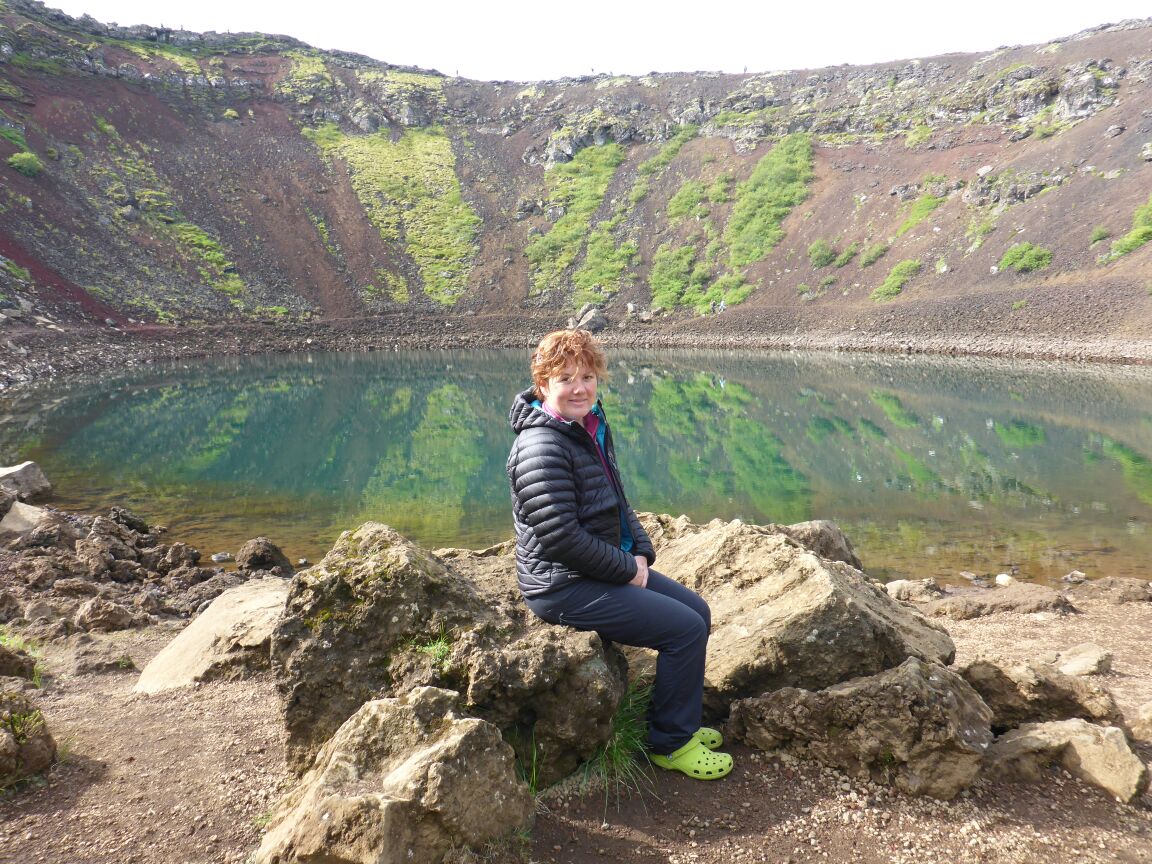
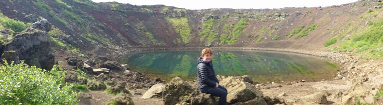 It is oval, about 270 m long, 170 m wide and 55 m deep: the depth of the water at the bottom varies between 7 and 14 m. According to an old tradition, a rise in the water level here is accompanied by a corresponding fall in the pond on Búrfell in Grímsnes and vice versa. Kerið lies in the Iceland´s Western Volcanic Zone, which runs through the Reykjanes peninsula and the glacier Langjökull. Traces of volcanism are not very obvious, since most of the eruption sites are low-lying and many of the craters are hidden by vegetation, but three craters in the Grímsnes area are clearly discernable and well-known features: Kerið, Seyðishólar and Kerhóll. We enjoy a lovely walk around the caldera and then down to the lake in the bottom.
From here we head for Selfoss. The town of Selfoss has a dramatic bridge that crosses Iceland’s most voluminous river. Today, the town is important for its creamery and is where a lot of Skyr (delicious Icelandic-style yoghurt) is made. The word Selfoss means ‘seal falls’ and we go off to find a geocache that will give us great views of the river.
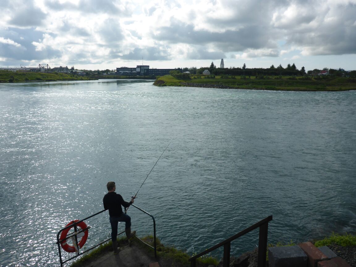
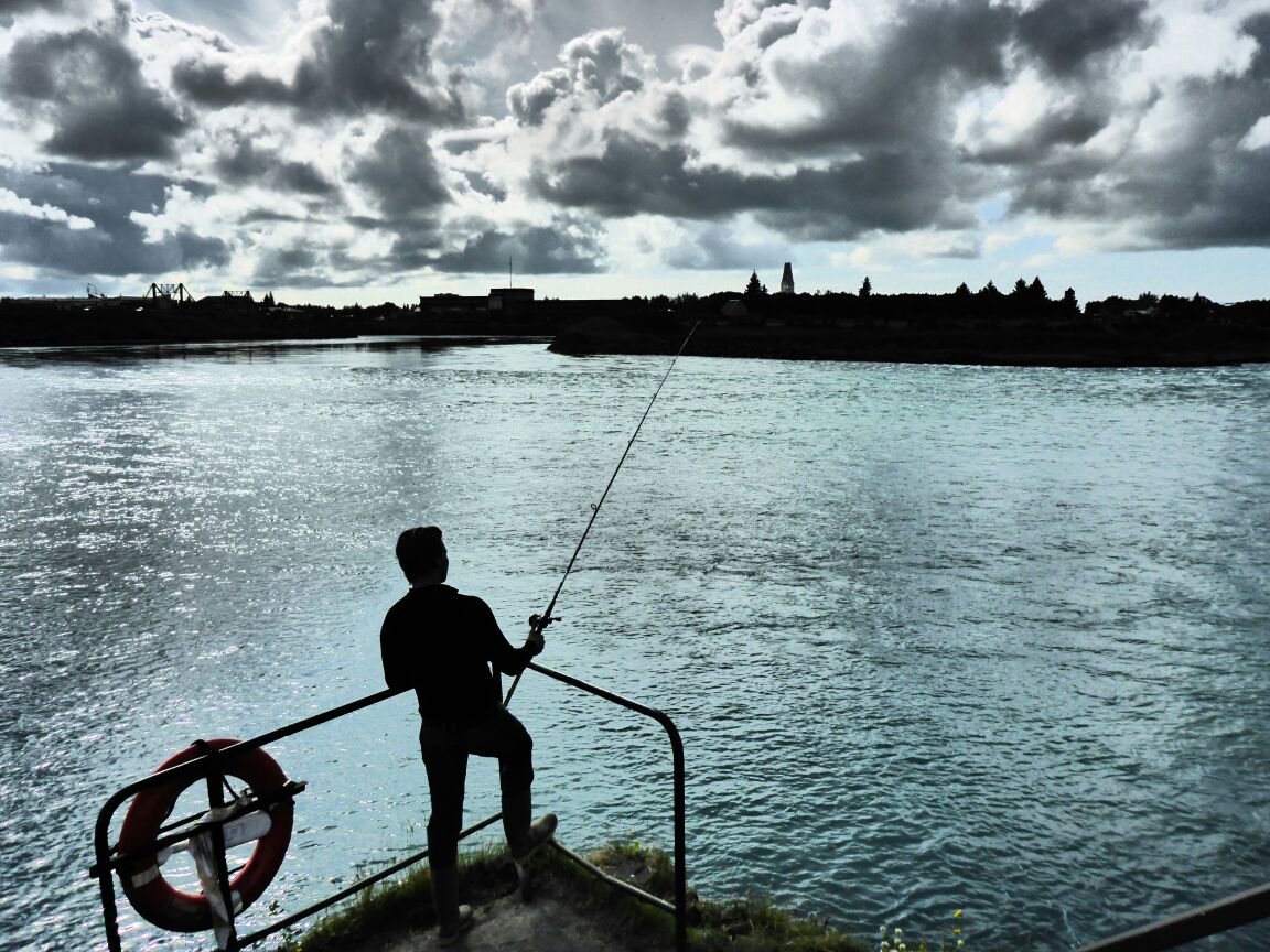
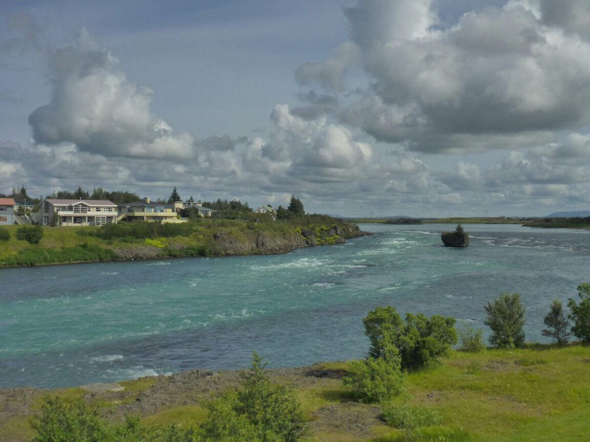
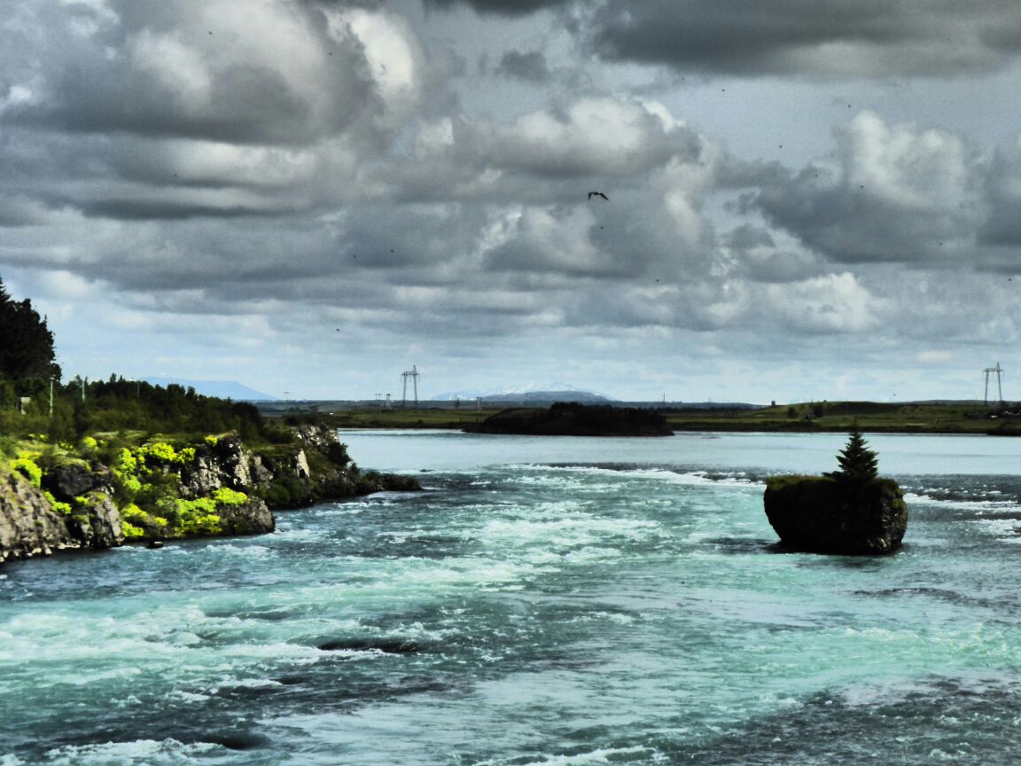 The river is impressive and there are several guys fishing for salmon. Selfoss is a small town, having grown from only 40 inhabitants in 1900, to approximately 6000 people by 2006. From the river we go to the market place seeking another cache and coffee.
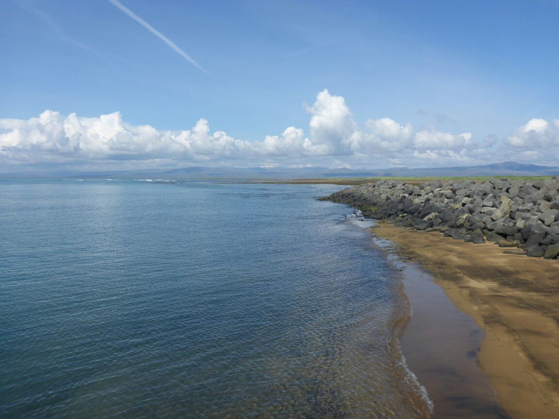
From Selfoss we drive to Eyrabakki. The landscape to this, the oldest fishing village in Iceland, is completely flat. In the village we drive to the now, disused harbour. They stopped fishing here in 1992 because of silt build up in the rivers. We have our picnic lunch looking out to sea, admiring the lovely view.


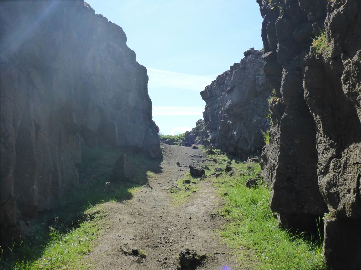
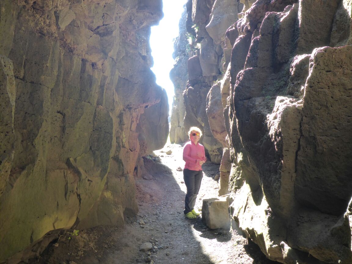
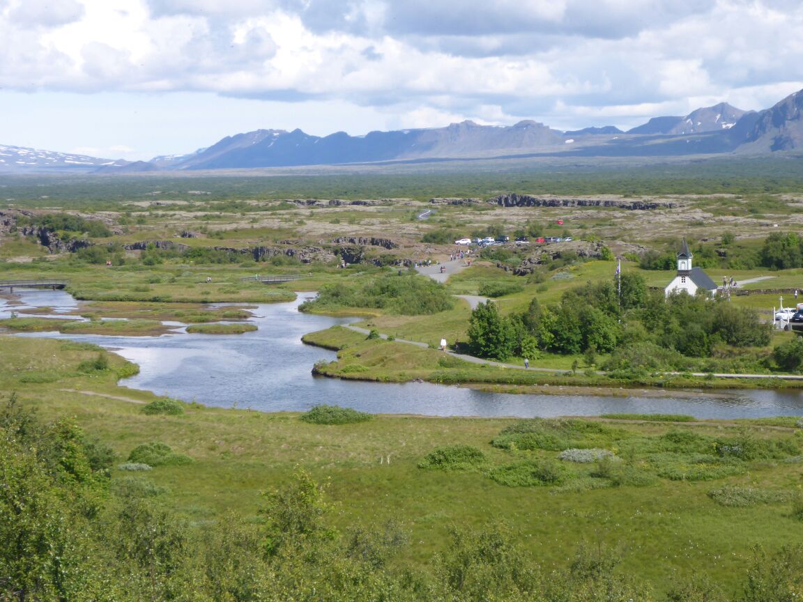
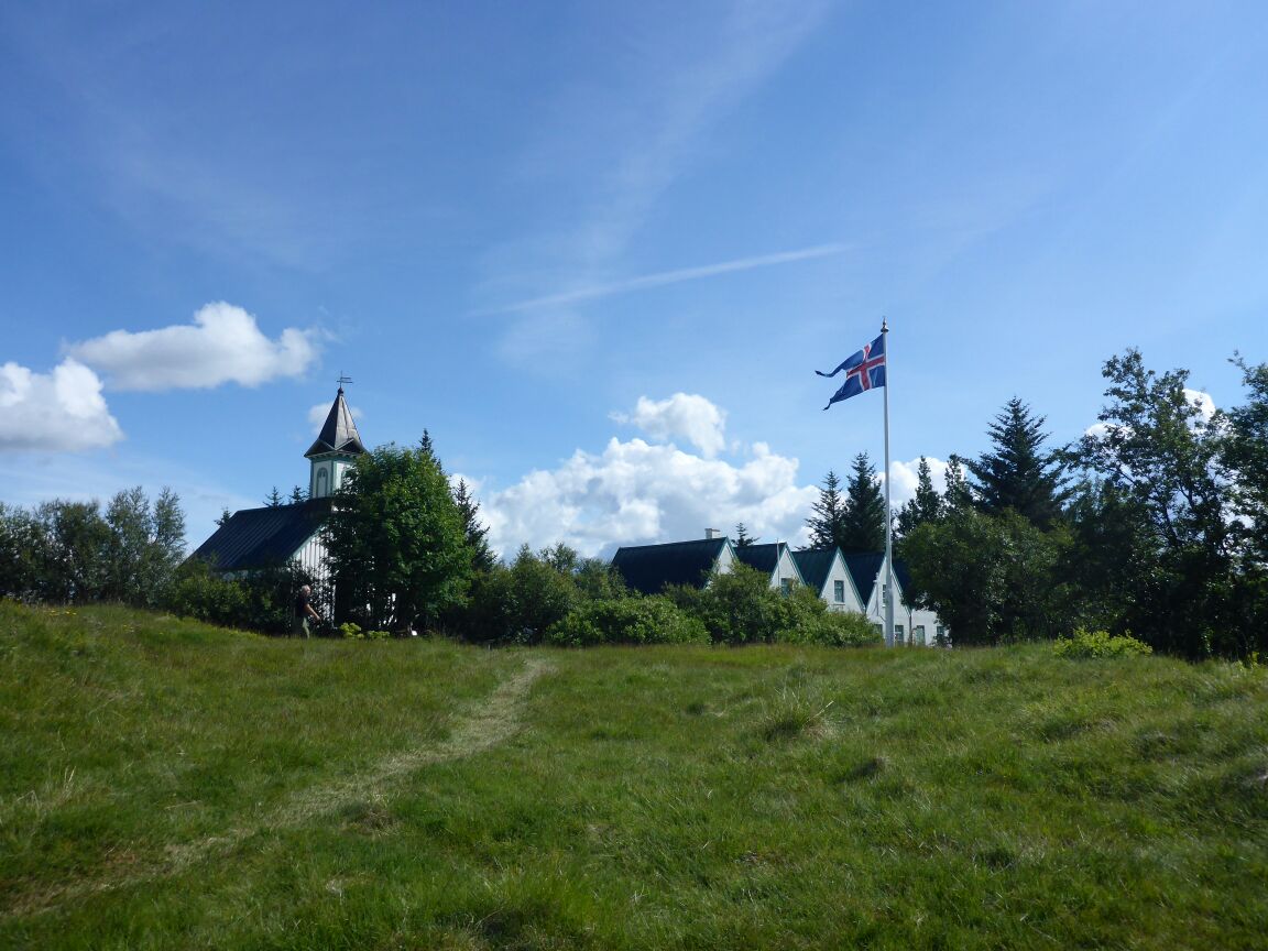
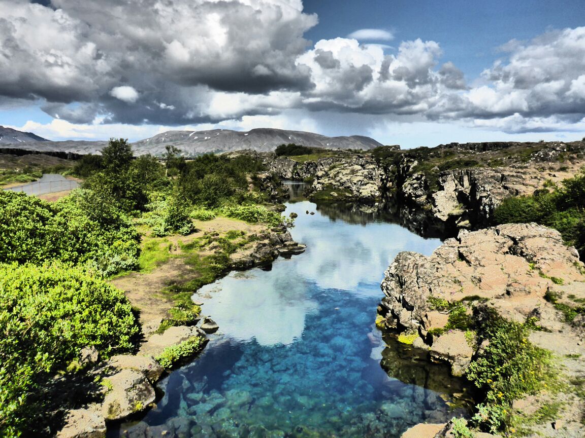
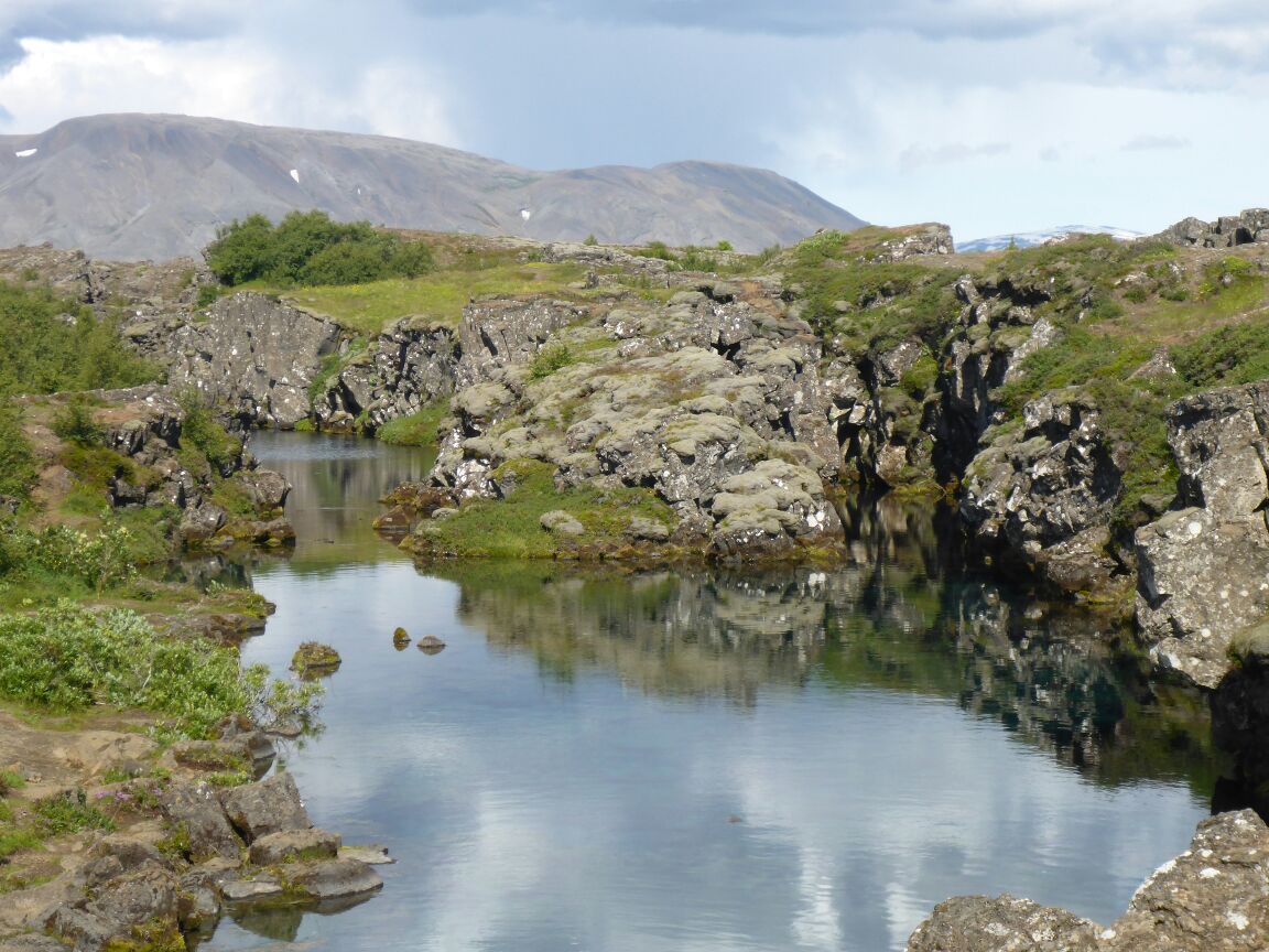
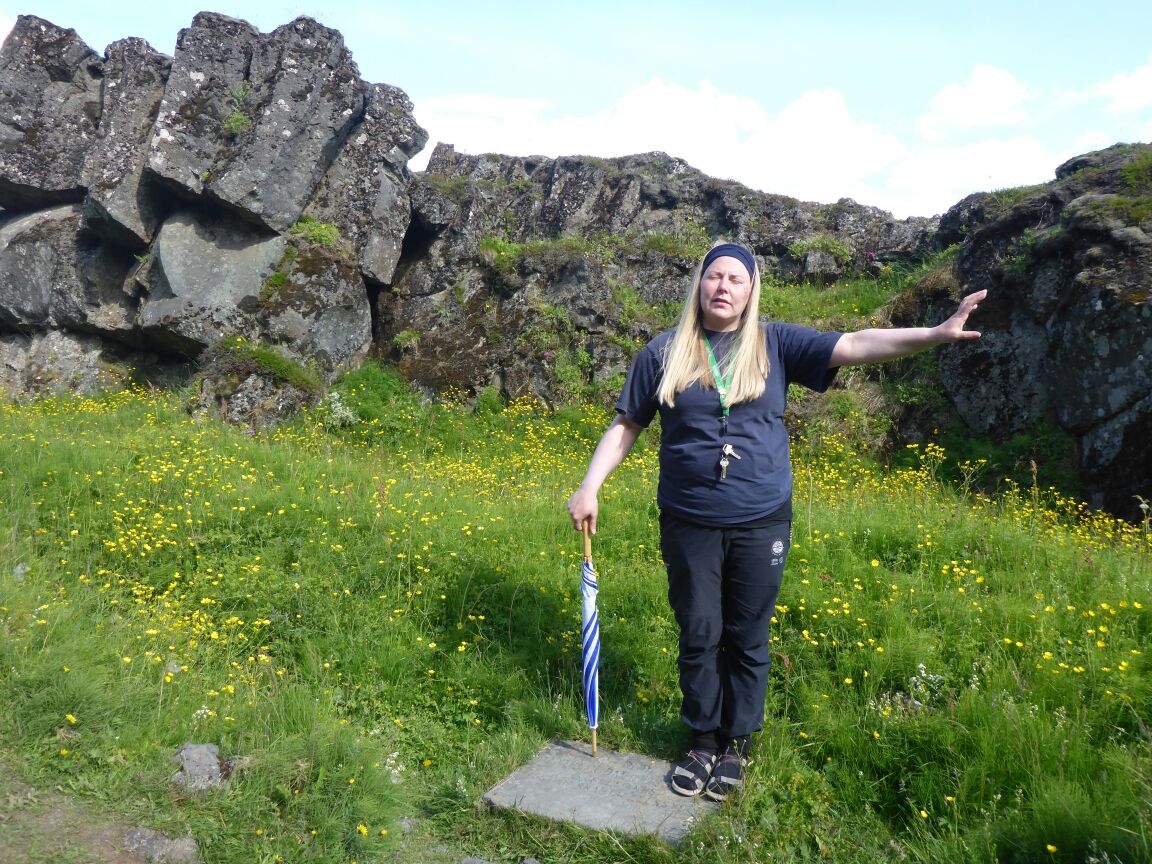
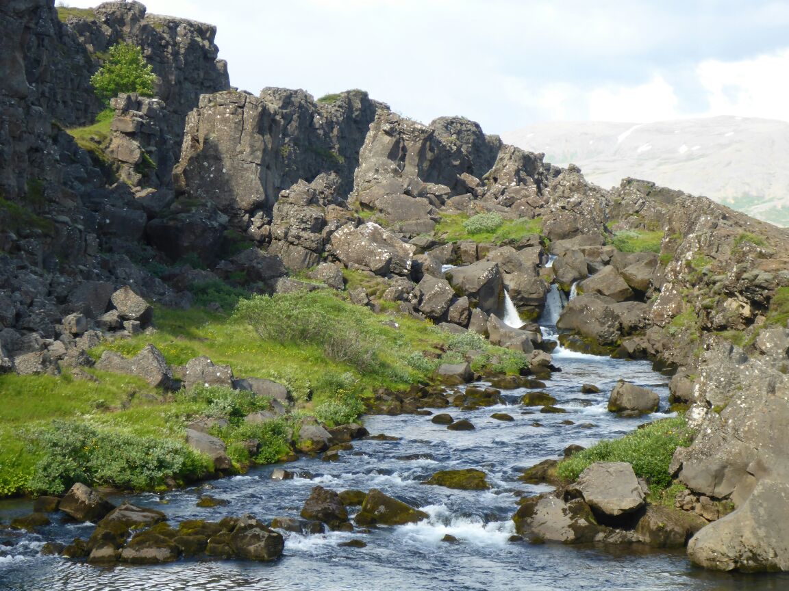
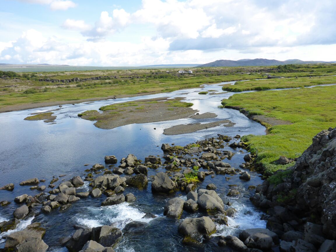
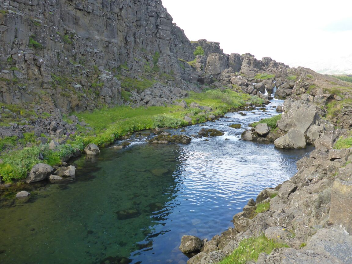
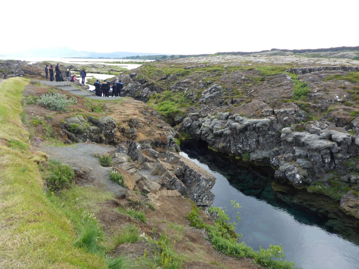
From Eyrabakki we head back inland to Thingvellir is a national park. Situated on the northern shore of lake Þingvallavatn, Þingvellir is the national shrine of Iceland. It is, for one, a key location in Icelandic history as the oldest existing parliament in the world first assembled there in 930 AD. Þingvellir has for this reason been designated a UNESCO World Heritage Site. Besides being a location of historical significance, Þingvellir is also protected as a national park due to its unique geology and natural features. Almannagjá is a canyon formed between two tectonic plates, a visual representation of continental drift.
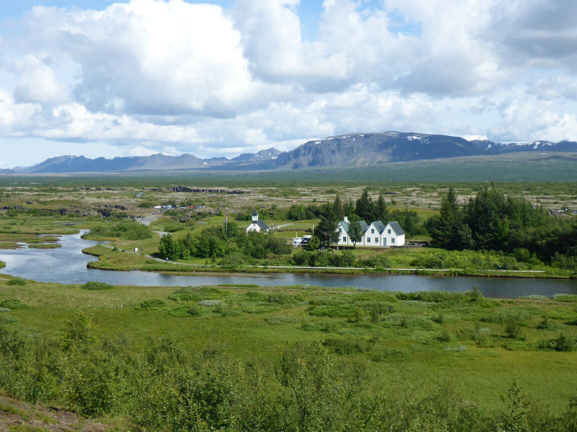

No single place epitomizes the history of Iceland and the Icelandic nation better than Þingvellir by the river Öxará.
At Þingvellir – literally “Parliament Plains” – the Alþing general assembly was established around 930 and continued to convene there until 1798. Major events in the history of Iceland have taken place at Þingvellir and therefore the place is held in high esteem by all Icelanders. Today Þingvellir is a protected national shrine. According to the law, passed in 1928, the protected area shall always be the property of the Icelandic nation, under the preservation of the Alþing.
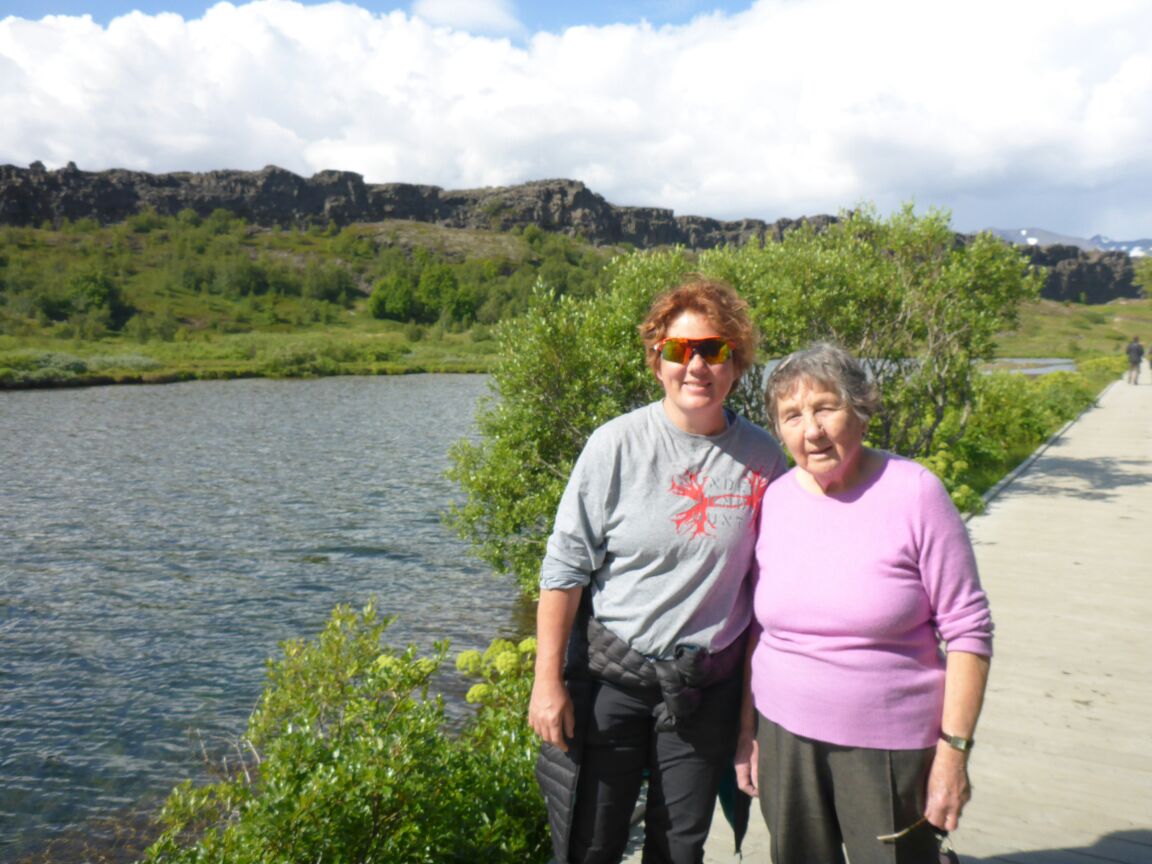
Once in the park we head to the visitors’ centre – there’s a guided walk that we want to join. Unfortunately there’s a rather tough walk to the start point and so mum feels she can’t participate. We leave her to enjoy the lake and views and follow the guide to the ‘lawrock’, the drowning pool, and the edge of the North American tectonic plates.
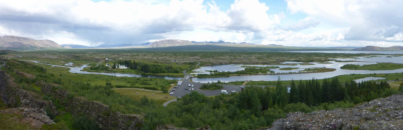
Once the walk is done we return to the visitors’ centre and look out from the viewing platform which looks out across the Lake, the largest lake in Iceland (83km2) and beyond. It is so beautiful! We drive round to pick up mum so she doesn’t need to walk back up the hill. From the park we drive out hugging the lake edge, and head for Laugarvatn.
Laugarvatn lies within the Golden Circle, a popular tourist route, and acts as a staging post. The town has a population of about 200 and lies predominantly along the west side of the lake. There is a small hostel situated in the town. The lake contains geothermal springs under its surface, making it a popular swimming spot with some warm patches along the shoreline year-round. In Laugarvatn we head to the geothermal spa and have coffee and cake (mum’s treat and she nearly has a heartattack when it costs £18!) whilst watching the bathing area. Then we walk by the lake where the water is bubbling vigorously and see the geothermal plant that is providing the hot water for the spa and village.
From here it’s home for dinner. Tonight it’s a homemade baked camembert dish.
Wednesday 29th July
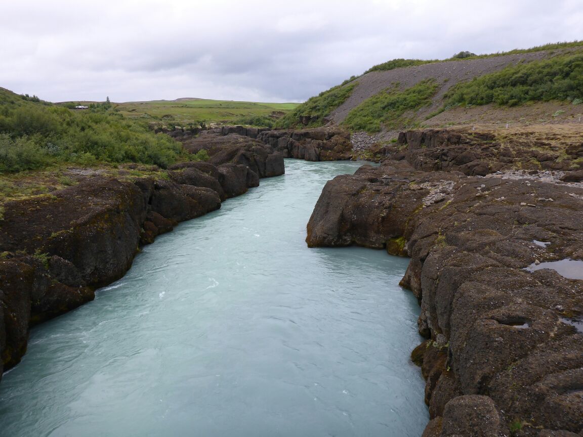
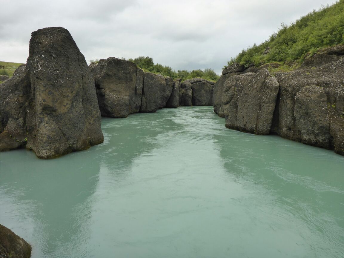
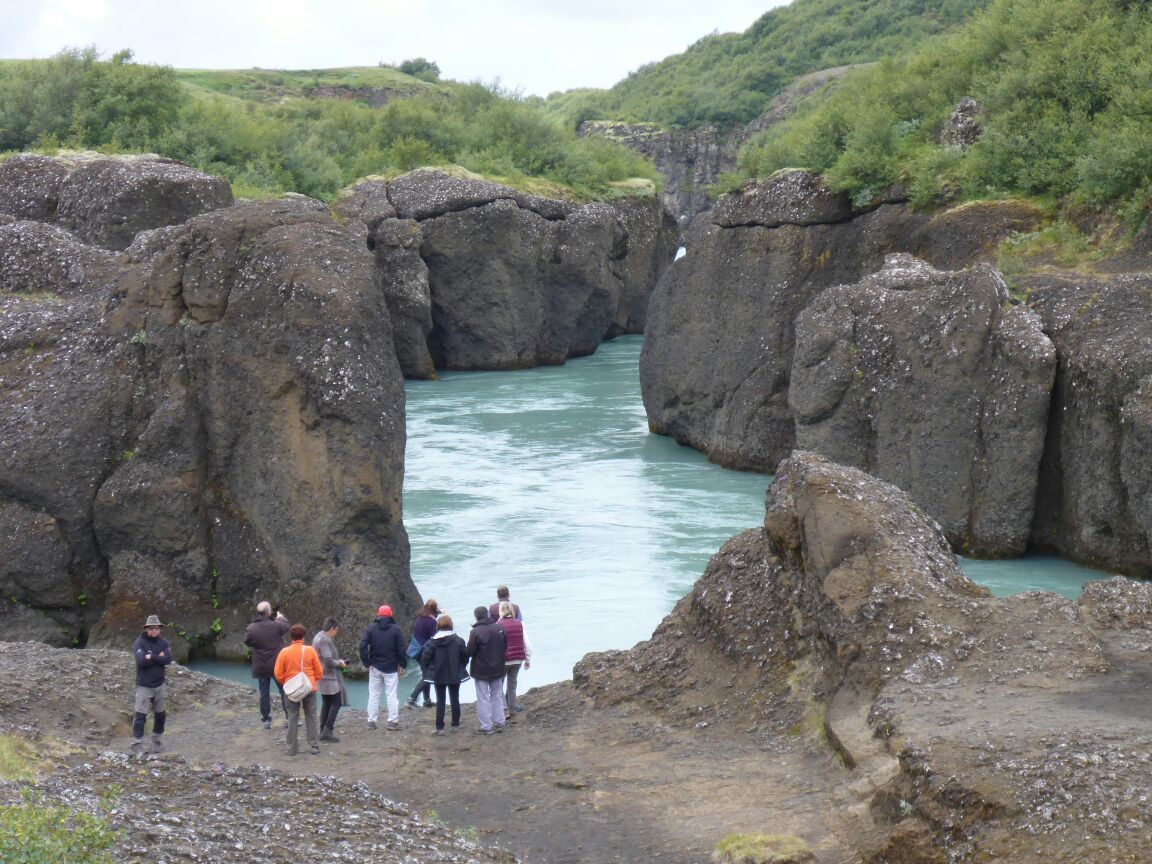
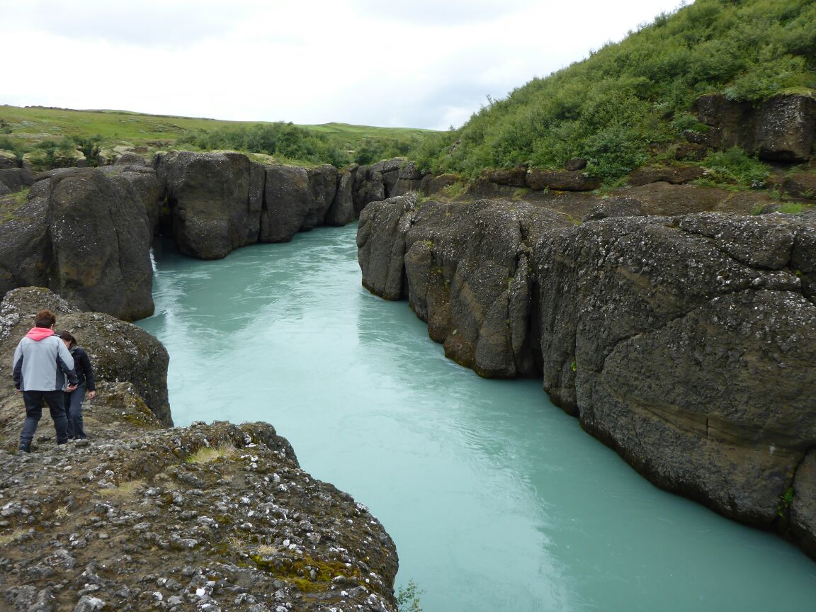
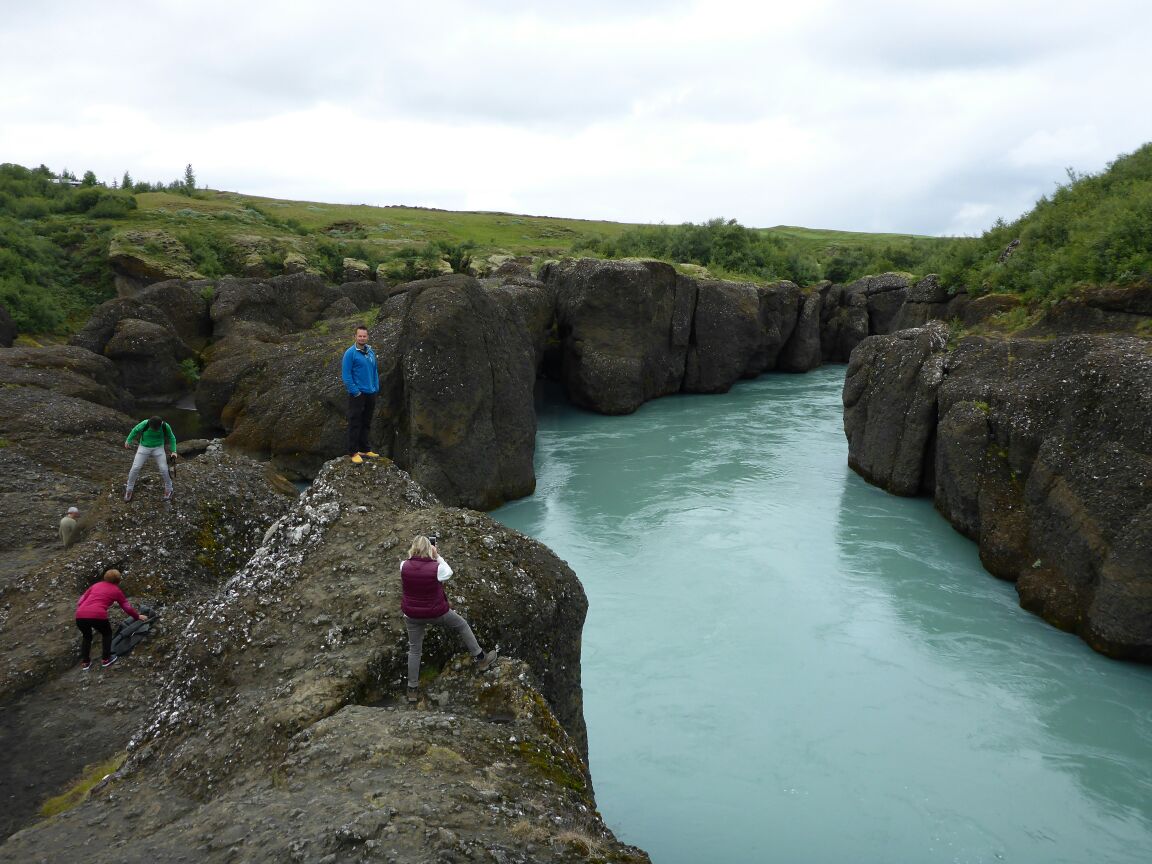
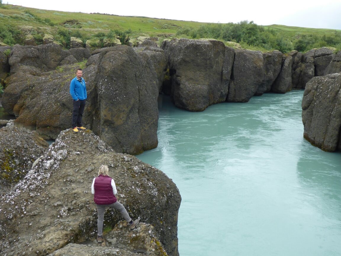
Today we want to see Seljalandsfoss and Skogarfoss and the Dyrhólæy bird cliffs. We’re not far into our journey when we cross the river Hvítá, the river that feeds Gullfoss. We stop to look at the river gorge, which is lined by massive boulder cliffs. Daz tells off an Italian woman he sees dropping her fagbutt, makes her pick it up and scuttle of back to her coach!!
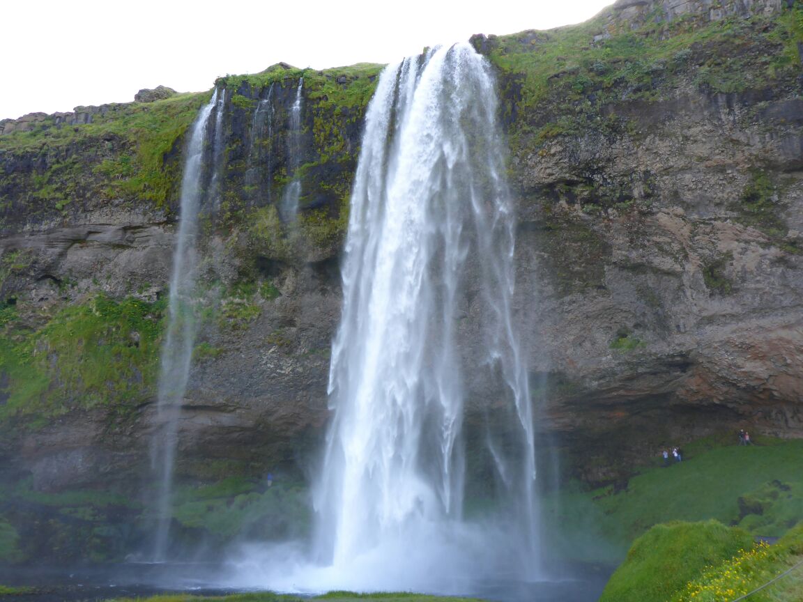
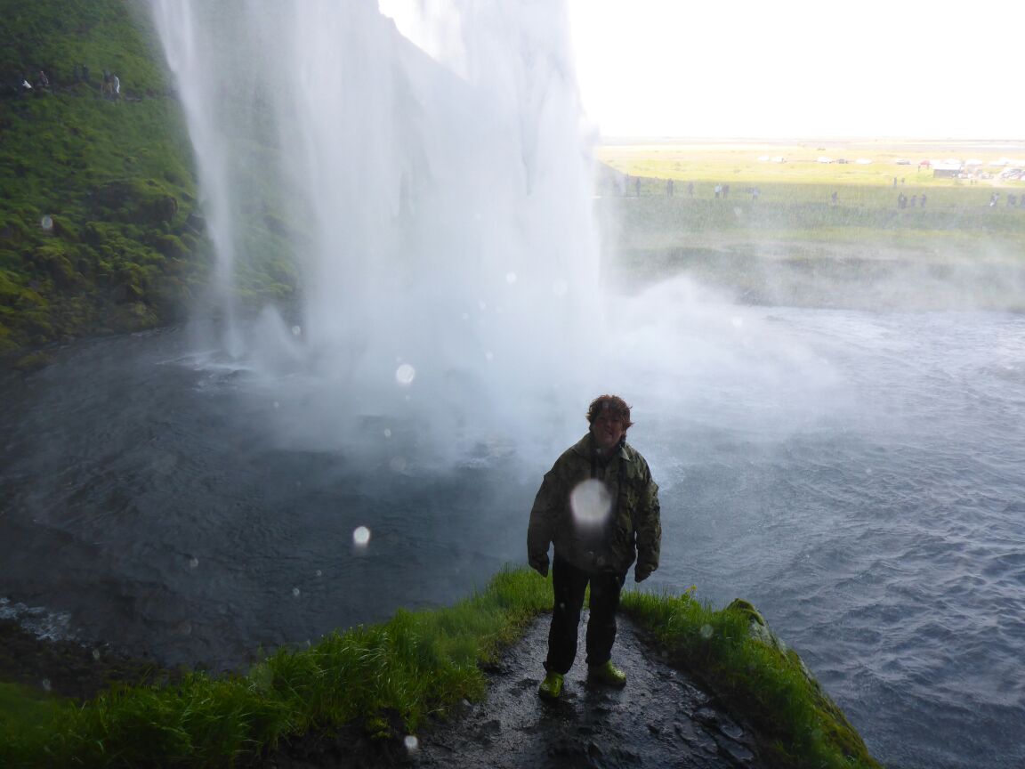
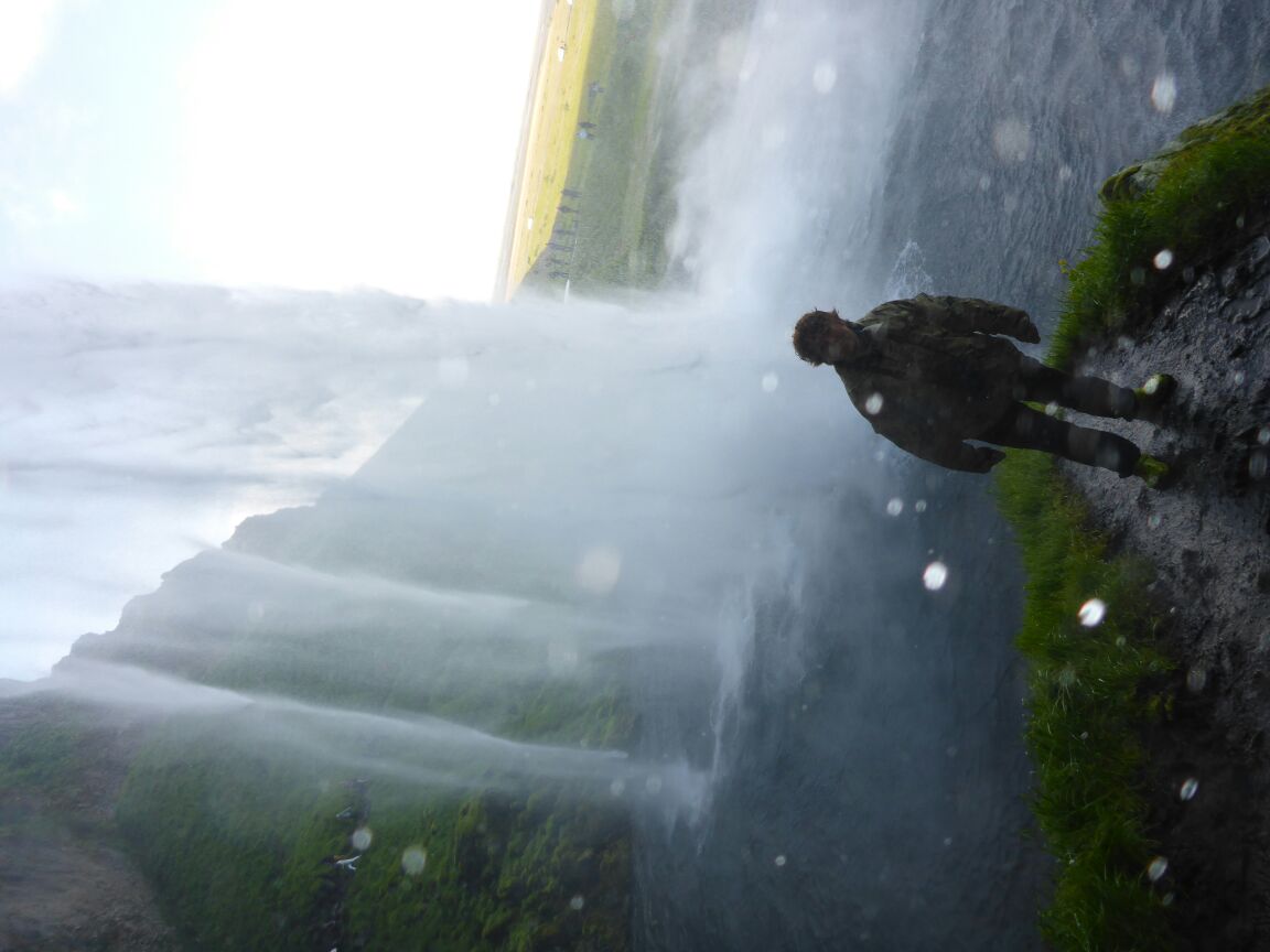
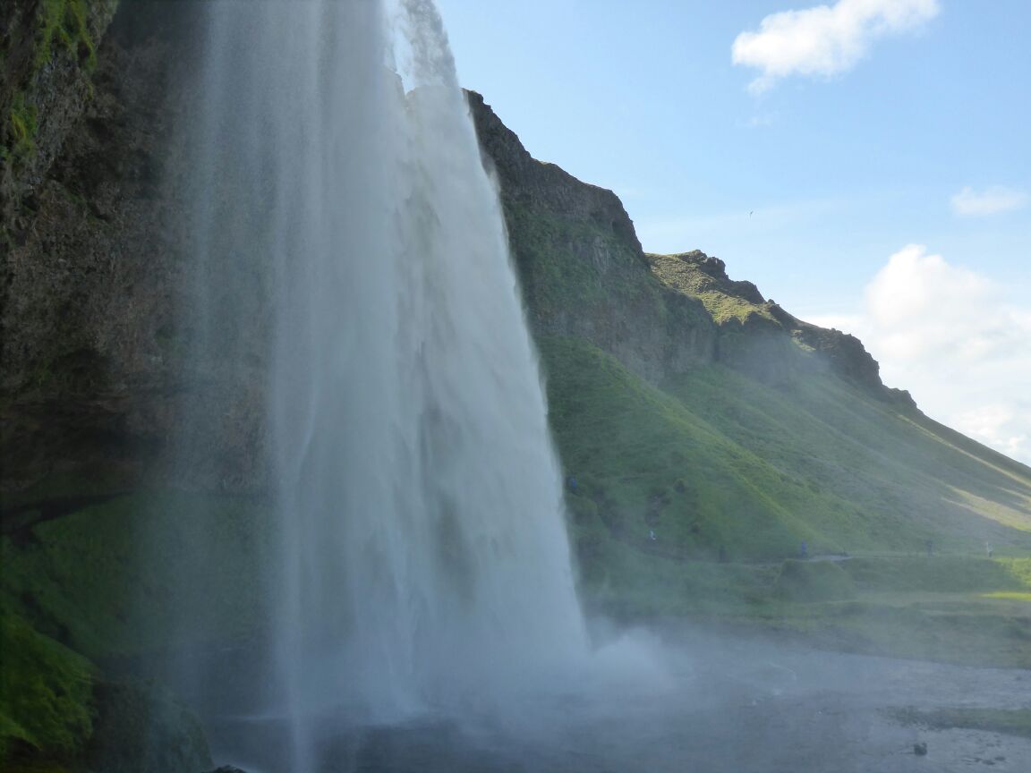
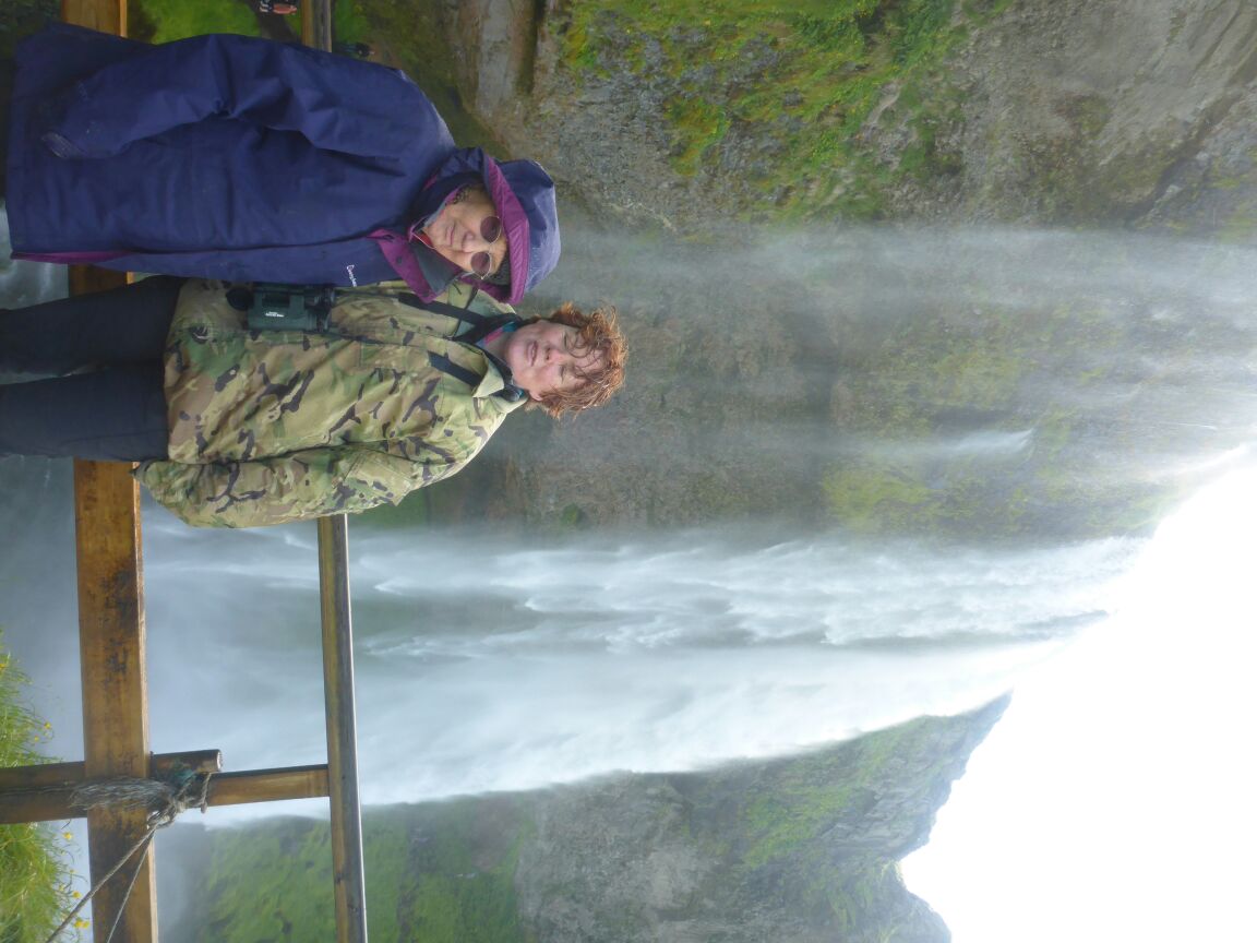
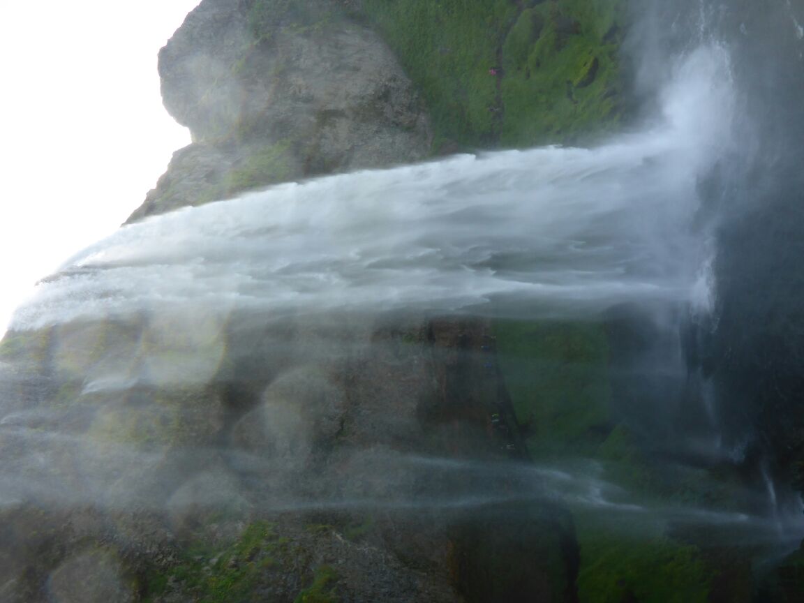
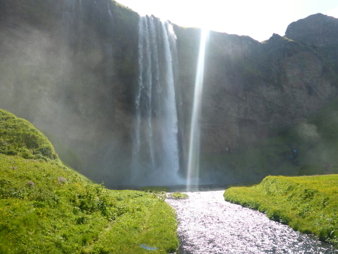
On to Seljalandsfoss waterfall of the river Seljalandsá which drops 60 metres (200 ft) over the cliffs of the former coastline. It is possible to walk behind the waterfall, so we do. Parts are a bit of a struggle for mum, with very large rock steps, but we manage and although we get wet it is a fabulous experience as the waters cascade and thunder in front of us.
 u
u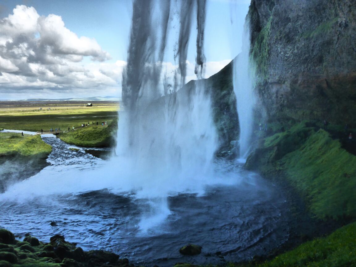

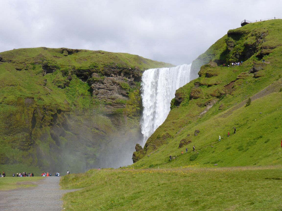
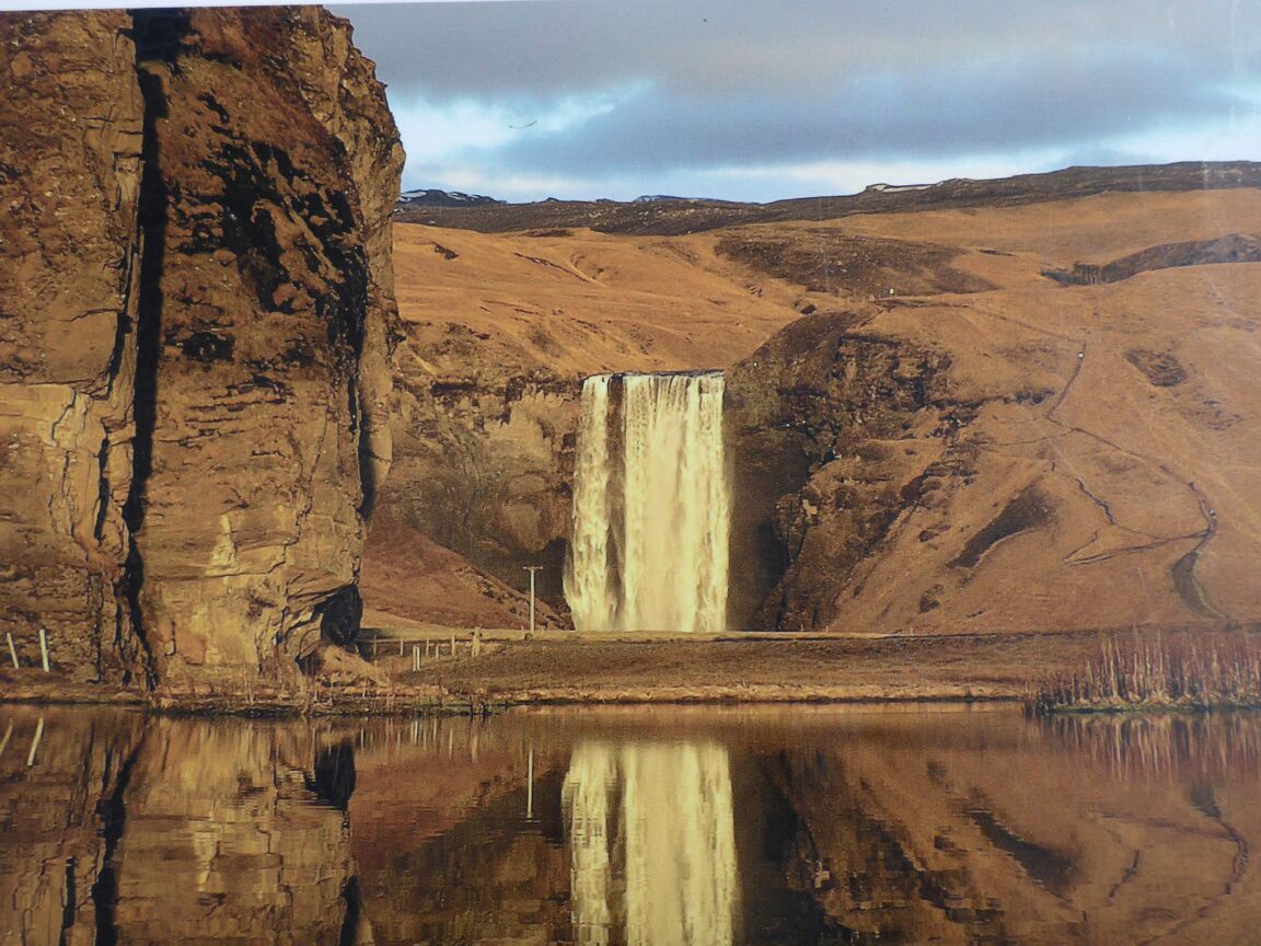
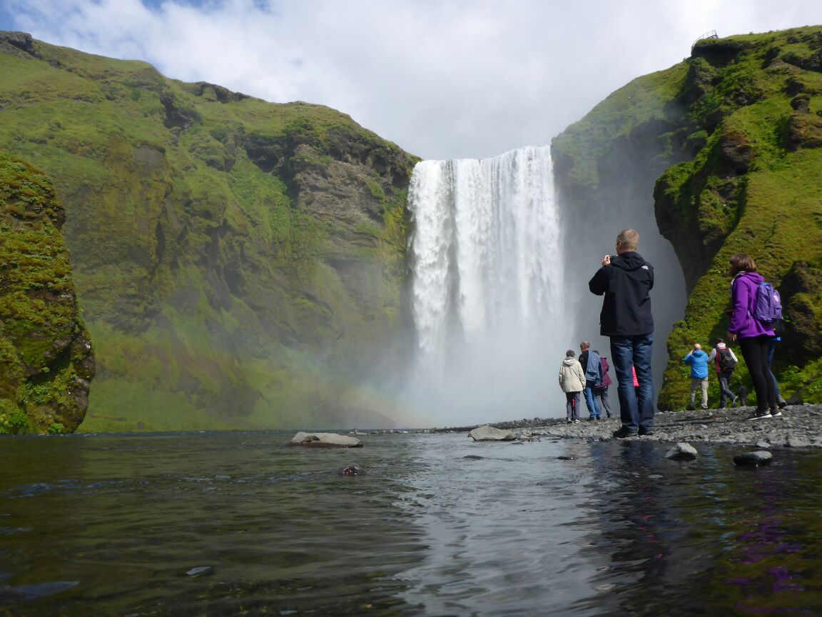
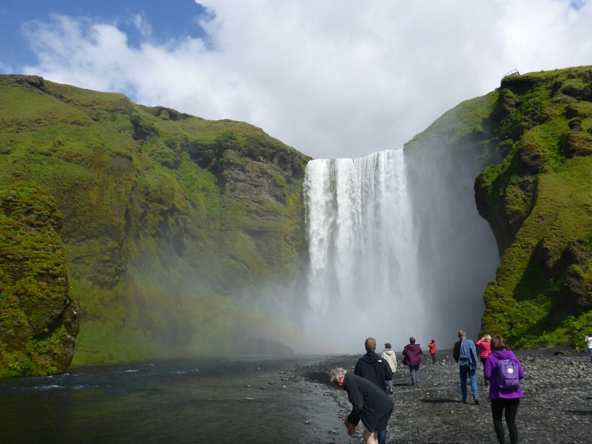
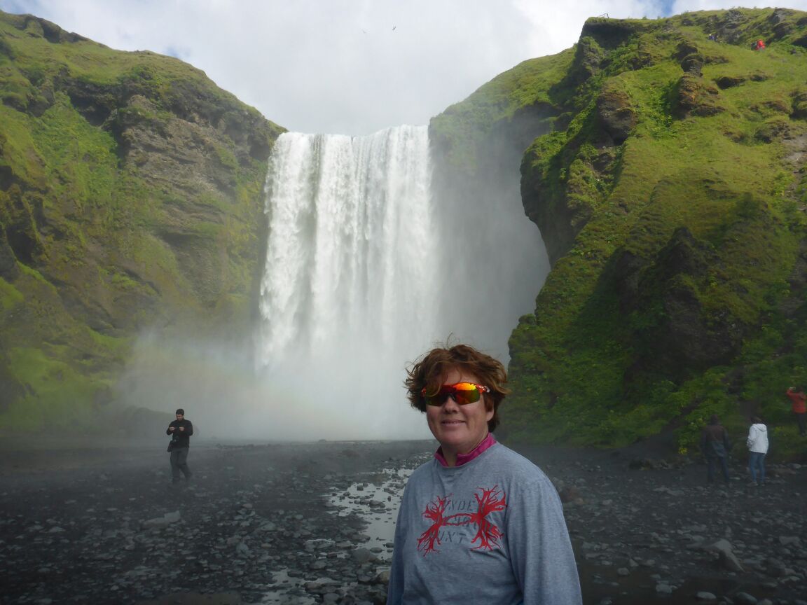
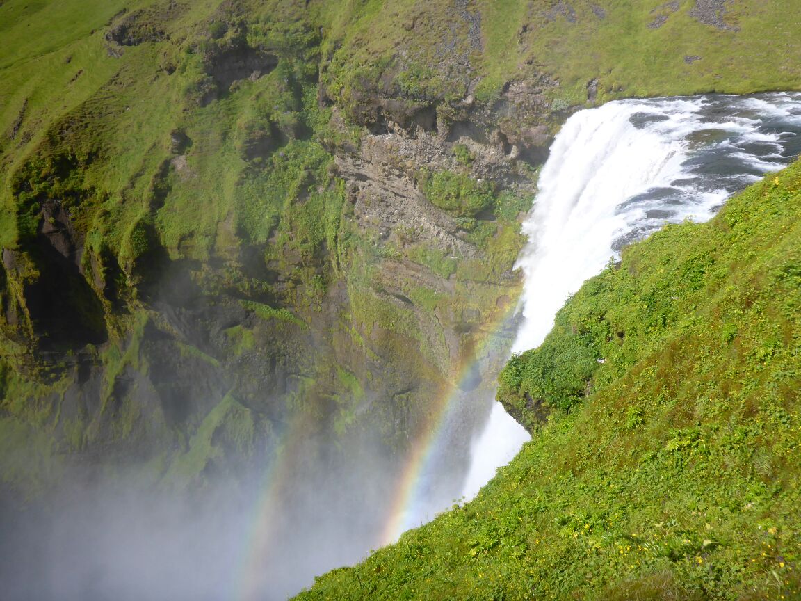
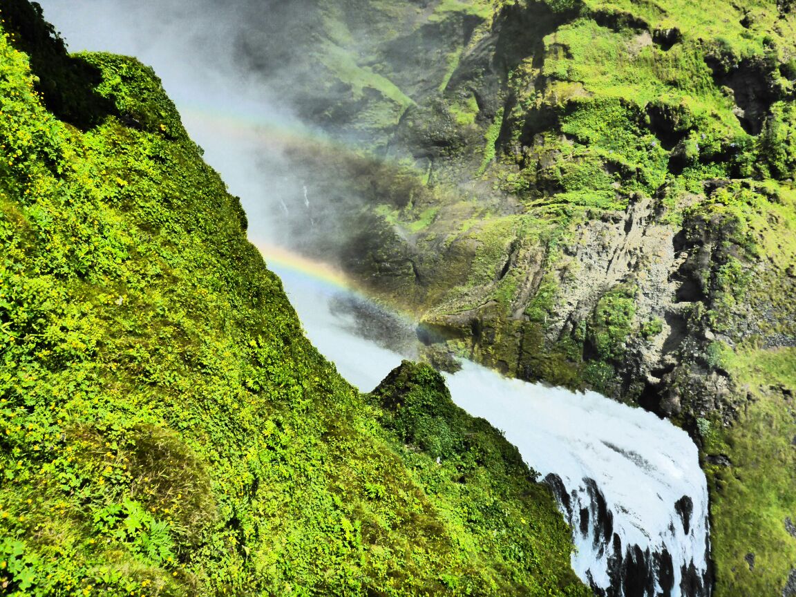
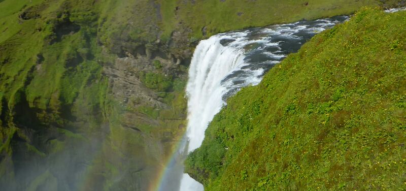
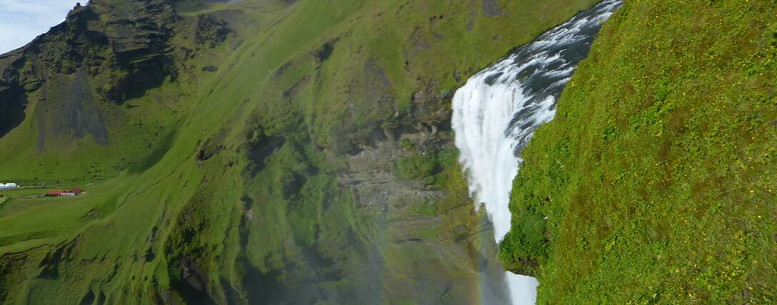
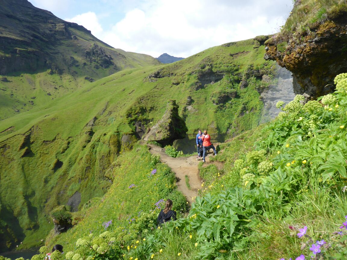
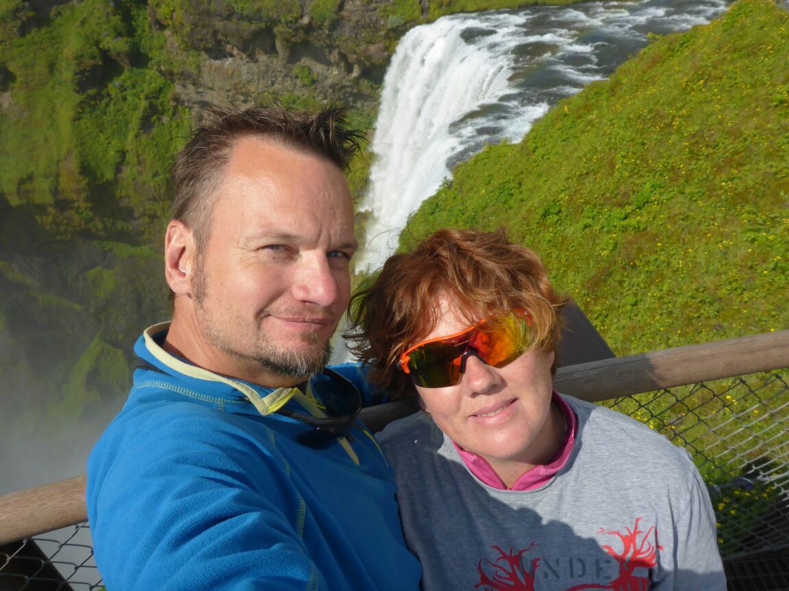
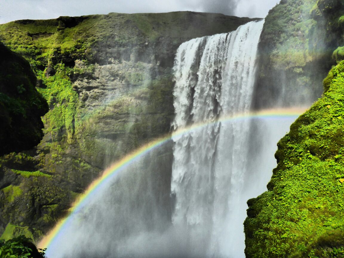
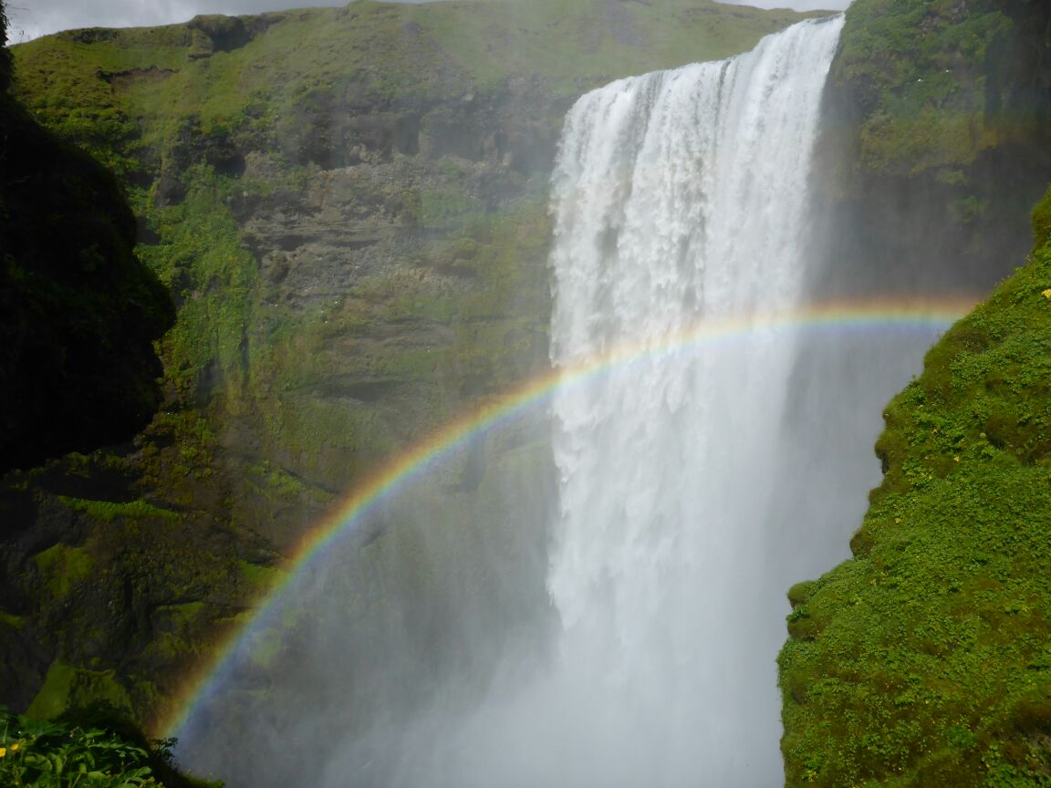
After a cup of coffee we drive on to Skogafoss which probably rivals Gullfoss as Iceland’s most famous waterfall. This is a classically-shaped rectangular waterfall that drops 60m with a width of 25m. It has a high volume of water making it thunder and produce rainbow-yielding mist.
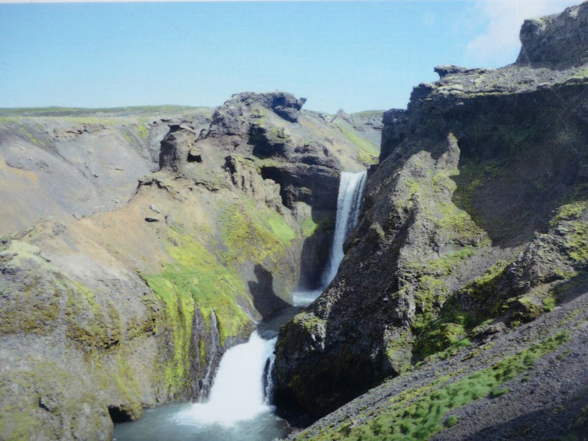
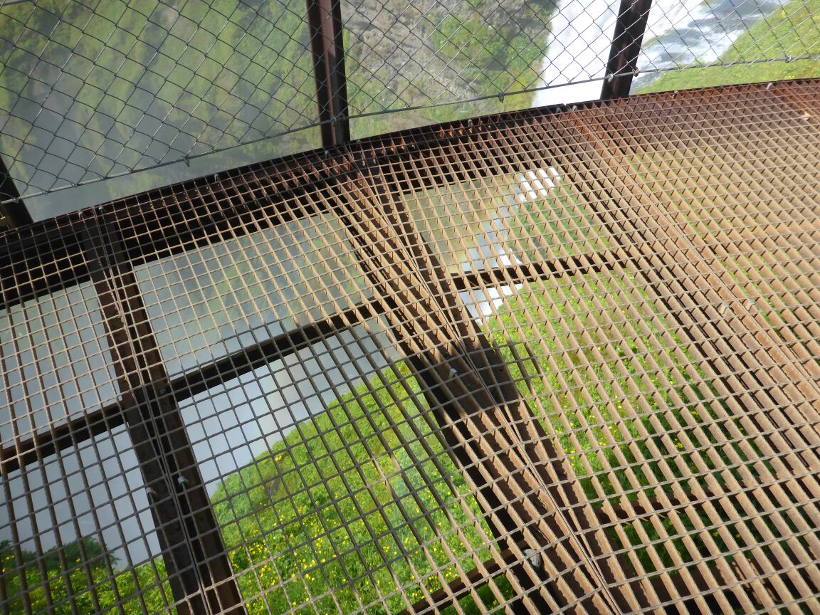
There’s a path besides the waterfall that leads up to a precarious viewpoint of both the waterfall but out over the Atlantic. Having had our picnic lunch Daz and I head up the path, whilst mum takes in the view from below.
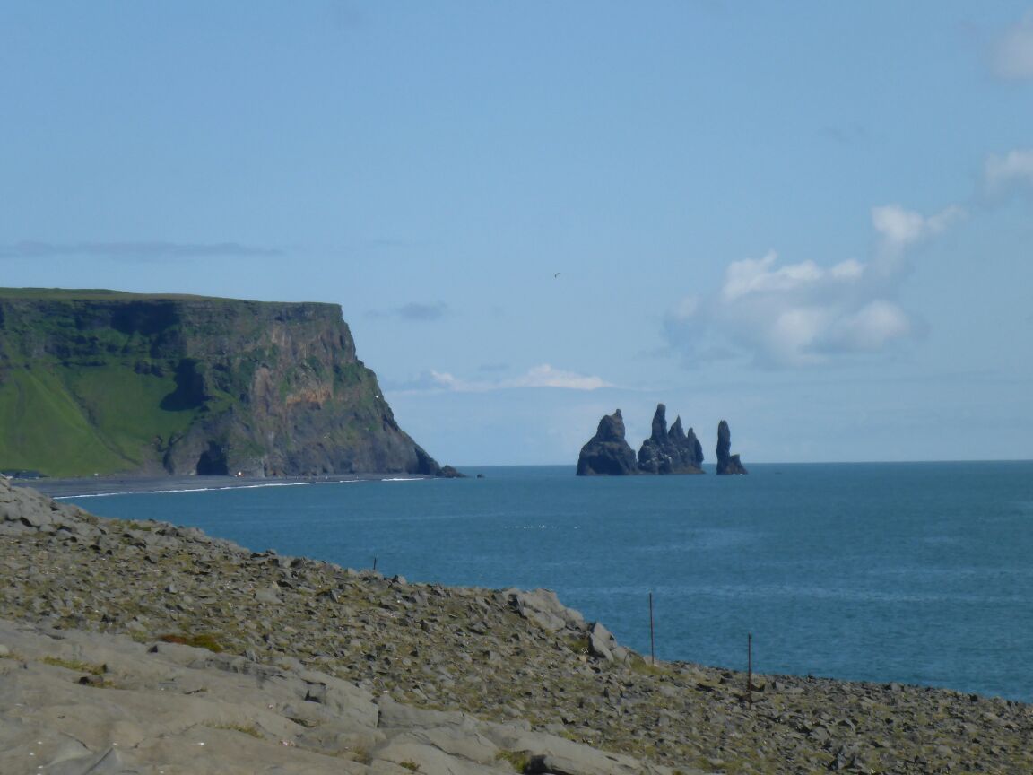
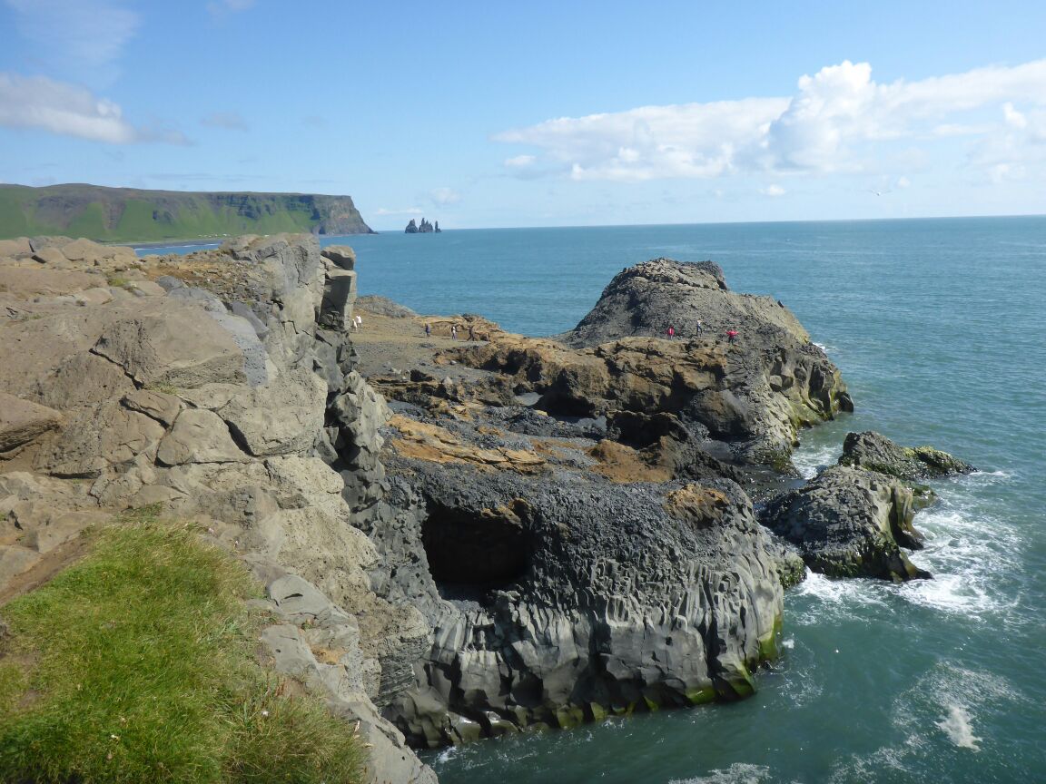
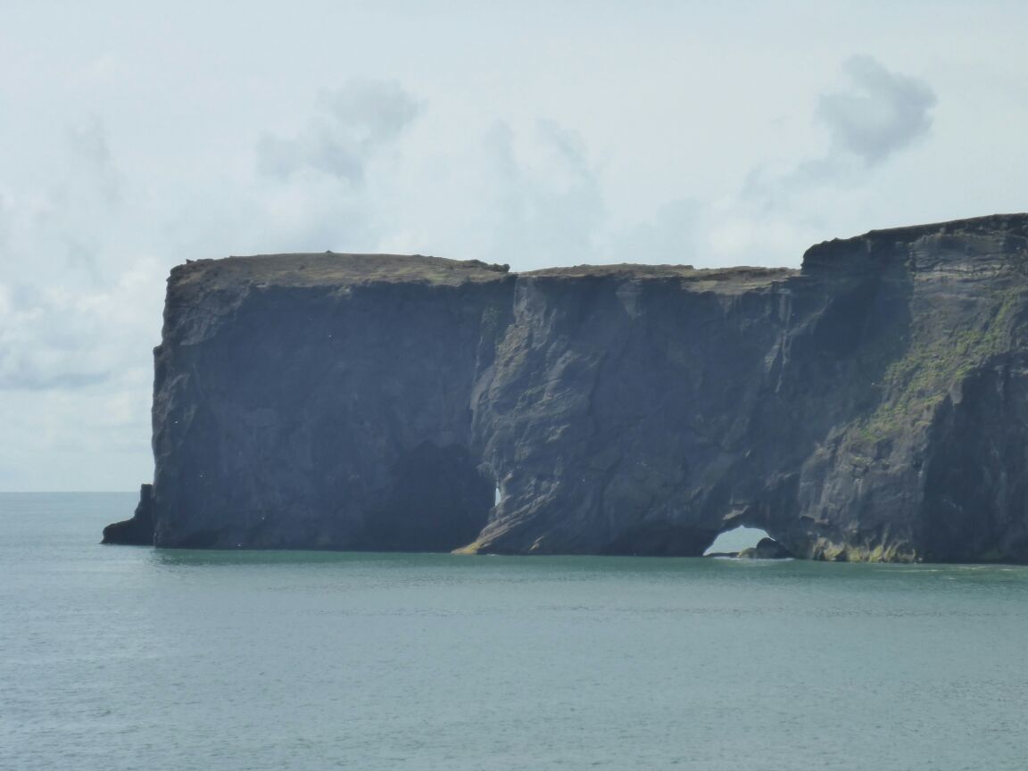
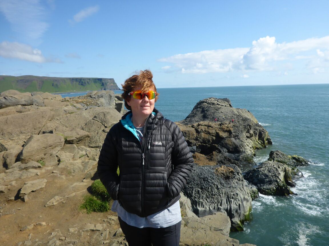
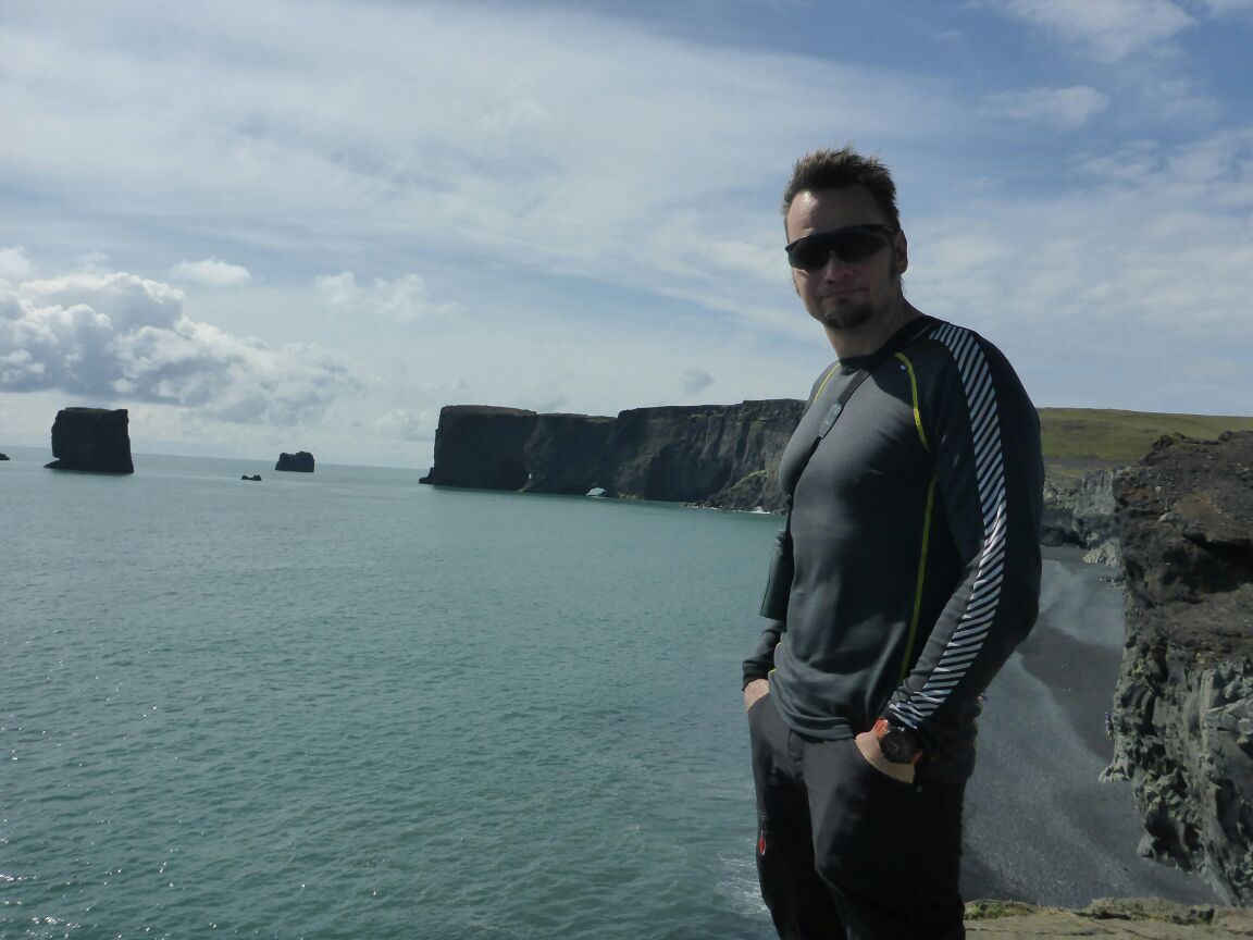
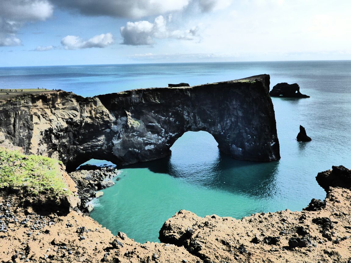
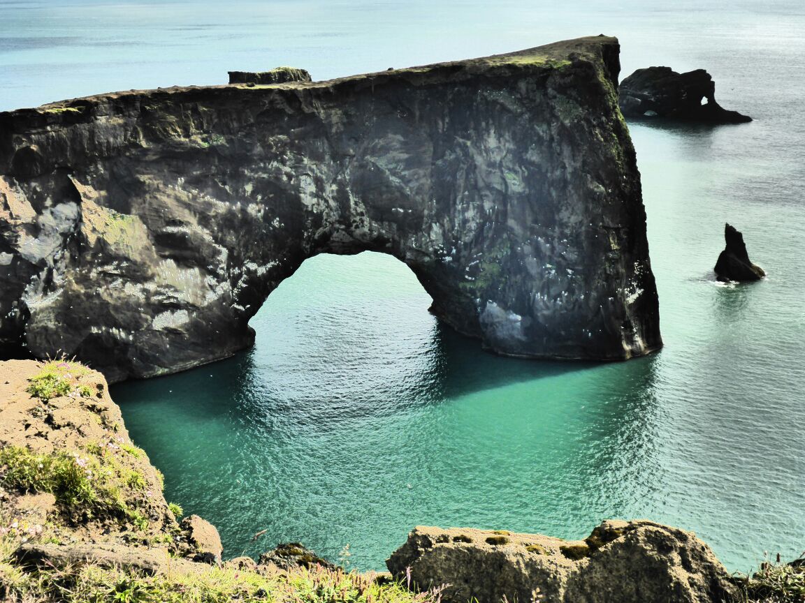
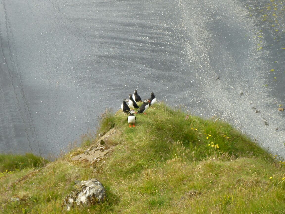
Dyrhólaey is a 120m high promontory and it name means “the door hole island”. And this is also how it looks. The promontory got its name from the massive stone arch that the sea has eroded from the headland. And this arch is visible from as far away as Skógar. The arch and scenery remind us of Durdledor and we see some puffins but unfortunately we’ve been spoilt by Latrabjerg.
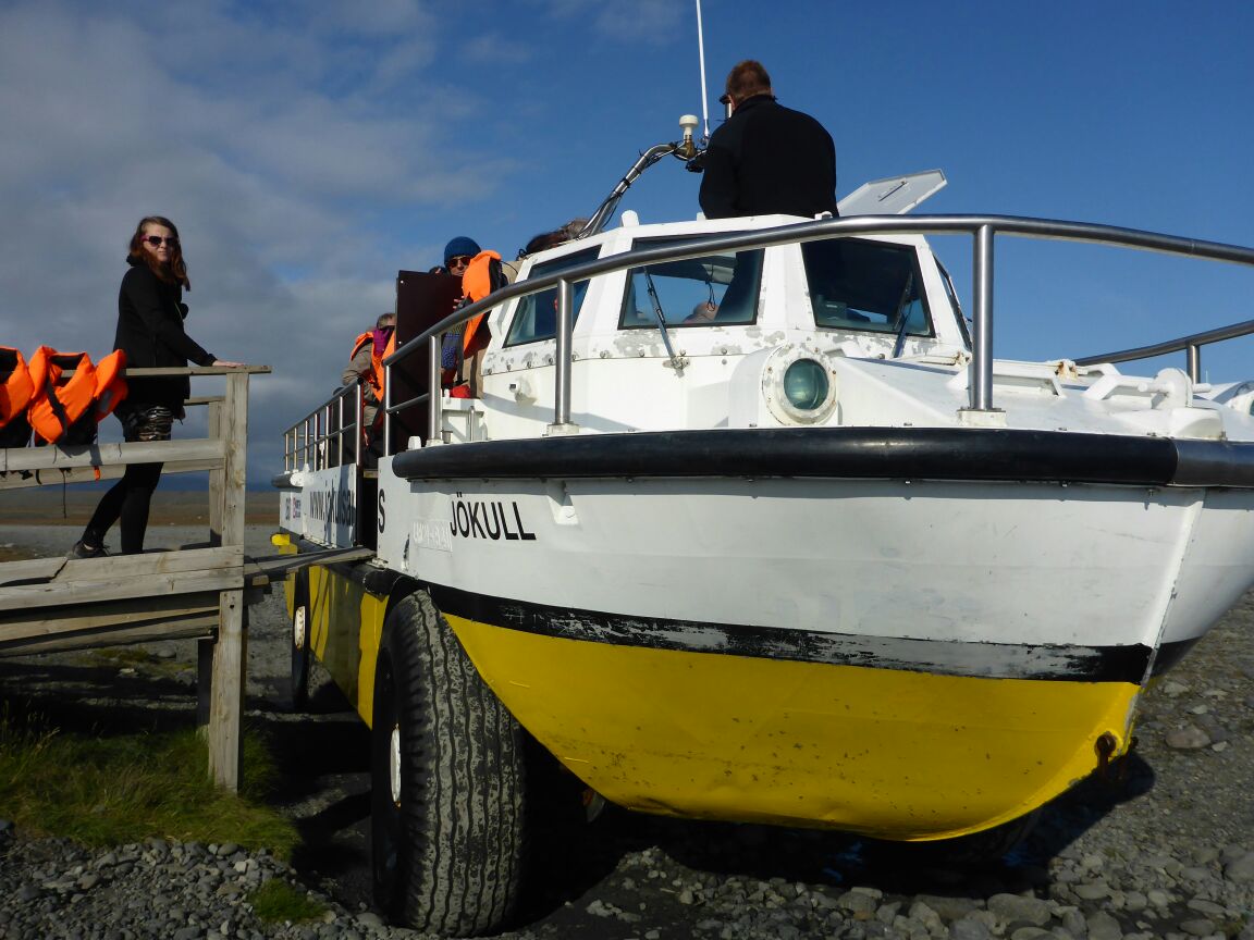
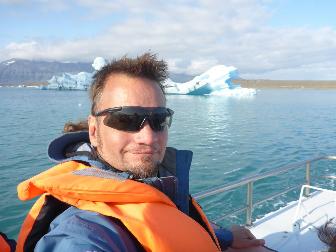
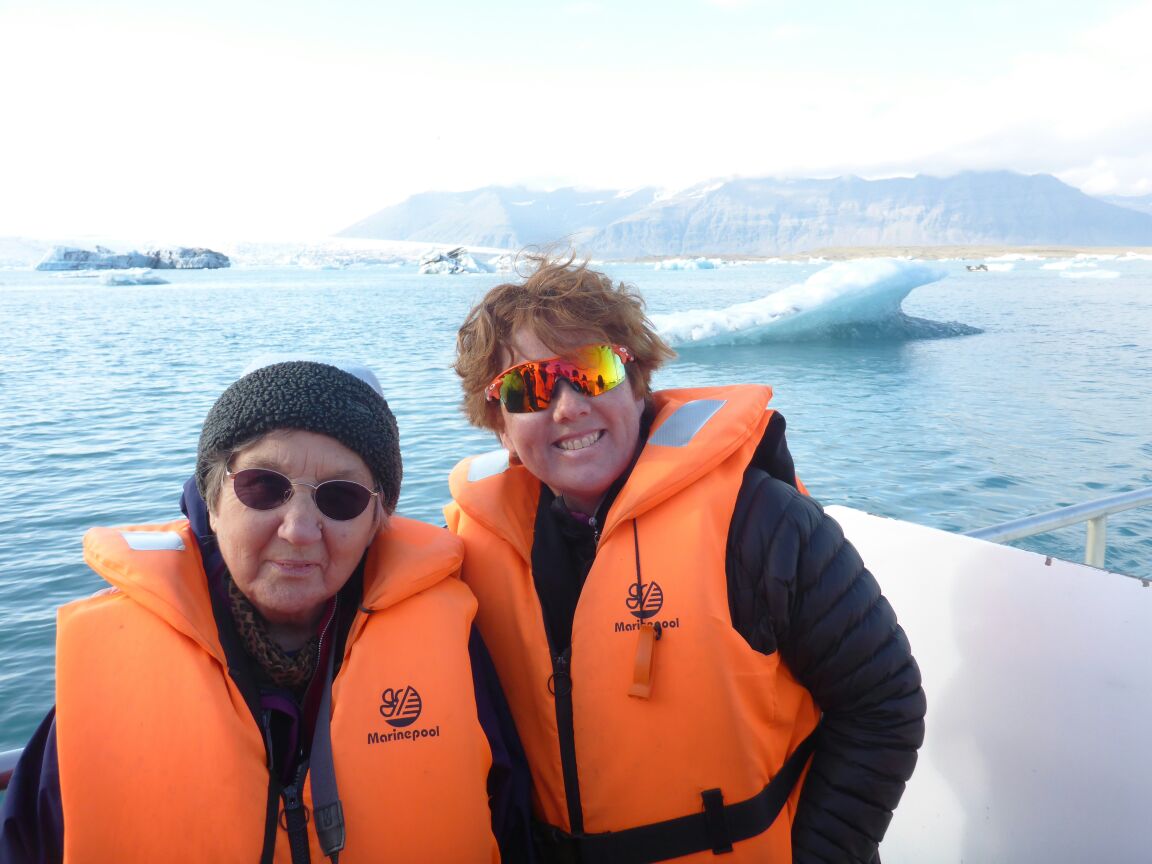
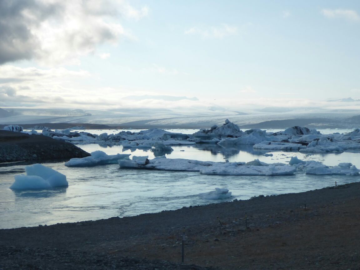
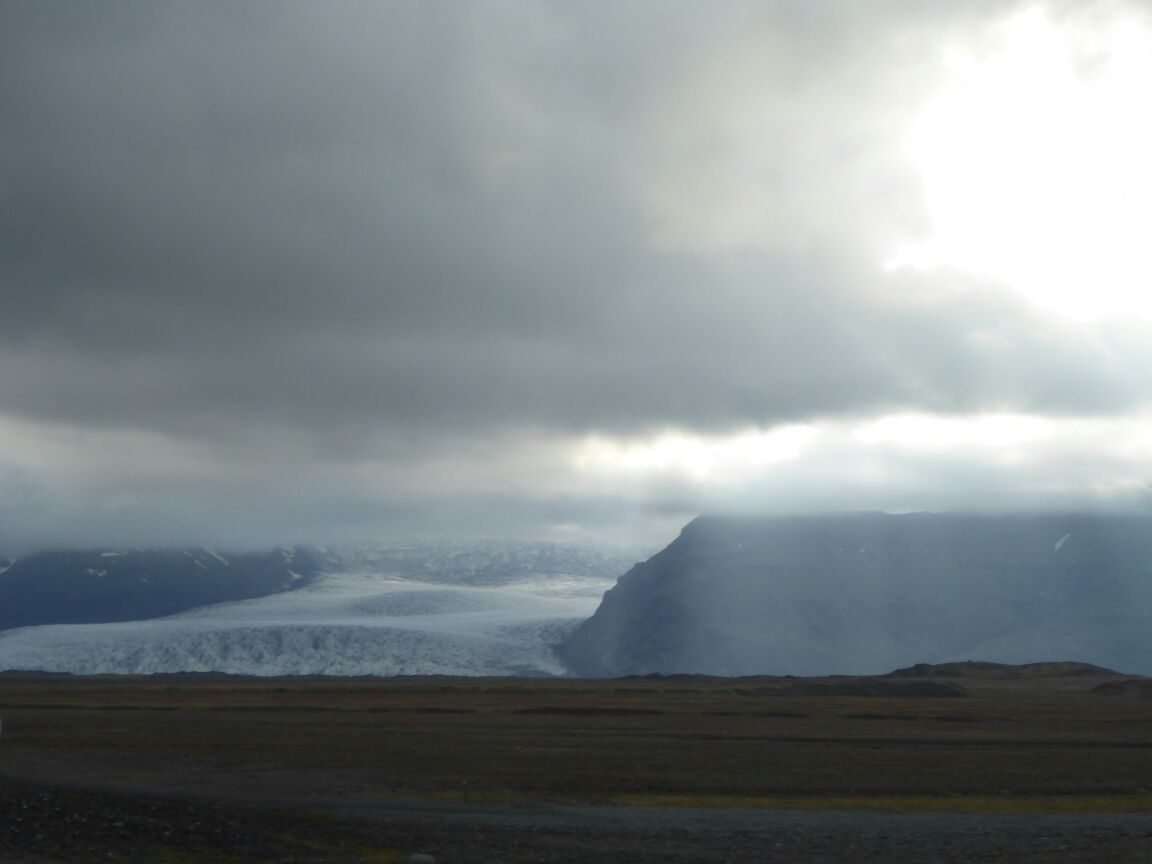
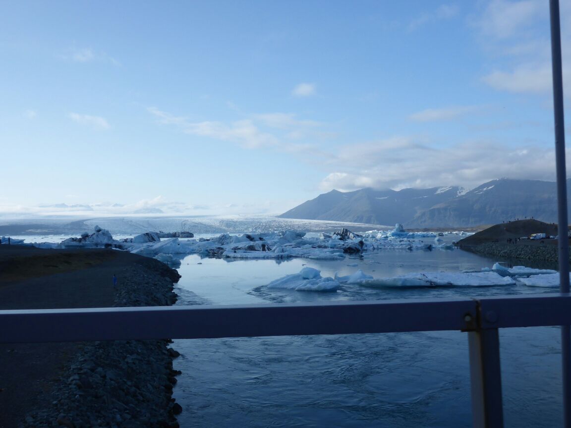
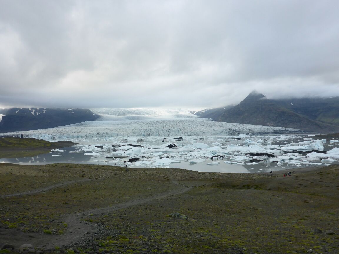
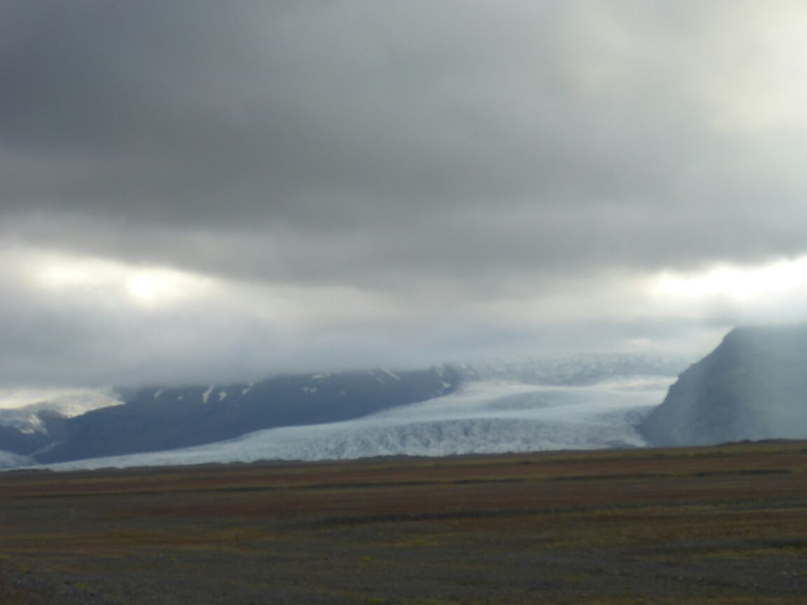
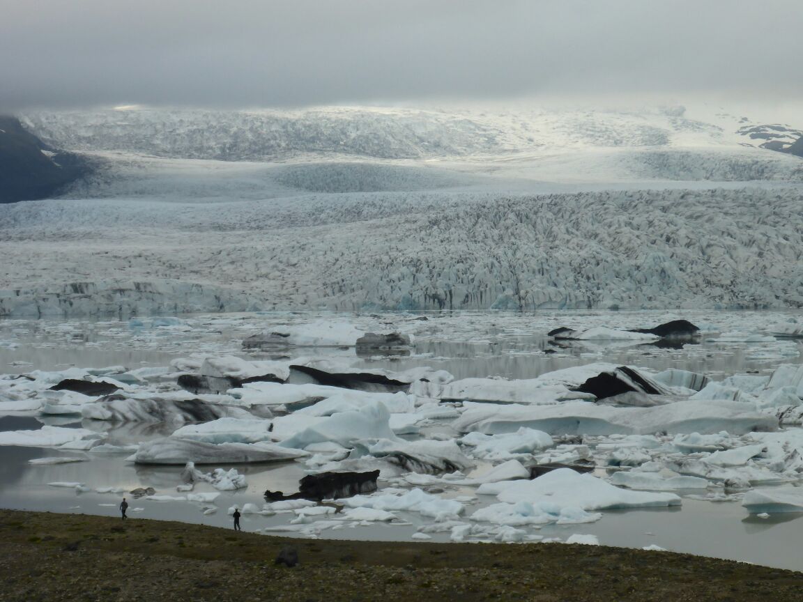
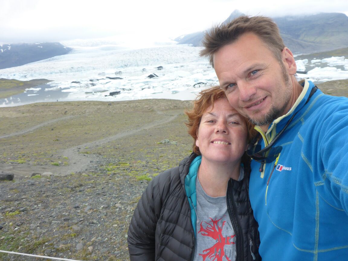
It’s already after 3pm and it’s decision time. We want to see Jökulsárlón glacier lagoon but it’s still 2 hours away and we’re worried we’ll miss the last boat trips out onto the lagoon. But we decide to go for it and we’re not disappointed. The large glacier lagoon is a unique place with icebergs constantly breaking off from the glacier and eventually drifting through the short river to the sea. The waves turn some of the icebergs back to the black sand beach where they lie scattered like gems. Jökulsárlón is extremely popular amongst photographers due to its spectacular scenery. Jökulsárlón was the setting for the Hollywood films A View to a Kill, Die another Day, Tomb Raider and Batman Begins – in addition to the reality-TV series Amazing Race. The glacier is Vatnajökull (meaning Glacier of Lakes), also known as the Vatna Glacier, is the largest and most voluminous ice cap in Iceland, and one of the largest in area in Europe. it covers more than 8 percent of the country.[1] It is over 8000km2.
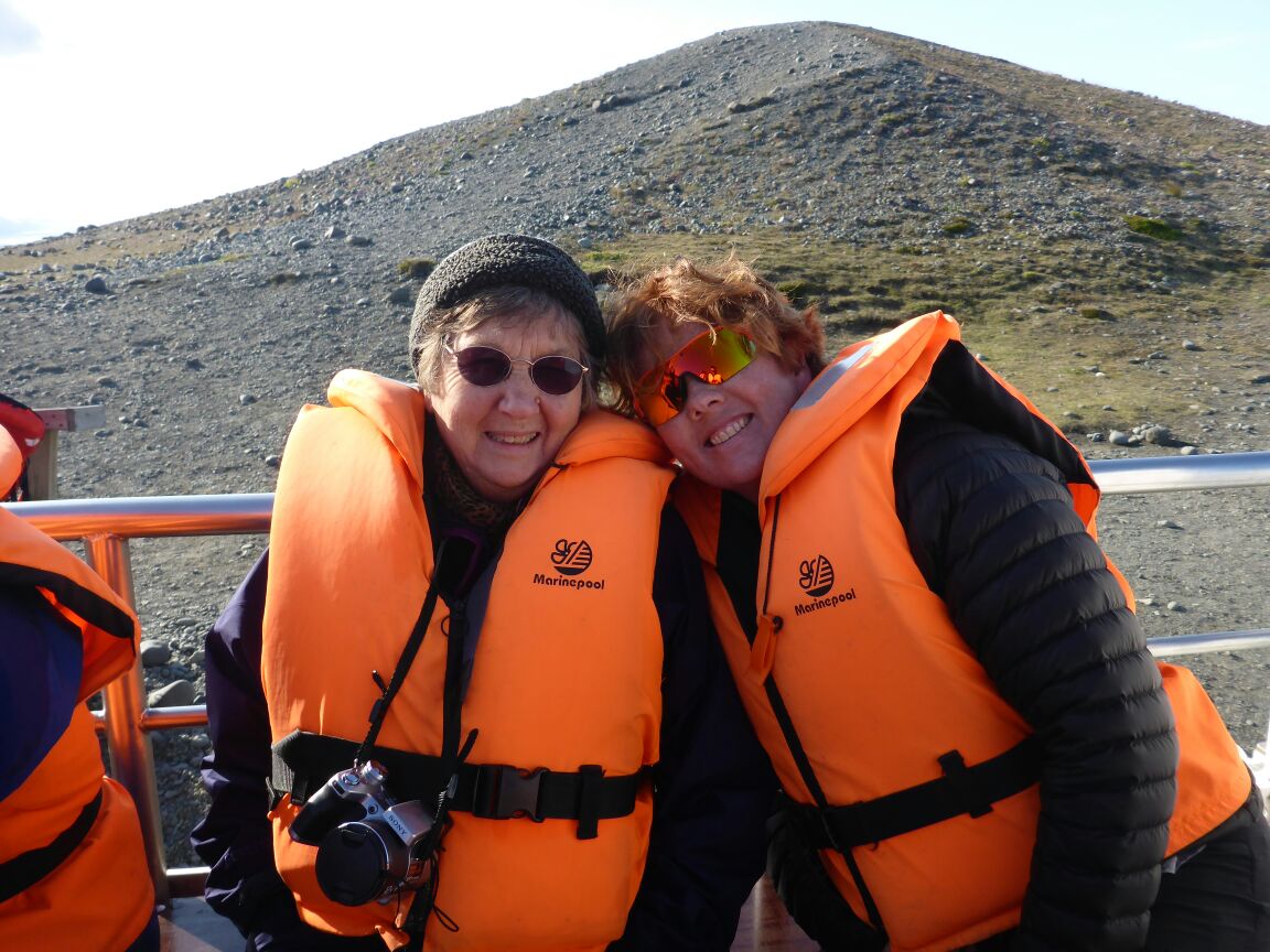
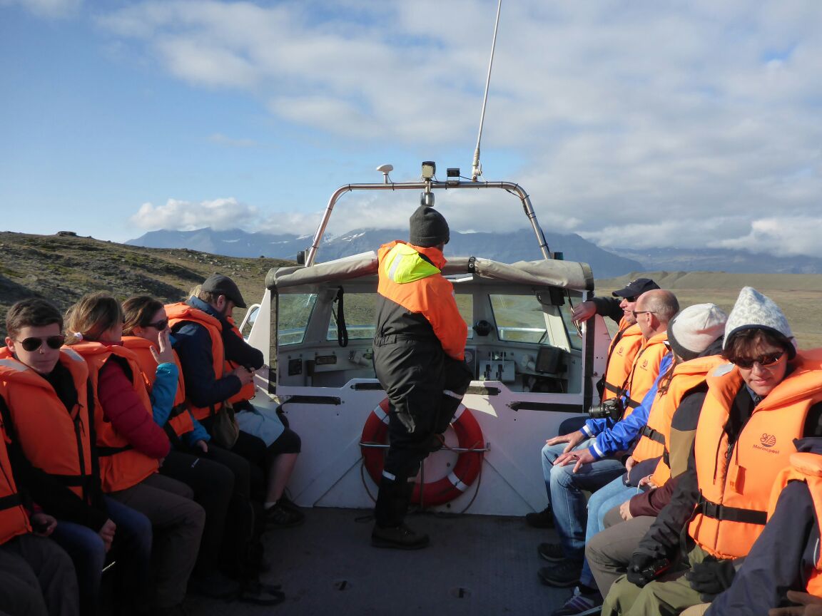
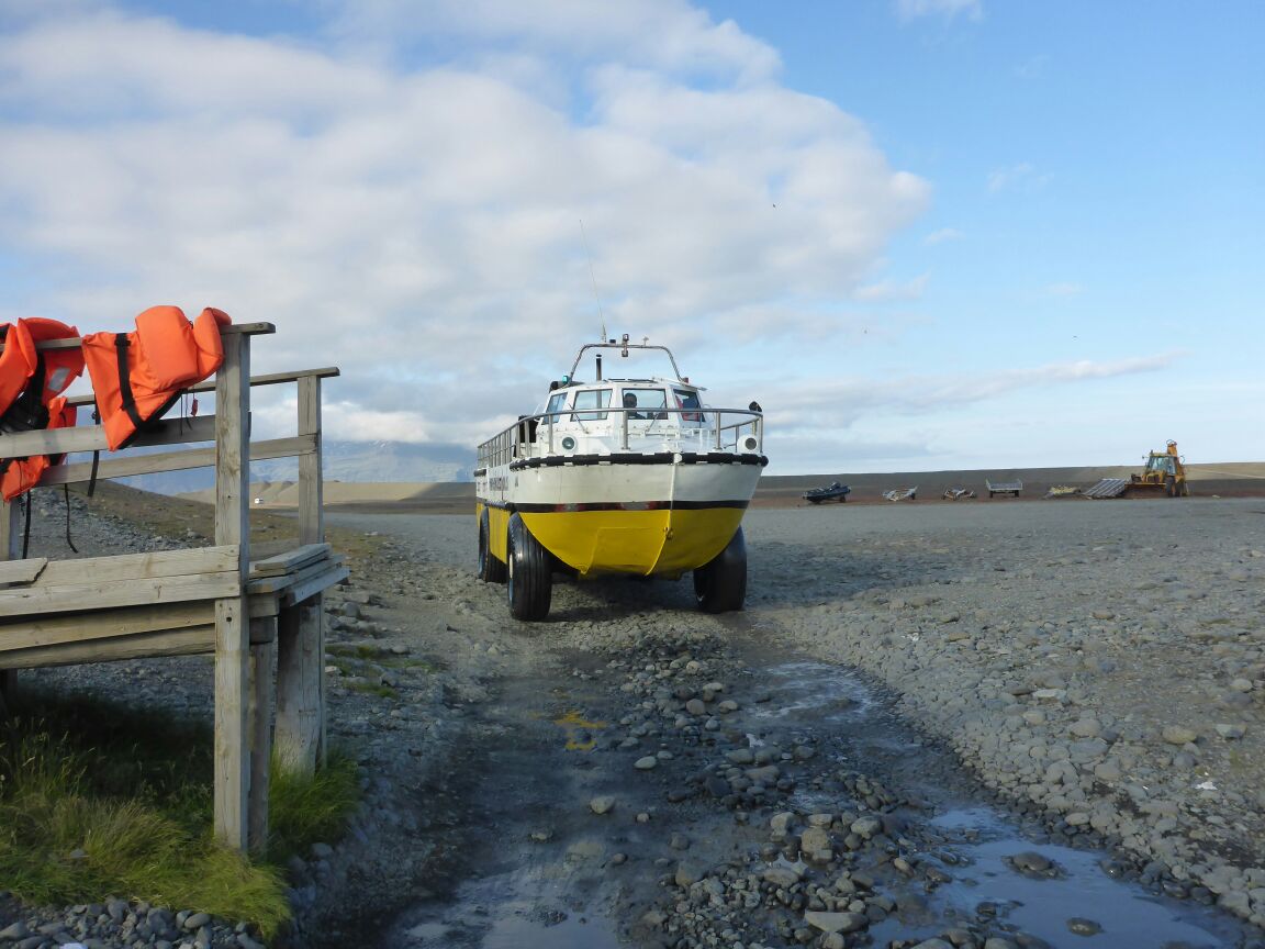
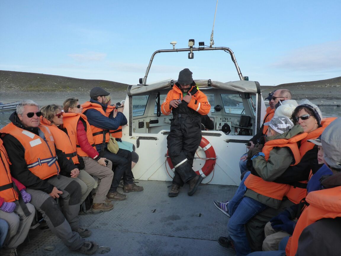
We go out onto the lagoon in a ‘duck’ an amphibious wheeled troop carrier and drive around the icebergs. They are made of ice over 1000 years old.
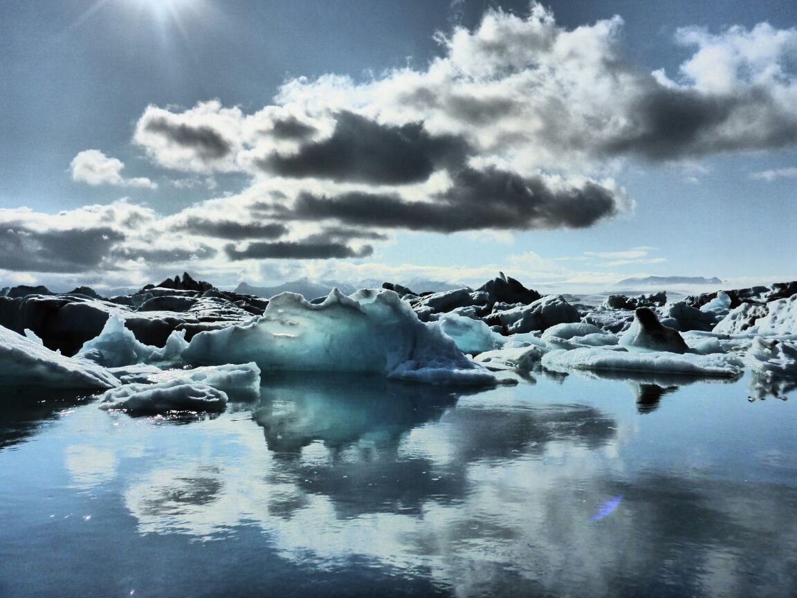
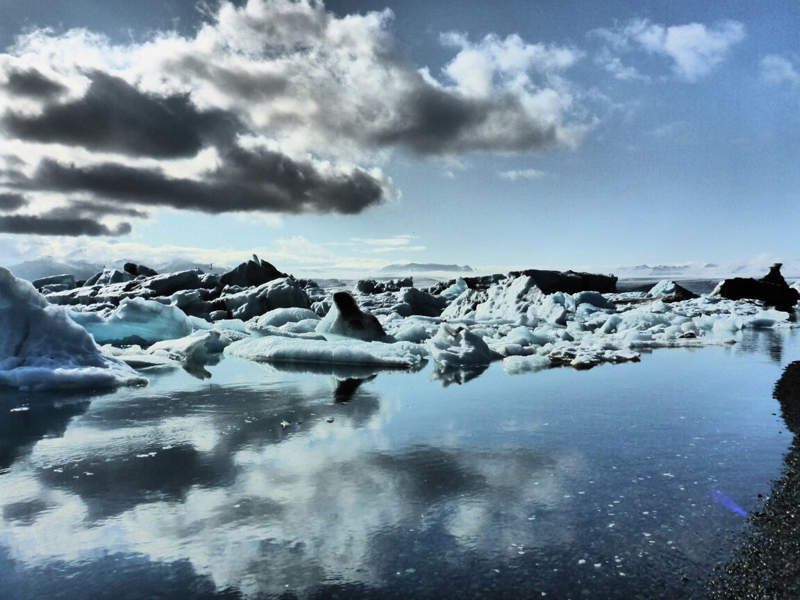
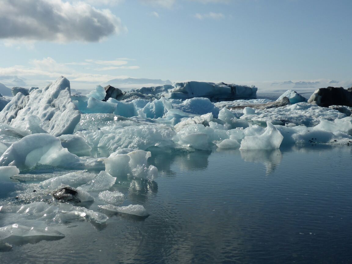
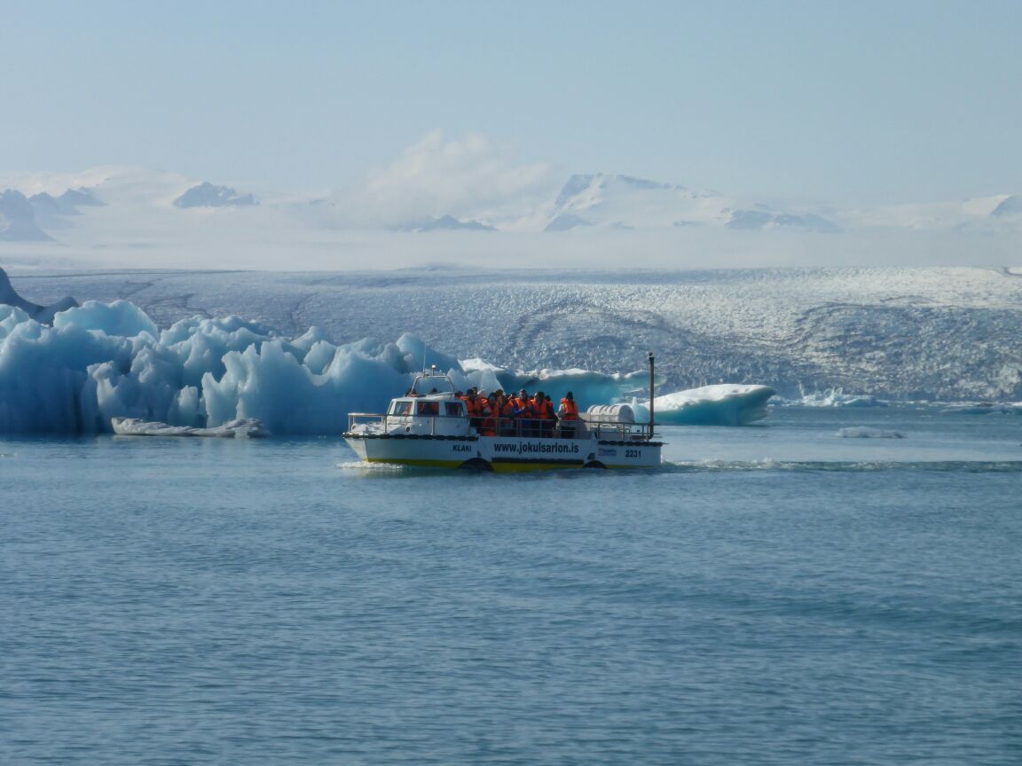
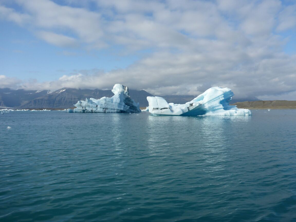
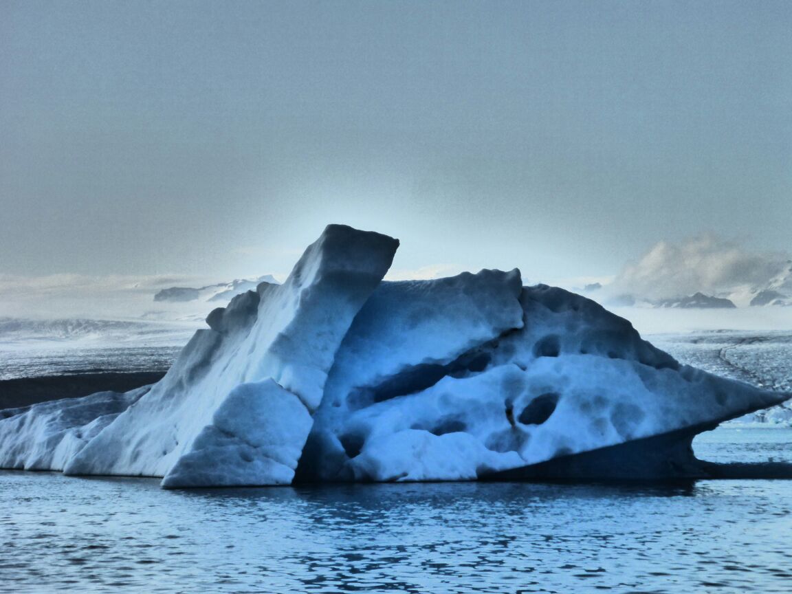
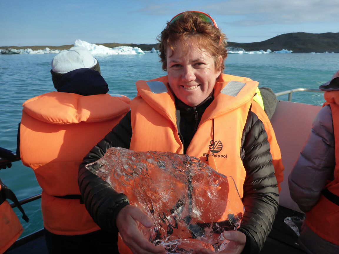
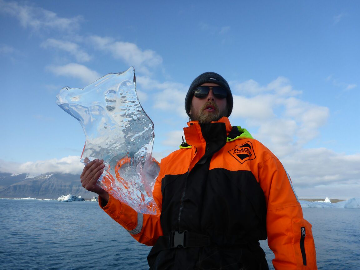
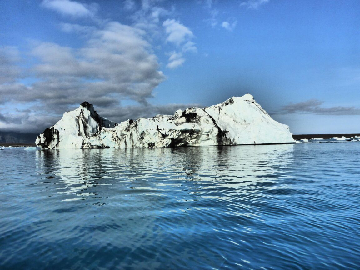
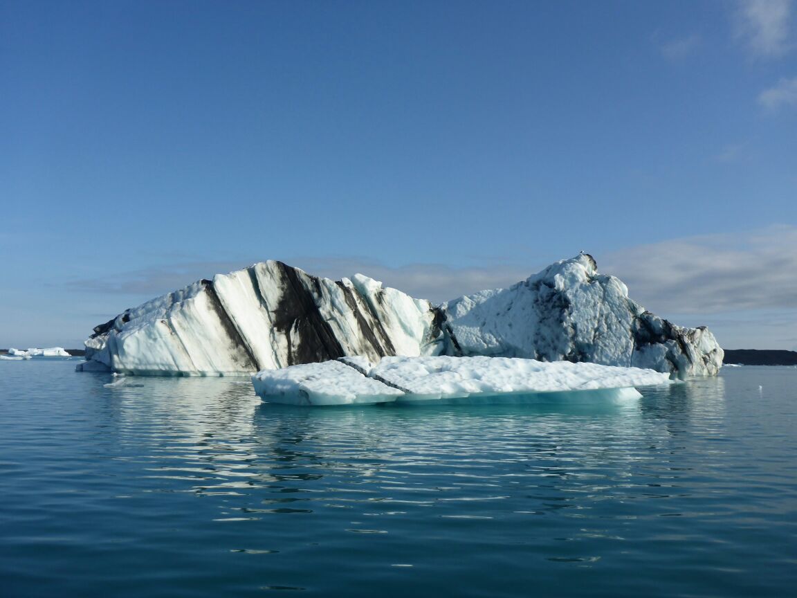
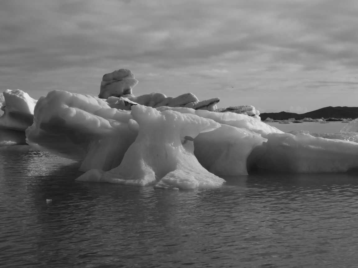
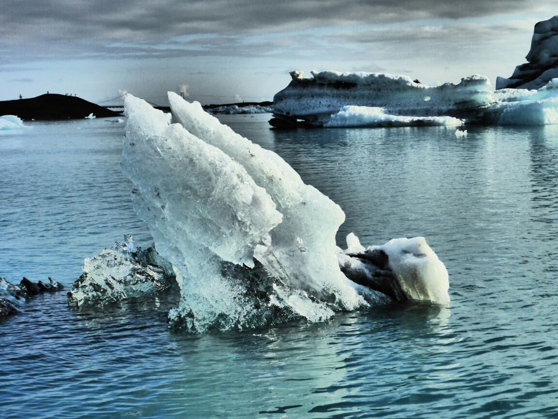
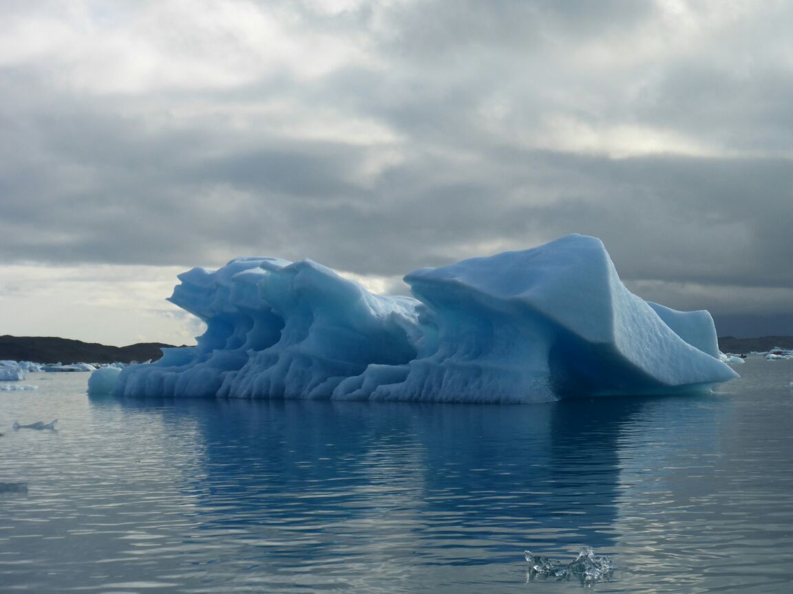
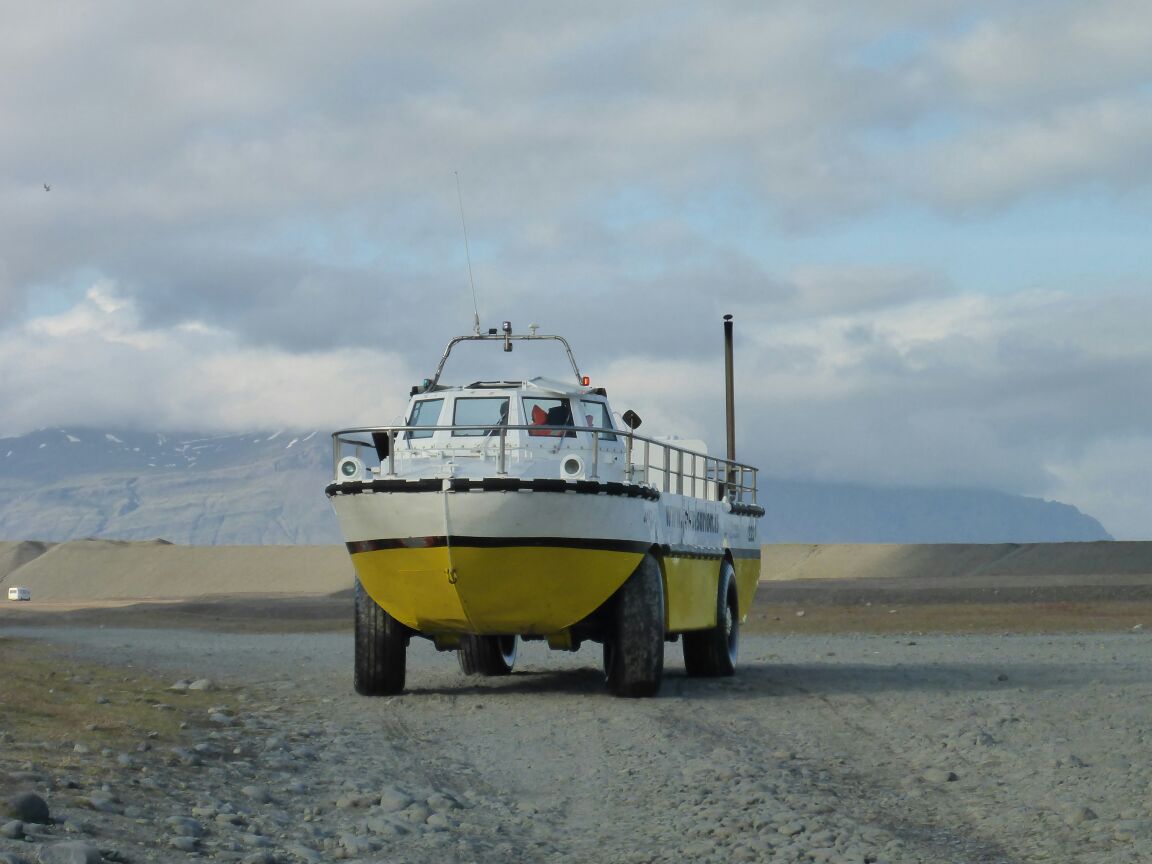 Some are white, where the snow has oxidised and others are blue, where the ice is clear as glass. And yet others are dirty grey with black stripes caused by the silt in the ice and the ash layers after a Volcanic eruption. They bring aboard ice from a glacier and it is incredibly clear and dense; the huge pressure within the glacier forcing out the muck and creating pure ice. It is the most amazing experience – we can see the ‘snout’ of the glacier over 7km away. In the 1930s it was only 1km between the glacier and the sea but the glacier is receding, the process accelerated by the contact with the brackish water in the Lake.
After the boat trip we head home but it’s gone 11pm before we get there and we’ve driven over 500 miles but it’s been a stunning day!